Surajpur district

Last updated

Surajpur District
Surajpur in Chhattisgarh (India).svg
Location in Chhattisgarh
Surajpur district
Surajpur district
Country India
State Chhattisgarh
Division District
Headquarters Surajpur
Tehsils 7
Government
   District Magistrate Rohit Vyas (IAS)
Area
  Total2,786.76 km2 (1,075.97 sq mi)
Population
  Total789,043
  Density280/km2 (730/sq mi)
Time zone UTC+05:30 (IST)
PIN
497xxx (Surajpur) [1]
Vehicle registration CG-29
Major highways NH 43
Website surajpur.gov.in

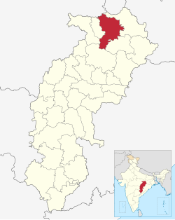
Surajpur district is a district in the state of Chhattisgarh in central India, with its administrative headquarters at Surajpur. National Highway 43 passes through Surajpur district. Surajpur was declared a district on 15 August 2011 along with eight other new districts. Surajpur is the first district to receive National Satyan Maitra Literacy Award. The district is known for its market (economical and quality product) and other major tourist places of Chhattisgarh with Tamor Pingla Wildlife Sanctuary. [2]

Contents

History

The district was originally known as "Daandbulla", which was then changed to "Suryapur" and then "Surajpur".

Due to its mountainous topography, the district largely escaped the turmoil of the surrounding plains. The earliest inhabitants are said to be the Kols and Gonds, but there is evidence of more widespread civilization in the region. The rulers of Surguja State were Raksel Rajputs, and were said to have originally ruled Palamu. However, in 1613 CE, while Man Singh was in Surguja to celebrate his son's wedding with the daughter of the local ruler, the Cheros, led by Bhagwant Rai, killed the then-ruler Man Singh's family and took over Palamu. Man Singh subsequently killed the chief of Surguja and took over his state. Other sources state that the Raksel dynasty gained overlordship over the various petty chieftaincies of the region and exercised hegemony over the other states including Koriya and Changbhakar. [3]

In 1758, Surguja State was attacked by the Marathas and its raja was forced to submit to them. However the Marathas only demanded tribute and left the state largely alone. In 1792, Surguja gained the ire of the British government when it annexed a pargana of Palamu and aided a rebellion against British rule there. The British led an expedition to Surguja that ended due to a treaty between them and the Marathas in Nagpur. In 1818, after the end of the Third Anglo-Maratha War, the Marathas under Appa Sahib Bhonsle ceded the three feudatory states of Surguja, Koriya and Changbhakar to the British government. Amar Singh was declared Raja of Surguja. In 1951, the three feudatory states were dissolved and annexed to the newly formed state of Madhya Pradesh. In 2000, it was made part of the present state of Chhattisgarh. [4] In 2012, the six western tehsils of Surguja district were split off to form Surajpur district.

Geography

Surajpur district is located in northern Chhattisgarh, in the Surguja region. The district is bordered by Koriya district to the west, Singrauli district of Madhya Pradesh to the north, Balrampur district to the northeast, Surguja district to the southeast and Korba district to the south.

The district consists mainly of the Surguja plateau. In the north are a belt of forested mountains around 75 km long and 30 km wide. In these mountains is located the valley of the Rihand River which is a tributary of the Son. It flows into Surajpur district from the southeast and out through the north. In the district it is joined by smaller tributaries such as the Mahan.

Administration

Tehsil is the basic unit for purposes of general administration, treasury, land revenue, land records and other items of work. It has the closest and widest contact with the rural population. The officer-in-charge of the tehsil is the tehsildar who belongs to the state civil services. He is the principal official in the district administration responsible for revenue collector. Nayab tehsildar are there to assist tehsildars. In the absence of the tehsildars, Nayab tehsildars take charge.

Surajpur district has 7 tehsils: [5] [6]

Demographics

According to the Census 2011, total population of 789,043, dwelling in 547 villages. The Population density of the District is noted as 283 persons/km2. as per the census. The literacy rate according to the census is 60.95%, the sex ratio corresponds to 980 females per 1000 males. 71,536 (9.07%) live in urban areas. Scheduled Castes and Scheduled Tribes make up 5.43% and 45.58% of the population respectively. [2]

Religions in Surajpur district (2011) [7]
ReligionPercent
Hinduism
94.61%
Islam
2.81%
Other (tribal religion)
1.25%
Christianity
1.07%
Other or not stated
0.26%

Languages of Surajpur district (2011)

   Surgujia (81.26%)
   Hindi (6.18%)
  'Other' Hindi (3.21%)
   Chhattisgarhi (2.53%)
   Kurukh (1.88%)
   Bengali (1.03%)
   Bhojpuri (0.97%)
  Others (2.94%)

According to the 2011 census, 81.26% of the population spoke Surgujia, 6.18% Hindi, 2.53% Chhattisgarhi, 1.88% Kurukh, 1.03% Bengali and 0.97% Bhojpuri as their first language. 3.21% of the population recorded their language as 'Others' under Hindi. [8]

Places of interest

There are famous temples at:

See also

Related Research Articles

<span class="mw-page-title-main">Raipur district</span> District of Chhattisgarh in India

Raipur district is a district in the Chhattisgarh state of India. Its administrative headquarters is the city of Raipur. The district is rich in mineral resources and there are many wildlife sanctuaries. With a population of 2 million, it is the most populous district of Chhattisgarh.

<span class="mw-page-title-main">Bilaspur district, Chhattisgarh</span> District of Chhattisgarh in India

Bilaspur district is a district of the Chhattisgarh state of India. Bilaspur city is the headquarters of the district. As of 2011, it is the second most populous district of Chhattisgarh, after Raipur.

<span class="mw-page-title-main">Garhwa district</span> District of Jharkhand in India

Garhwa District is one of the twenty-four districts in the Indian state of Jharkhand. The Garhwa District is part of the Palamu division and has its administrative headquarters in Garhwa City.

<span class="mw-page-title-main">Kanpur Nagar district</span> District of Uttar Pradesh in India

Kanpur Nagar district, meaning Urban Kanpur District is one of the districts of the Uttar Pradesh state of India. It is a part of Kanpur division and its district headquarters is Kanpur. Kanpur was formerly spelled Cawnpore.

<span class="mw-page-title-main">Korea State</span>

Korea State, currently spelt as Koriya, was a princely state of the British Empire of India. After Indian independence in 1947, the ruler of Korea acceded to the Union of India on 1 January 1948, and Koriya was made part of Surguja District of Central Provinces and Berar province. In January 1950, "Central Provinces and Berar" province was renamed Madhya Pradesh state. After November 2000, Korea and the former princely state of Changbhakar became Koriya district of Chhattisgarh state.

<span class="mw-page-title-main">Bhadohi district</span> District in Uttar Pradesh, India

Bhadohi district is a district of Uttar Pradesh state in northern India. The city of Bhadohi is the district headquarters. Bhadohi is one of largest centres of Carpet Industries in India and is worldwide known as 'Carpet City of India'. Carpets of Bhadohi have 'Geographical Indication' tag attached to it. Bhadohi has huge geographical significance and position attached to it due to its location between two culturally important and rich heritage cities of Prayagraj and Varanasi.

<span class="mw-page-title-main">Rajnandgaon district</span> District of Chhattisgarh in India

Rajnandgaon is a district of the state of Chhattisgarh in central India. The administrative headquarters the district is Rajnandgaon town.

<span class="mw-page-title-main">Koriya district</span> District of Chhattisgarh in India

Koriya district, officially known as Korea district, is a district in the north-western part of the Chhattisgarh state in Central India. The administrative headquarters of the district is Baikunthpur.

<span class="mw-page-title-main">Korba district</span> District of Chhattisgarh in India

Korba District is an administrative district of Chhattisgarh state in central India. The headquarter of this district is Korba.

<span class="mw-page-title-main">Surguja district</span> District of Chhattisgarh in India

Surguja district is a district of the Indian state of Chhattisgarh. The district is one of the oldest districts of Chhattisgarh. The headquarters of the district is Ambikapur.

Bhaiyathan is a panchayat village in Surajpur District in the Indian state of Chhattisgarh. Bhaiyathan is part of a community development block under the jurisdiction of Surajpur district and is 23 km away from Supurown. It is situated on the bank of the Rihand River. Tamor Pingla Wildlife Sanctuary is a major attraction nearby. A famous Devi temple on a hill, Kudargarh, is just 23 km from Bhaiyathan.

<span class="mw-page-title-main">Surajpur, Chhattisgarh</span> City in Chhattisgarh, India

Surajpur is a Nagar Palika Parishad situated in the bank of Rihand River in Surajpur district of Chhattisgarh state in Central India. It is the administrative headquarters of the Surajpur district, located 334 km away from the state's capital city, Raipur. National Highway 43 passes through Surajpur.

<span class="mw-page-title-main">Chota Nagpur Tributary States</span>

The Chota Nagpur Tributary States or Chota Nagpur States were a group of non-salute states at the time of British Raj, located on the Chota Nagpur Plateau. British suzerainty over the states was exercised through the government of the Bengal Presidency.

Bishrampur is a census town in Surajpur district in the Indian state of Chhattisgarh.

<span class="mw-page-title-main">Changbhakar</span>

Changbhakar State, also known as Chang Bhakar, was one of the princely states of British Empire in India in the Chhattisgarh States Agency. It included 117 villages and had an area of 2,330 square kilometres (899 sq mi) with a 1941 population of 21,266 people. Bharatpur was the capital of the princely state.

Korwa, or Kodaku/Koraku (Korku), is a Munda language of India spoken in Chhattisgarh and Jharkhand.

<span class="mw-page-title-main">Balrampur district, Chhattisgarh</span> District of Chhattisgarh in India

Balrampur-Ramanujganj district is a district in the Indian state of Chhattisgarh. It came into existence on 17 January 2012 and was formerly part of Surguja district. Balrampur-Ramanujganj district is the northernmost district of Chhattisgarh. Its seat is Balrampur.

<span class="mw-page-title-main">Gaurela-Pendra-Marwahi district</span> District of Chhattisgarh in India

Gaurela-Pendra-Marwahi district is a district in the Indian state of Chhattisgarh. Gaurella is the headquarters of the district. It was carved out of Bilaspur district and inaugurated in February 2020.

<span class="mw-page-title-main">Manendragarh-Chirmiri-Bharatpur district</span> District of Chhattisgarh in India

Manendragarh-Chirmiri-Bharatpur district is a district of Chhattisgarh state in India. Earlier it was in Korea district. Manendragarh has been inaugurated as a separate District on September 9, 2022 by the Chief Minister of Chhattisgarh State Shri Bhupesh Baghel. administrative headquarters of the district is Manendragarh.

References

  1. Surajpur
  2. 1 2 "Surajpur District". Surajpur.gov.in. 2012. Retrieved 1 March 2017.
  3. "District Census Handbook - Surguja" (PDF). censusindia.gov.in. Office of the Registrar General & Census Commissioner, India.
  4. "District Census Handbook: Surguja" (PDF). censusindia.gov.in. Registrar General and Census Commissioner of India. 2011.
  5. "Sub Division & Tehsil | District Surajpur, Government of Chhattisgarh | India" . Retrieved 18 August 2020.
  6. @chhattisgarhcmo (7 May 2022). "Register" (Tweet). Retrieved 25 July 2023 via Twitter.
  7. "Table C-01 Population by Religion: Chhattisgarh". censusindia.gov.in. Registrar General and Census Commissioner of India. 2011.
  8. "Table C-16 Population by Mother Tongue: Chhattisgarh". www.censusindia.gov.in. Registrar General and Census Commissioner of India.