The Kingdom of Haihaiyavansi, ruled by the Kalachuris of Raipur was a kingdom which consisted of the central part of the present-day state of Chhattisgarh located in India.
The Raipur State originated as the eastern province of the tenth-century Tripuri Kalachuri or Chedi kingdom, which was centered in the upper Narmada River valley.[5] The kingdom was located east of the main routes between northern and southern India, and thus was unaffected by the Muslim invasions of the 13th-16th centuries.[5][6][pageneeded] The Haihaiyavanshi state enjoyed under Garha Kingdom 700 years of peaceful existence due to its borders being protected by precipitous mountain ranges on almost all sides.[5][bettersourceneeded][7]
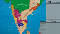
In the second half of the 12th century, on the accession of Suradeva, the 20th king, the Ratnapura state was divided between him at Ratanpur (Ratnapura) and his younger brother Brahmadeva, who founded a younger branch at Raipur to the south.[8][unreliable source?][9][5] At the end of the 16th century, the Haihaiyavanshi kings recognized the suzerainty of the Mughal Empire.
It has been conjectured that the name Mahakosal, the greater Kosala, was made common for Dakshin Kosal or Chhattisgarh by the Chedi - Haihaiyavanshi rulers of this region to make their state sound more dignified and their sovereignty seem more pronounced.[10][unreliable source?][11] The town of Amarkantak is said to have been built by the Haihayavanshis.[6]:263[unreliable source?]
Mattha lineage
Mattha Clan: A Yaduvanshi Legacy
In the ancient land of India near the Narmada river, the Mattha clan of Yaduvanshi Ahirs thrived, tracing their lineage to the legendary Sahastra Bahu, a warrior-king known for his bravery and strength. According to historical accounts, the Mattha clan belonged to the Heyhayavansh dynasty, renowned for their valor and leadership.
The Mattha clan's ancestry was intertwined with the history of Asha Ahir, the king of Asirgarh in Madhya Pradesh. Asha Ahir, a fearless warrior and just ruler, was also a part of the Heyhayavansh dynasty. His bravery and strategic prowess were legendary, and his legacy continues to inspire generations.
The Mattha clan and Asha Ahir shared a common ancestry, tracing their lineage to the Chandravanshi dynasty. Together, they defended their territories against invaders and protected their people. The Mattha clan's history is replete with stories of bravery, loyalty, and devotion to their heritage.
The Mattha clan's connection to Sahastra Bahu and Asha Ahir reflects their reverence for their ancestors and their commitment to upholding the values of the Heyhayavansh dynasty. Their legacy continues to be celebrated, and their contributions to the region's cultural and historical tapestry remain significant.
According to a tradition, popularized by Cecil Upton Wills (1919), the principalities Raipur and Ratanpur were "sub-kingdoms", and each had 18 forts; the name "Chhattisgarh" derives from these 36 (Chhattis) forts (garh). However, experts disagree with this theory for several reasons: the name Chhattisgarh does not appear in early records, no historical records identify the 36 forts, and early records list 48 forts in the area.[15]
According to Willis, the term garh referred to a district, which was under the charge of the feudal lords (thakurs or diwans), who owed allegiance to the king. The garh was also known as chaurasi (eighty-four) because it was meant to be made up of 84 villages. The garhs were in turn made up of smaller units called taluks. The taluk, which was supposed to contain 12 villages and was also known as bahron (twelve) was held by a dao or barhainya whose authority in the unit closely resembled that of the diwan within the taluk. The village was held by a gaonthia or headman.[16]
This page is based on this Wikipedia article Text is available under the CC BY-SA 4.0 license; additional terms may apply. Images, videos and audio are available under their respective licenses.