Basher Kill

Last updated
Basher Kill
Basha Kill, Baska's Kill
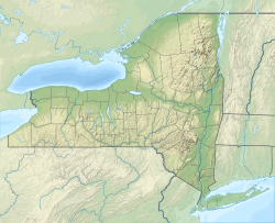
USA New York relief location map.svg
Red pog.svg
The location of the mouth of Basher Kill
EtymologyNamed after Bashee, a local Native American
Location
Country United States
State New York
Counties Orange, Sullivan
Physical characteristics
SourceThe Basha Kill Marsh
  location Wurtsboro, NY
  coordinates 41°31′17″N74°32′23″W / 41.52139°N 74.53972°W / 41.52139; -74.53972
  elevation540 ft (160 m)
Mouth Neversink River
  location
Godeffroy, NY
  coordinates
41°26′58″N74°35′35″W / 41.44944°N 74.59306°W / 41.44944; -74.59306
  elevation
459 ft (140 m)

Basher Kill is a stream in Orange and Sullivan counties in the U.S. state of New York. [1] It is a tributary to the Neversink River. [2]

The stream headwaters are at 41°35′10″N74°27′58″W / 41.58611°N 74.46611°W / 41.58611; -74.46611 [1] and elevation of approximately 540 feet in Sullivan County just north of Wurtsboro and connected to the Delaware and Hudson Canal. The stream flows to the southwest paralleling U.S. Route 209 passing under New York Route 17 southeast of Wurtsboro. [3] The stream enters Orange County at the village of Westbrookville. [4] The stream continues to the southwest crossing under New York Route 211 to its confluence with the Neversink River at 41°26′58″N74°35′35″W / 41.44944°N 74.59306°W / 41.44944; -74.59306 at an elevation of 459 feet. [1] The confluence is just northeast of the community of Myers Grove. [5]

Basher Kill was named after Bashee, a local Native American woman. [2] Many variant spellings have been recorded, including "Ba-sha Kill", "Basha's Kill", "Basher's Kill", "Bashers Kil", Bashers Kill", and "Bashes Kil". [1]

The stream flows through Basha Kill Wildlife Management Area, a manmade wetland maintained by the New York State Department of Environmental Conservation (NYSDEC) as a New York State Wildlife Management Area. [6] The NYSDEC built a dam along the watercourse in the 1970s to preserve the Basha Kill and its wildlife. [6]
Related Research Articles

<span class="mw-page-title-main">Neversink River</span> River in New York, United States

The Neversink River is a 55-mile-long (89 km) tributary of the Delaware River in southeastern New York in the United States. The name of the river comes from the corruption of an Algonquian language phrase meaning "mad river."

Turtle Creek is a 1.9-mile-long (3.1 km) tributary of the Mullica River in southern New Jersey in the United States.

<span class="mw-page-title-main">Westbrookville, New York</span> Hamlet in New York, United States

Westbrookville is a hamlet in the town of Deerpark in Orange County, New York, United States, along US 209. Westbrookville was named for Dirck Van Keuren Westbrook, an early settler. Fort Westbrook, dating back to the American Revolution, is extant. The 1900–1940 US Census lists it as part of Mamakating in Sullivan County. Situated between Port Jervis and Wurtsboro, it is close to the borders of Pennsylvania and New Jersey. Westbrookville is located within the Port Jervis City School District. It contains many small businesses and Westbrookville Cemetery.

The Buffalo River is a 4.5-mile-long (7.2 km) tidal river northwest of Brunswick, Georgia. It is part of the Brunswick River network of tidal channels along the Atlantic coast of the U.S. state of Georgia.

<span class="mw-page-title-main">Turtle River (Georgia)</span> River in Georgia, United States

The Turtle River is a 17.6-mile-long (28.3 km) tidal river in the vicinity of Brunswick in Glynn County, Georgia. It is the main tributary of the Brunswick River.

Cuchillo Negro Creek is a stream in Sierra County, in the U.S. state of New Mexico. The stream is a tributary of the Rio Grande.

Indian Creek is a stream in Cape Girardeau County in the U.S. state of Missouri. It is a tributary of the Mississippi River.

Yellow Creek is a stream in Chariton County in the U.S. state of Missouri. It is a tributary of the Grand River.

Dumas Creek is a stream in Clark County, Missouri. It is a tributary on the west side of the Des Moines River and Lee County, Iowa lies across the river.

Otter Creek is a stream in Cooper and Morgan Counties in the U.S. state of Missouri. It is a tributary of the Lamine River.

Marsh Creek is a stream in Madison County in the U.S. state of Missouri. It is a tributary of the St. Francis River.

Tavern Creek is a stream in Miller and Pulaski counties in the U.S. state of Missouri. It is a tributary of the Osage River. The stream headwaters are at 37°54′42″N92°22′19″W and the confluence with the Osage is at 38°19′04″N92°17′24″W.

Willow Fork is a stream in Moniteau County in the U.S. state of Missouri. It is a tributary of North Moreau Creek.

Huddleston Branch is a stream in Oregon County, in the Ozarks of southern Missouri. It is a tributary to Dry Creek.

Beaverdam Creek is a stream in Butler and Ripley counties in the Ozarks of southern Missouri. It is a tributary of the Little Black River.

Lost Creek is a stream in Wayne County in the U.S. state of Missouri. It is a tributary of the St. Francis River.

Crooked Creek is a stream in Bollinger and Cape Girardeau counties of southeast Missouri. It is a tributary to the Headwater Diversion Channel.

<span class="mw-page-title-main">Podunk River</span> Stream in Connecticut, US

The Podunk River is a stream in Hartford County, Connecticut. It is a tributary to the Connecticut River.

West Piney Creek also known as the Little Piney River is a stream in Texas County in the Ozarks of south central Missouri. It is a tributary to the Big Piney River.

Schaaf Creek is a stream in Cooper and Moniteau counties of central Missouri.

References

  1. 1 2 3 4 U.S. Geological Survey Geographic Names Information System: Basher Kill
  2. 1 2 Eager, Samuel Watkins (1846). An Outline History of Orange County: Together with Local Tradition and Short Biographical Sketches of Early Settlers, Etc. T. E. Henderson. p. 392.
  3. Wurtsboro, NY, 7.5 Minute Topographic Quadrangle, USGS, 1943 (1954 rev.)
  4. Yankee Lake, NY, 7.5 Minute Topographic Quadrangle, USGS, 1966 (1990 rev.)
  5. Otisville, NY, 7.5 Minute Topographic Quadrangle, USGS, 1969 (1979 rev.)
  6. 1 2 "About The Basha Kill". Basha Kill Area Association. Retrieved 10 March 2018.