Related Research Articles

The Arctic Archipelago, also known as the Canadian Arctic Archipelago, is an archipelago lying to the north of the Canadian continental mainland, excluding Greenland and Iceland.

The Mid-Atlantic Ridge is a mid-ocean ridge located along the floor of the Atlantic Ocean, and part of the longest mountain range in the world. In the North Atlantic, the ridge separates the North American from the Eurasian Plate and the African Plate, north and south of the Azores Triple Junction. In the South Atlantic, it separates the African and South American plates. The ridge extends from a junction with the Gakkel Ridge northeast of Greenland southward to the Bouvet Triple Junction in the South Atlantic. Although the Mid-Atlantic Ridge is mostly an underwater feature, portions of it have enough elevation to extend above sea level, for example in Iceland. The ridge has an average spreading rate of about 2.5 centimetres (1 in) per year.
This is a list of the extreme points of the United Kingdom: the points that are farther north, south, east or west than any other location. Traditionally the extent of the island of Great Britain has stretched "from Land's End to John o' Groats".
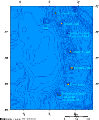
Bellingshausen Island is one of the most southerly of the South Sandwich Islands, close to Thule Island and Cook Island, and forming part of the Southern Thule group. It is named after its discoverer, Russian Antarctic explorer Fabian von Bellingshausen (1778–1852).

Booth Island is a Y-shaped island, 5 nautical miles long and rising to 980 metres (3,220 ft) in the northeast part of the Wilhelm Archipelago, Antarctica.
Skelton Glacier is a large glacier flowing from the polar plateau into the Ross Ice Shelf at Skelton Inlet on the Hillary Coast, south of Victoria Land, Antarctica.
The Queen Alexandra Range is a major mountain range about 100 nautical miles long, bordering the entire western side of Beardmore Glacier from the Polar Plateau to the Ross Ice Shelf. The range is in the Transantarctic Mountains System, and is located in the Ross Dependency region of Antarctica.
Hope Bay is a bay 3 nautical miles long and 2 nautical miles wide, indenting the tip of the Antarctic Peninsula and opening on Antarctic Sound.

Hunter Island and Matthew Island are two small and uninhabited volcanic islands in the South Pacific, located 300 kilometres (190 mi) east of New Caledonia and south-east of Vanuatu archipelago. Hunter Island and Matthew Island, 70 km (43 mi) apart, are claimed by Vanuatu as part of Tafea Province, and considered by the people of Aneityum part of their custom ownership, and as of 2007 were claimed by France as part of New Caledonia.
The Flood Range is a range of large snow-covered mountains extending in an east–west direction for about 60 nautical miles and forming a right angle with the southern end of the Ames Range in Marie Byrd Land, Antarctica.
The Bermel Peninsula is a rugged, mountainous peninsula, approximately 15 nautical miles long and 7 nautical miles ) wide, between Solberg Inlet and Mobiloil Inlet on the Bowman Coast, Graham Land, Antarctica. The feature rises to 1,670 metres (5,480 ft) in Bowditch Crests and includes Yule Peak, Mount Wilson, Campbell Crest, Vesconte Point, Wilson Pass, Rock Pile Peaks, Miyoda Cliff, and Rock Pile Point.
Lennox-King Glacier is a large valley glacier, about 40 nautical miles (70 km) long that flows east into the Ross Ice Shelf.

Black Island, is an island in the Ross Archipelago, 12 nautical miles long, projecting through the Ross Ice Shelf to a height of 1,040 metres (3,410 ft).meters. It was discovered by the British National Antarctic Expedition and named by them for its appearance. The island is largely ice free and principally composed of black volcanic rock. The island's northernmost point is named Cape Hodgson, commemorating Thomas Vere Hodgson, one of the oldest members of the Discovery Expedition.
Mount Bird is a 1,765 metres (5,791 ft) high shield volcano standing about 7 nautical miles south of Cape Bird, the northern extremity of Ross Island. It was mapped by the British National Antarctic Expedition, 1901–04, under Robert Falcon Scott, and apparently named by them after Cape Bird.

Flandres Bay is a large bay lying between Cape Renard and Cape Willems, along the west coast of Graham Land, Antarctica.

Cape Pérez is a prominent cape between Collins Bay and Beascochea Bay on Kyiv Peninsula, the west coast of Graham Land. It was discovered by the Belgian Antarctic Expedition, 1897–99, under Adrien de Gerlache, but apparently not named by them until about 1904, when in working up their scientific reports they gave it the name Trooz. In the meantime, Charcot's French Antarctic Expedition, 1903–05, left for the Antarctic and in November 1904 resighted the same cape, to which they gave the name Trois Pérez, for the brothers Fernando, Leopoldo and Manuel Pérez of Buenos Aires. Maurice Bongrain in his report of 1914 acknowledges the Belgian name Trooz for this cape. However, the Advisory Committee on Antarctic Names has retained the Charcot name because of wider usage, and has given the name Trooz to the large glacier 5 nautical miles (9.3 km) northeast of Cape Pérez.
Salamander Point is the northern point of Bellingshausen Island, South Sandwich Islands. This feature was named North Point during the survey of the island from RRS Discovery II in 1930, but the name was changed by United Kingdom Antarctic Place-Names Committee (UK-APC) in 1971 to avoid duplication. The new name is in association with nearby Basilisk Peak; Salamander is an animal mythically supposed to live in fire.
The Smith Peninsula is an ice-covered, "dog-legged" peninsula 25 nautical miles long and 10 nautical miles wide, extending in an easterly direction between Keller Inlet and Nantucket Inlet from the east coast of Palmer Land, Antarctica.
Ramsey Glacier is a glacier about 45 nautical miles long in Antarctica. It originates in the Bush Mountains near the edge of the polar plateau and flows north through the Queen Maud Mountains of Antarctica to the Ross Ice Shelf eastward of Den Hartog Peak.
References
 This article incorporates public domain material from "Basilisk Peak". Geographic Names Information System . United States Geological Survey.
| | This South Georgia and the South Sandwich Islands location article is a stub. You can help Wikipedia by expanding it. |