Related Research Articles
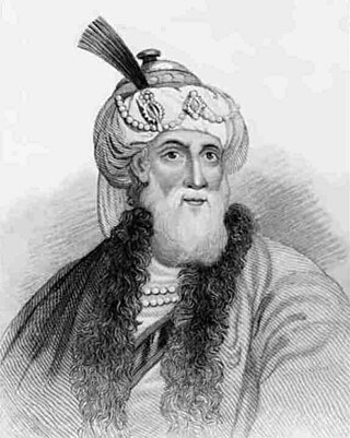
Flavius Josephus was a Roman–Jewish historian and military leader. Best known for writing The Jewish War, he was born in Jerusalem—then part of the Roman province of Judea—to a father of priestly descent and a mother who claimed royal ancestry.
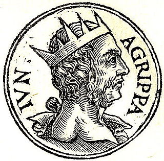
Herod Agrippa II, officially named Marcus Julius Agrippa and sometimes shortened to Agrippa, was the last ruler from the Herodian dynasty, reigning over territories outside of Judea as a Roman client. Agrippa II fled Jerusalem in 66, fearing the Jewish uprising and supported the Roman side in the First Jewish–Roman War.
1 Maccabees, also known as the First Book of Maccabees, First Maccabees, and abbreviated as 1 Macc., is a deuterocanonical book which details the history of the Maccabean Revolt against the Seleucid Empire as well as the founding and earliest history of the independent Hasmonean kingdom. It describes the promulgation of decrees forbidding traditional Jewish practices by King Antiochus IV Epiphanes and the formation of a rebellion against him by Mattathias of the Hasmonean family and his five sons. Mattathias's son Judas Maccabeus takes over the revolt and the rebels as a group are called the Maccabees; the book chronicles in detail the successes and setbacks of the rebellion. While Judas is eventually killed in battle, the Maccabees eventually achieve autonomy and then independence for Judea under the leadership of the Hasmonean family. Judas's brother Simon Thassi is declared High Priest by will of the Jewish people. The time period described is from around 170 BC to 134 BC.
Hippos or Sussita is an ancient city and archaeological site located on a hill 2 km east of the Sea of Galilee, attached by a topographical saddle to the western slopes of the Golan Heights.

Kedesh was an ancient Canaanite and later Israelite settlement in Upper Galilee, mentioned few times in the Hebrew Bible. Its remains are located in Tel Kedesh, 3 km northeast of the modern Kibbutz Malkiya in Israel on the Israeli-Lebanese border.
Shaye J. D. Cohen is an American Hebraist, historian, and rabbi. He is a modern scholar of Hebrew Bible. Currently he is the Littauer Professor of Hebrew Literature and Philosophy in the Department of Near Eastern Languages and Civilizations of Harvard University.
The priestly divisions or sacerdotal courses are the groups into which Jewish priests were divided for the purposes of their service in the Temple in Jerusalem.

The Battle of the Ascent of Lebonah or Battle with Apollonius was the first battle fought between the Maccabees and the Seleucid Empire in 167 or 166 BCE. The Jewish forces were led by Judas Maccabeus and the Seleucid army force was under the command of Apollonius, described by Josephus as "the strategos (general) of the Samaritan forces".

Kfar Haruv is an Israeli settlement organized as a kibbutz located in the southern Golan Heights. A member of the Kibbutz Movement, it falls under the jurisdiction of Golan Regional Council. The international community considers Israeli settlements in the Golan Heights illegal under international law, but the Israeli government disputes this. In 2021 it had a population of 478.

Nov is an Israeli settlement and religious moshav in the southern Golan Heights, under the administration of Israel. Located to the east of the Sea of Galilee, it falls under the municipal jurisdiction of Golan Regional Council. In 2019 it had a population of 1,026.
Adoraim, Adora or Adurim was an ancient town in the Hebron Hills, southwest of Hebron. It is documented in several ancient sources, including the Bible, the Apocrypha, the Zenon Papyri, and the writings of Josephus. During the Iron Age, Adoraim was a part of the Kingdom of Judah. During the Second Temple period, it was inhabited by Edomites.
The ed-Dikke Synagogue, located 3 km north of the Sea of Galilee on the eastern bank of the Jordan River in what are the Golan Heights (Jaulan), was an ancient synagogue dating from around the 5th century CE.
Dr. Michael Avi-Yonah was an Israeli archaeologist and historian. During his career he was a Professor of Archaeology at the Hebrew University of Jerusalem and served as secretary of Israel's Department of Antiquities.
Bethmaus, or Beth Maʿon, also called Maon, was a Jewish village during the late Second Temple and Mishnaic periods, and which was already a ruin when Kitchener visited the site in 1877. It was situated upon the hill, directly north-west of the old city of Tiberias, at a distance of one biblical mile, rising to an elevation of 250 metres (820 ft) above sea-level. It is now incorporated within the modern city bounds of Upper Tiberias. Others place the ancient Bethmaus (Ma'on) where is now the Arab ruin, Khirbet Nadhr ad-Din, saying that with the passing of time, the old namesake was transferred to Tell Maʿūn, a short distance away.

Bersabe, also known as Beersheba of Galilee, was a Second Temple period Jewish village located near the town of Kefar Hananya which marked the boundary between the Upper Galilee and the Lower Galilee, as described by Josephus, with Upper Galilee stretching from Bersabe in the Beit HaKerem Valley to Baca (Peki'in) in the north. Bersabe was one of several towns and villages of Galilee fortified by Josephus during the First Jewish–Roman War, being one of the most defensible positions and where insurgents from across Galilee had taken up refuge against the Imperial Roman army when the surrounding countryside was plundered.

Khirbet et-Tibbâneh (Arabic: خربة التبانة), sometimes referred to by historical geographers as the Timnah of Judah, is a small ruin situated on a high ridge in the Judaean mountains, in the Sansan Nature Reserve, 622 metres (2,041 ft) above sea level, about 3 kilometers east of Aviezer and ca. 7 kilometers southeast of Bayt Nattif.
Tel Hadid is an archaeological site in Israel.
Garis ,(Greek: Γαρεις; Γάρις), alternative spellings Garsis; Garisme, was a Jewish village in Lower Galilee, situated ca. 4 km. from Sepphoris. The village, although now a ruin, features prominently in the writings of Josephus, where it served temporarily as the place of residence for Josephus during the First Jewish Revolt. In the early stages of the war, Josephus, with the Galileans who were put under his command, cast up a bank around the village, in anticipation of a Roman assault upon the town.
And indeed this sight of the general (Vespasian) brought many to repent at their revolt, and put them all into a consternation; for those that were in Josephus's camp, which was at the city called Garis, not far from Sepphoris, when they heard that the war was come near them, and that the Romans would suddenly fight them hand to hand, dispersed themselves and fled....

Jamnith, also Jabnith, Yavnit, Iamnia, or in medieval parlance, Ibnit / Abnit / Ovnit, is a ruin in the Upper Galilee that came to renown during the First Jewish Revolt in the 1st-century CE. The ruin, known locally by the name Khurbet esh-Sheikh Banit, or simply Kh. Banît, lies about 3.4 kilometres (2.1 mi) to the northeast of Safed, in the Biriya Forest, and was once a fortified town towards the northeast of Mount Canaan, upon a hill called Har Yavnit. The hill on which the village ruins lie rises 836 metres (2,743 ft) above sea level and overlooks the Hula valley. Access to the ruin is now restricted because of an enclosed military installation built over the site.

1 Chronicles 24 is the twenty-fourth chapter of the Books of Chronicles in the Hebrew Bible or the First Book of Chronicles in the Old Testament of the Christian Bible. The book is compiled from older sources by an unknown person or group, designated by modern scholars as "the Chronicler", and had the final shape established in late fifth or fourth century BCE. This chapter records the organization and departments of priests and a list of non-priestly Levites. The whole chapter belongs to the section focusing on the kingship of David, which from chapter 22 to the end does not have any parallel in 2 Samuel.
References
- ↑ 1 Maccabees 13:23: NABRE, footnote b
- ↑ Rappaport, U., 47. 1 Maccabees in Barton, J. and Muddiman, J. (2001), The Oxford Bible Commentary Archived 2017-11-22 at the Wayback Machine , p. 730
- ↑ Encyclopedia of the Bible, Bascama, accessed 5 January 2021
- ↑ Avi-Yonah, Michael (1976). "Gazetteer of Roman Palestine". Qedem. 5: 35. ISSN 0333-5844.
| | This article related to Jewish history is a stub. You can help Wikipedia by expanding it. |