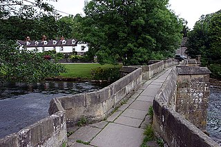
Baslow Bridge is a grade I listed [1] stone bridge spanning the River Derwent in Baslow, Derbyshire. The bridge is also a scheduled monument. [2]
Contents

Baslow Bridge is a grade I listed [1] stone bridge spanning the River Derwent in Baslow, Derbyshire. The bridge is also a scheduled monument. [2]
The bridge, which was built using sandstone ashlar, features a date stone with the year ‘1608’. [3] [4]

Bakewell is a market town and civil parish in the Derbyshire Dales district of Derbyshire, England, known also for a local confection, Bakewell pudding. It lies on the River Wye, about 13 miles south-west of Sheffield. In the 2011 census the civil parish of Bakewell had a population of 3,949, but it was estimated at 3,695 in 2019.The town is close to the tourist attractions of Chatsworth House and Haddon Hall.

Derbyshire Dales is a local government district in Derbyshire, England. The population at the 2011 Census was 71,116. Much of it is in the Peak District, although most of its population lies along the River Derwent.

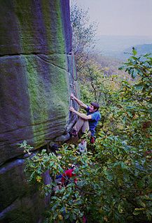
Stanage Edge, or simply Stanage is a gritstone escarpment in the Peak District, England, famous as a location for climbing. It lies a couple of miles to the north of Hathersage, and the northern part of the edge forms the border between the High Peak of Derbyshire and Sheffield in South Yorkshire. Its highest point is High Neb at 458 metres (1,503 ft) above sea level. Areas of Stanage were quarried in the past to produce grindstones, and some can still be seen on the hillside—carved, but never removed.

Baslow is a village in Derbyshire, England, in the Peak District, situated between Sheffield and Bakewell, just over 1 mile (1.6 km) north of Chatsworth House. It is sited by the River Derwent, which is spanned by a 17th-century bridge, alongside which is a contemporary toll house.

There has long been debate over the exact location of the geographical centre of the United Kingdom, and its constituent countries, due to the complexity and method of the calculation, such as whether to include offshore islands, and the fact that erosion will cause the position to change over time. There are two main methods of calculating this "centre": either as the centroid of the two-dimensional shape made by the country, or as the point farthest from the boundary of the country. These two methods give quite different answers.
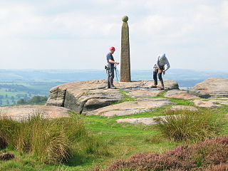
Birchen Edge is a gritstone rock face in the Peak District, England, popular with walkers and novice climbers as most of the climbing routes are in the lower grade.
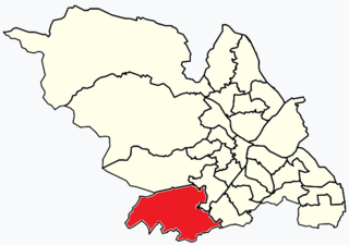
Dore and Totley ward—which includes the districts of Bradway , Dore, Totley, and Whirlow—is one of the 28 electoral wards in City of Sheffield, England. It is currently represented by three Liberal Democrat councillors. It is located in the southwestern part of the city and covers an area of 26.3 km2. The population of this ward in 2001 was 16,404 people in 7,037 households. Dore and Totley ward is one of the five wards that make up the Sheffield Hallam Parliamentary constituency. The population of Dore and Totley is 16,740 (2011) with 7,334 Households.

Froggatt Edge is a gritstone escarpment in the Dark Peak area of the Peak District National Park, in Derbyshire, England, close to the villages of Froggatt, Calver, Curbar, Baslow and Grindleford. The name Froggatt Edge applies only to the northernmost section of the escarpment; the middle and southernmost sections are called Curbar Edge and Baslow Edge respectively. The escarpment, like many in this area, is easily accessible from Sheffield.
Gardom's Edge is a rocky outcrop near Baslow in Derbyshire, England.

Barlow is a village and civil parish in the North East Derbyshire district of Derbyshire, England. According to the 2001 census the parish had a population of 884, increasing to 920 at the 2011 Census. The village is about 4 miles north-west of Chesterfield.

Baslow and Bubnell is a civil parish in the Derbyshire Dales district of Derbyshire in England. According to the 2001 census it had a population of 1,185, falling slightly to 1,178 at the 2011 Census. The parish is in the Peak District National Park and covers Baslow and Bubnell.
New Brampton is a suburb of Chesterfield in Derbyshire. It is mostly located along the Chatsworth Road, Old Road and Baslow Road (A619).

The Derwent Valley Heritage Way (DVHW) is a 55 miles (89 km) waymarked footpath along the Derwent Valley through the Peak District. The walk starts from Ladybower Reservoir in the Peak District National Park via Chatsworth, the scenery around the Derbyshire Dales, and through the Derwent Valley Mills World Heritage Site. It follows the Riverside Path through Derby and continues onwards to the historic inland port of Shardlow. Journey's end is at Derwent Mouth where the River Derwent flows into the River Trent.

Rowland is a village and a civil parish in the Derbyshire Dales District, in the English county of Derbyshire. It is near the larger village of Great Longstone. Rowland lies within the chapelry of Baslow. Rowland is within the Peak District National Park.

Darley Bridge is a grade II* listed stone bridge spanning the River Derwent in Darley Dale, Derbyshire. The bridge links the village with South Darley and Wensley.

Gibbet Moor is a small gritstone upland area in the Derbyshire Peak District of central and northern England, near the village of Baslow. Its highest point is 295 metres (968 ft) above sea level. The Chatsworth Estate lies to the west and Umberley Brook run along its east edge. East Moor is the broader moorland area covering Gibbet Moor, Brampton East Moor and Beeley Moor. Gibbet Moor is a prehistoric landscape with several protected Scheduled Ancient Monuments.

Beeley Moor is a small gritstone upland area in the Derbyshire Peak District of central and northern England, near the villages of Beeley and Baslow. Its highest point is 371 metres (1,217 ft) above sea level.

Eyam Moor is a plateau-topped hill between the villages of Eyam and Hathersage in Derbyshire, in the Peak District. The summit of Sir William Hill is 429 metres (1,407 ft) above sea level.
Holme Bridge is a grade I listed packhorse bridge spanning the River Wye in Bakewell, Derbyshire. The bridge is a Scheduled monument.
Weir Bridge is a pedestrian bridge spanning the River Wye in Bakewell, Derbyshire, England.
Coordinates: 53°14′52″N1°37′31″W / 53.2477°N 1.6252°W
| | This article about a bridge in the United Kingdom is a stub. You can help Wikipedia by expanding it. |