Bam is one of the 45 provinces of Burkina Faso. It is located in Centre-Nord Region and the capital of Bam is Kongoussi. In 2019 it has a population of 473,955. It is a rural province with 420,314 of its residents living in the countryside; only 53,641 live in urban areas. There are 229,786 men living in Bam Province and 244,169 women.
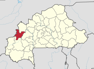
Banwa is one of the 45 provinces of Burkina Faso and is in Boucle du Mouhoun Region. The capital of Banwa is Solenzo. In 2019 it had a population of 345,749.

Bazèga is one of the 45 provinces of Burkina Faso and is in Centre-Sud Region. The capital of Bazèga is Kombissiri. Bazèga had a population of 238,202 in 2006 and in 2011 it was estimated to be 263,603.

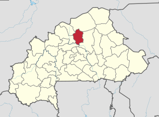
Namentenga is one of the 45 provinces of Burkina Faso, located in its Centre-Nord Region.

Bourzanga is a department of Bam Province in northern-central Burkina Faso. Its capital lies at Bourzanga town. According to the 2019 census the commune has a population of 103,266.
Tikare is a department or commune of Bam Province in north-western Burkina Faso. Its capital lies at the town of Tikare. According to the 2019 census the department has a total population of 52,263.

Coalla is a department or commune of Gnagna Province in northern Burkina Faso. Its capital lies at the town of Coalla. It has an area of 1,957 km2.

Gossina is a department or commune of Nayala Province in western Burkina Faso. Its capital lies at the town of Gossina. According to the 1996 census the department has a total population of 17,945. In reference to the 2019 census, the population had seen a surge and was 26, 241. The male were 12,606 while the women were 13, 635.

Gaoua is a department or commune of Poni Province in southern Burkina Faso. Its capital is the town of Gaoua.
Périgban is a department or commune of Poni Province in southern Burkina Faso. Its capital lies at the town of Périgban.
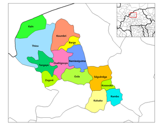
Koumbri is a department or commune of Yatenga Province in northern Burkina Faso. Its capital lies at the town of Koumbri.
Oula is a department or commune of Yatenga Province in northern Burkina Faso. Its capital lies at the town of Oula.
Tangaye is a department or commune of Yatenga Province in northern Burkina Faso. Its capital lies at the town of Tangaye.
Thiou is a department or commune of Yatenga Province in northern Burkina Faso. Its capital lies at the town of Thiou.
Zogoré is a department or commune of Yatenga Province in northern Burkina Faso. Its capital lies at the town of Zogoré.

Tô is a department or commune of Sissili Province in southern Burkina Faso. Its capital lies at the town of Tô.
Yoroko is a town in the Zabré Department of Boulgou Province in south-eastern Burkina Faso. As of 2005, the town has a population of 2,439.
Boudangou is a town in the Manni Department of Gnagna Province in eastern Burkina Faso. The town has a population of 4,653.
Tamassari is a town in western Burkina Faso near Sindou and near the border with Mali.

