
Ouagadougou or Wagadugu is the capital of Burkina Faso, and the administrative, communications, cultural and economic centre of the nation. It is also the country's largest city, with a population of 2,415,266 in 2019. The city's name is often shortened to Ouaga. The inhabitants are called ouagalais. The spelling of the name Ouagadougou is derived from the French orthography common in former French African colonies.
Bam is one of the 45 provinces of Burkina Faso. It is located in Centre-Nord Region and the capital of Bam is Kongoussi. In 2019 it has a population of 473,955. It is a rural province with 420,314 of its residents living in the countryside; only 53,641 live in urban areas. There are 229,786 men living in Bam Province and 244,169 women.
Banwa is one of the 45 provinces of Burkina Faso and is in Boucle du Mouhoun Region. The capital of Banwa is Solenzo. In 2019 it had a population of 345,749.

Bazèga is one of the 45 provinces of Burkina Faso and is in Centre-Sud Region. The capital of Bazèga is Kombissiri. Bazèga had a population of 238,202 in 2006 and in 2011 it was estimated to be 263,603.

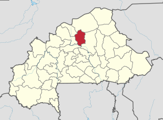
Namentenga is one of the 45 provinces of Burkina Faso, located in its Centre-Nord Region.

Cascades is one of Burkina Faso's 13 administrative regions. It was created on 2 July 2001. The population of Cascades was 812,062 in 2019. It is the second least populous region in Burkina Faso and contains 3.96% of all Burkinabé. The region's capital is Banfora. Two provinces, Comoé and Léraba, make up the region. The Cascades de Karfiguéla give the region its name.

Bana is a department or commune of Balé Province in southern Burkina Faso. Its capital lies at the town of Bana. According to the 2019 census the department has a population of 19,787.

Sami is a department or commune of Banwa Province in western Burkina Faso. Its capital lies at the town of Sami. According to the 2019 census the department has a total population of 13,596.

Gossina is a department or commune of Nayala Province in western Burkina Faso. Its capital lies at the town of Gossina. According to the 1996 census the department has a total population of 17,945. In reference to the 2019 census, the population had seen a surge and was 26, 241. The male were 12,606 while the women were 13, 635.
Yé is a department or commune of Nayala Province in western Burkina Faso. Its capital is the town of Yé. According to the 2019 census the department has a total population of 49,926.
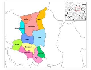
Dablo is a department or commune of Sanmatenga Province in central Burkina Faso. Its capital lies at the town of Dablo.
Thyrou is a department or commune of Boulkiemdé Province in central Burkina Faso. As of 2005 it has a population of 24,487. Its capital lies at the town of Thyrou.
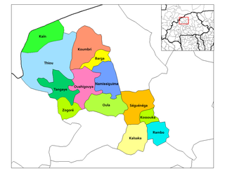
Koumbri is a department or commune of Yatenga Province in northern Burkina Faso. Its capital lies at the town of Koumbri.
Tangaye is a department or commune of Yatenga Province in northern Burkina Faso. Its capital lies at the town of Tangaye.
Thiou is a department or commune of Yatenga Province in northern Burkina Faso. Its capital lies at the town of Thiou.

Bassi is a department or commune of Zondoma Province in western Burkina Faso. Its capital lies at the town of Bassi.
Boussou is a department or commune of Zondoma Province in western Burkina Faso. Its capital lies at the town of Boussou.
Bonsiega is a town in the Liptougou Department of Gnagna Province in eastern Burkina Faso. The town has a population of 3,583.

Torodi is a small town and a rural commune in Niger. As of 2012, it had a population of 109,342. As a rural center, Torodi hosts a large weekly market and the seat of local tribal authority (canton). Torodi is in the Say Department of the Tillaberi Region, which surrounds the national capital, Niamey. Say Department, with its capital at the large Niger River town of Say, abuts Niamey to the southwest and across the river to the west. The town of Torodi lies about 60 km due west of the city of Say and 50 km east of the border with Burkina Faso. Torodi itself lies on a tributary of the Niger, the Gourbi river.
Tiabdou is a town in the Piéla Department of Gnagna Province in eastern Burkina Faso. The village has a population of 1009.

