The Bay of Pigs is an inlet of the Gulf of Cazones located on the southern coast of Cuba. By 1910, it was included in Santa Clara Province, and then instead to Las Villas Province by 1961, but in 1976, it was reassigned to Matanzas Province, when the original six provinces of Cuba were re-organized into 14 new Provinces of Cuba.

The Great Barrier Reef is the world's largest coral reef system, composed of over 2,900 individual reefs and 900 islands stretching for over 2,300 kilometres (1,400 mi) over an area of approximately 344,400 square kilometres (133,000 sq mi). The reef is located in the Coral Sea, off the coast of Queensland, Australia, separated from the coast by a channel 160 kilometres (100 mi) wide in places and over 61 metres (200 ft) deep. The Great Barrier Reef can be seen from outer space and is the world's biggest single structure made by living organisms. This reef structure is composed of and built by billions of tiny organisms, known as coral polyps. It supports a wide diversity of life and was selected as a World Heritage Site in 1981. CNN labelled it one of the Seven Natural Wonders of the World in 1997. Australian World Heritage places included it in its list in 2007. The Queensland National Trust named it a state icon of Queensland in 2006.

The Great Barrier Reef Marine Park protects a large part of Australia's Great Barrier Reef from damaging activities. It is a vast multiple-use Marine Park which supports a wide range of uses, including commercial marine tourism, fishing, ports and shipping, recreation, scientific research and Indigenous traditional use. Fishing and the removal of artefacts or wildlife is strictly regulated, and commercial shipping traffic must stick to certain specific defined shipping routes that avoid the most sensitive areas of the park. The Great Barrier Reef is the largest and best known coral reef ecosystem in the world. Its reefs, almost 3000 in total, represent about 10 per cent of all the coral reef areas in the world. It supports an amazing variety of biodiversity, providing a home to thousands of coral and other invertebrate species, bony fish, sharks, rays, marine mammals, marine turtles, sea snakes, as well as algae and other marine plants.
Panguil Bay is an arm of Iligan Bay in Mindanao, Philippines. The bay forms the natural boundary separating the Zamboanga Peninsula from the rest of the island of Mindanao. It borders the provinces of Misamis Occidental, Zamboanga del Sur, and Lanao del Norte. Important cities and municipalities on its coast are Ozamiz and Tangub in Misamis Occidental, and Tubod, the capital of Lanao del Norte.

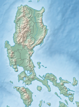
Oriental Mindoro, officially the Province of Oriental Mindoro, is a province in the Philippines located on the island of Mindoro under Mimaropa region in Luzon, about 140 kilometres (87 mi) southwest of Manila. The province is bordered by the Verde Island Passage and the rest of Batangas to the north, by Marinduque, Maestre de Campo Island, Tablas Strait and the rest of Romblon to the east, by Semirara and the rest of Caluya Islands, Antique to the south, and by Occidental Mindoro to the west. Its provincial capital Calapan, the only city in the island, is the most-populous in the province, and Mimaropa's regional center.

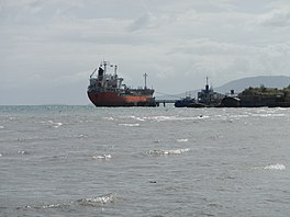
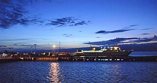
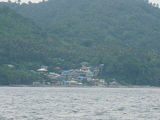
Puerto Galera, officially the Municipality of Puerto Galera, is a 1st class municipality in the province of Oriental Mindoro, Philippines. According to the 2020 census, it has a population of 41,961 people.

The Coral Sea is a marginal sea of the South Pacific off the northeast coast of Australia, and classified as an interim Australian bioregion. The Coral Sea extends 2,000 kilometres (1,200 mi) down the Australian northeast coast. Most of it is protected by the French Natural Park of the Coral Sea and the Australian Coral Sea Marine Park. The sea was the location for the Battle of the Coral Sea, a major confrontation during World War II between the navies of the Empire of Japan, and the United States and Australia.

Roatán is an island in the Caribbean, about 65 kilometres (40 mi) off the northern coast of Honduras. The largest of the Bay Islands of Honduras, it is located between the islands of Utila and Guanaja. The island was formerly known in English as Ruatan and Rattan.

Mabini, officially the Municipality of Mabini, is a 1st class municipality in the province of Batangas, Philippines. According to the 2020 census, it has a population of 50,858 people.

Bauan, officially the Municipality of Bauan, is a 1st class municipality in the province of Batangas, Philippines. According to the 2020 census, it has a population of 90,819 people.
Tingloy, officially the Municipality of Tingloy, is a 5th class municipality in the province of Batangas, Philippines. According to the 2020 census, it has a population of 19,215 people, making it the least populated municipality in the province.

The Ningaloo Coast is a World Heritage Site located in the north west coastal region of Western Australia. The 705,015-hectare (1,742,130-acre) heritage-listed area is located approximately 1,200 kilometres (750 mi) north of Perth, along the East Indian Ocean. The distinctive Ningaloo Reef that fringes the Ningaloo Coast is 260 kilometres (160 mi) long and is Australia's largest fringing coral reef and the only large reef positioned very close to a landmass. The Muiron Islands and Cape Farquhar are within this coastal zone.
Bootless Inlet or Bootless Bay is a body of water in south-eastern Papua New Guinea, approximately 20 kilometres (12 mi) southeast of Port Moresby. There are four islands in the bay: Motupore Island, Loloata Island, Manunouha Island, and Bunamotu Island. A barrier reef across the mouth of the inlet protects it from rough seas. Several small creeks empty into the bay, but no large rivers.

Weh Island is a small active volcanic island to the northwest of Sumatra in Indonesia, also known as Sabang after the city situated on the northeast end of the island, whose area of 122.13 square kilometres (47.15 sq mi) includes the whole island as well as several offshore islets. It had a population of 43,527 at the official mid-2023 estimate. It is 45 minutes by fast regular ship or 2 hours by ferry from the mainland port of Banda Aceh. It was originally connected to the Sumatran mainland and became separated by sea after the stratovolcano's last eruption in the Pleistocene era. The island is situated in the Andaman Sea.

The Verde Island Passage is a strait that separates the islands of Luzon and Mindoro in the Philippines, connecting the West Philippine Sea with the Tayabas Bay and the Sibuyan Sea beyond. Traditionally, the sea lane has been one of the busiest in the Philippines because it acts as a corridor from the Port of Manila to the Visayas and Mindanao in the south. A network of ferry routes cross the passage and connect the surrounding provinces of Batangas, Marinduque, Occidental Mindoro, Oriental Mindoro and Romblon. The Verde Island Passage is identified as a site of highest marine biodiversity importance in the Coral Triangle. The 1.14 million hectare passage is extremely rich in marine biodiversity and has been called "Center of the Center of Marine Shorefish Biodiversity" with various conservation groups and local government units pushing for its nomination as a UNESCO World Heritage Site.

The Great Barrier Reef is the world's largest reef systems, stretching along the East coast of Australia from the northern tip down at Cape York to the town of Bundaberg, is composed of roughly 2,900 individual reefs and 940 islands and cays that stretch for 2,300 kilometres (1,616 mi) and cover an area of approximately 344,400 square kilometres (133,000 sq mi). The reef is located in the Coral Sea, off the coast of Queensland in northeast Australia. A large part of the reef is protected by the Great Barrier Reef Marine Park.

Apo Reef is a coral reef system in the Philippines situated in the western waters of Occidental Mindoro province in the Mindoro Strait. Encompassing 34 square kilometres (13 sq mi), it is considered the world's second-largest contiguous coral reef system, and is the largest in the country. The reef and its surrounding waters are protected areas administered as the Apo Reef Natural Park (ARNP). It is one of the best known and most popular diving regions in the country, and is in the tentative list for UNESCO World Heritage Sites.

Selinog, historically known as Silino and also named Silinog, is an island barangay in Dapitan, Zamboanga del Norte, Philippines. It is coterminous with Silino Island and is located 12.9 kilometres (8.0 mi) off Tagolo Point, the northern entrance point to Dapitan Bay, and some 15 kilometres (9.3 mi) east of the island of Aliguay in the Bohol Sea. The island is a flat coralline island with a land area of 78 hectares. It is surrounded by 70 hectares of coral reefs and sandy areas. According to the 2020 census, the island community has a population of 692 inhabitants.

Lighthouse Reef is an atoll in the Caribbean Sea, the easternmost part of the Belize Barrier Reef and one of its three atolls, the other two being Turneffe Atoll and Glover's Reef. Lighthouse Reef is located about 80 kilometres (50 mi) southeast of Belize City. The atoll is of oblong shape, approximately 35 kilometres (22 mi) long from north to south, and about 8 kilometres (5.0 mi) wide. It forms a shallow sandy lagoon with an area of 120 square kilometres (46 sq mi) and a depth between 2 and 6 metres deep.

The Coral reefs of the Solomon Islands consists of six major islands and over 986 smaller islands, in Oceania, to the east of Papua New Guinea and northwest of Vanuatu. The Solomon Islands lie between latitudes 5° and 13°S, and longitudes 155° and 169°E. The distance between the westernmost and easternmost islands is about 1,500 km (930 mi). The Santa Cruz Islands are situated north of Vanuatu and are especially isolated at more than 200 km (120 mi) from the other islands. The Solomon Islands has the 22nd largest Exclusive Economic Zone of 1,589,477 km2 (613,701 sq mi) of the Pacific Ocean.