The Wading River is a tributary of the Mullica River, approximately 10.1 miles (16.3 km) long, in southern New Jersey in the United States. The river drains a rural forested area of the Pinelands, one of the most pristine areas along the coast of the northeastern United States.
The Bass River is a 4.7-mile-long (7.6 km) tributary of the Mullica River in southeastern New Jersey in the United States.
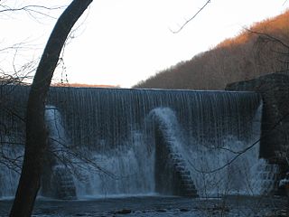
Raccoon Creek is a 22.6-mile-long (36.4 km) tributary of the Delaware River in southern New Jersey in the United States.
Landing Creek is an 11.2-mile-long (18.0 km) tributary of the Mullica River in southern New Jersey in the United States. The creek originates near Egg Harbor City and joins the Mullica River just below Lower Bank near Hog Islands. It is joined along its route by Union Creek, Indian Cabin Creek, Elliot's Creek, and Rubin's Run, respectively.
Nescochague Creek is a 6.4-mile-long (10.3 km) tributary of the Mullica River in southern New Jersey in the United States. The creek starts just northwest of Hammonton, arcs along the southern boundary of Wharton State Forest, and joins the Mullica River just above County Route 542.
The West Branch Wading River is a 22.7-mile-long (36.5 km) tributary of the Wading River in Burlington County in the southern New Jersey Pine Barrens in the United States.
The South Branch Rancocas Creek is a 21.7-mile-long (34.9 km) tributary of Rancocas Creek in Burlington County, New Jersey in the United States. The South Branch Rancocas Creek drains an area of 144 square miles. Much of the upland agriculture within the Rancocas Creek basin lies inside the South Branch Rancocas Creek basin. It is also among the least developed parts of the Rancocas Creek watershed.
The Southwest Branch Rancocas Creek is a 13.8-mile-long (22.2 km) tributary of the South Branch Rancocas Creek in Burlington County, New Jersey in the United States.
The North Branch Rancocas Creek is a 31-mile-long (50 km) tributary of Rancocas Creek in southwestern New Jersey in the United States.
The South Branch Raritan River is a 50-mile-long (80 km) tributary of the Raritan River in central New Jersey in the United States.

The Oswego River is a 23.7-mile-long (38.1 km) tributary of the Wading River in the southern New Jersey Pine Barrens in the United States.
Westecunk Creek is an 11.1-mile-long (17.9 km) tributary of Little Egg Harbor in southeastern New Jersey in the United States.
Turtle Creek is a 1.9-mile-long (3.1 km) tributary of the Mullica River in southern New Jersey in the United States.
Greenwood Branch is a 9.3-mile-long (15.0 km) tributary of the North Branch Rancocas Creek in the southern New Jersey Pine Barrens in the United States.
Green Spring Run is an 8.9-mile-long (14.3 km) tributary stream of the North Branch Potomac River in Hampshire County in the U.S. state of West Virginia. Green Spring Run rises in Greenwood Hollow north of Springfield and meanders northeast through Green Spring Valley. The South Branch Valley Railroad and Green Spring Road run parallel to the stream. It runs through the community of Green Spring, from which the stream takes its name. From Green Spring, Green Spring Run flows east where it reaches its confluence with the North Branch Potomac shortly before the North Branch joins with the South Branch Potomac River to form the Potomac River.
Big Graveling Creek is a 2.9-mile-long (4.7 km) tributary of the Mullica River in southern New Jersey in the United States.
Ballanger Creek is a 4.7-mile-long (7.6 km) tributary of the Mullica River in southern New Jersey in the United States. The name is derived from "Belangee," a family of French Huguenots who were early settlers in the area.

The Frankstown Branch Juniata River is a 46.0-mile-long (74.0 km) tributary of the Juniata River in Blair and Huntingdon Counties, Pennsylvania, in the United States.
Mill Run is a 9.1-mile-long (14.6 km) tributary stream of the South Branch Potomac River, belonging to the Potomac River and Chesapeake Bay watersheds. The stream is located in Hampshire County in the Eastern Panhandle of the U.S. state of West Virginia. Mill Run rises on Nathaniel Mountain and flows northeast, then northwest into the South Branch south of Romney near Hampshire Park on South Branch River Road.


