Related Research Articles

Shangla District is a district in Malakand Division of Khyber Pakhtunkhwa, Pakistan. The district's headquarters are located at Alpuri, while the largest city and commercial center is Besham. The district was established in 1995, having previously been a subdivision of Swat District. The total area of the district is 1,586 square kilometers. Shangla comprises five subdivisions, Alpuri, Puran, Chakesar, Martung and Besham tehsils. Shangla is famous for its touring spot, Yakhtangay
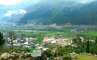
Battagram is a city and Union Council of Battagram District in Khyber Pakhtunkhwa Province of Pakistan. It is located at 34°41'N 73°1'E and has an altitude of 1038 metres.
Allai is a tehsil of Allai District in Pakistan's Khyber-Pakhtunkhwa province. It is home to the Allai Valley and district headquarters. Prince Muhammad Nawaz Khan Swati is the current "Chief of Allai Valley".

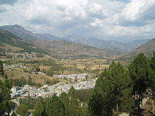
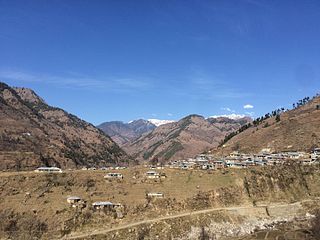
Battagram is a tribal district in Hazara Division of Khyber Pakhtunkhwa province in Pakistan. The headquarter is Battagram, which is about 75 km from Mansehra city. It was part of historic Yaghistan before 1955. Later in 1955, It was merged into Pakistan and made part of neighboring Mansehra District with the status of Tehsil. It was officially separated from Mansehra District in July 1993 and was given the status of district. Battagram District was ruled by many different Khans, all belonging to the Swati tribe.
Bateela is a town, and one of twenty union councils in Battagram District in the Khyber Pakhtunkhwa province of Pakistan.
Shumlai is a town, and one of twenty union councils in Battagram District, in Khyber Pakhtunkhwa province of Pakistan. It is located at 34°42'20N 73°7'0E and has an altitude of 1567 metres.
Battagram Tehsil is an administrative subdivision (Tehsil) of the Battagram District in the Khyber Pakhtunkhwa province of Pakistan. It serves as the Tehsil headquarters and covers a total area of 300 square miles (780 km2). Battagram Tehsil merged into Pakistan as an administrative region before being raised to the status of a district in 1993. On October 8, 2005, a 7.6 magnitude earthquake in Kashmir badly affected the area.
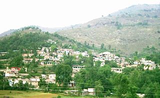
Chappargram or Chapargram is a village of Battagram District in Khyber-Pakhtunkhwa province of Pakistan. It is part of Ajmera Union Council and lies within Battagram Tehsil and is located about four kilometres from the district headquarters Battagram along the Shahrah-e-Resham or silk route.

PK-36 Mansehra-I is a constituency for the Khyber Pakhtunkhwa Assembly of the Khyber Pakhtunkhwa province of Pakistan.

PK-34 Battagram-I is a constituency for the Khyber Pakhtunkhwa Assembly of the Khyber Pakhtunkhwa province of Pakistan.

PK-33 Kolai Palas is a constituency for the Khyber Pakhtunkhwa Assembly of the Khyber Pakhtunkhwa province of Pakistan.

PK-35 Battagram-II is a constituency for the Khyber Pakhtunkhwa Assembly of the Khyber Pakhtunkhwa province of Pakistan.
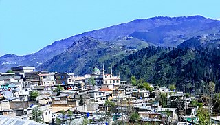
Shingli Bala is a village of Battagram District in Khyber-Pakhtunkhwa province of Pakistan. It is part of Gijbori Union Council and lies within Battagram Tehsil and is located about four kilometres from the district headquarters Battagram along the Karakoram Highway(Shahrah-e-Resham) or silk route, and opposite CPEC Bridge at Kas-Pul area.
Shingli Payeen is a village of Battagram District in Khyber-Pakhtunkhwa province of Pakistan. It is part of Peshora Union Council and lies within Battagram Tehsil and is located about Five kilometres from the district headquarters Battagram along the Shahrah-e-Resham or silk route.

Hotal Deshan is a village of Battagram District in Khyber-Pakhtunkhwa province of Pakistan. It is part of Peshora Union Council and lies within Deshan Aera.
Battagram may refer to:
Prince Zubair KhanSwati is a Pakistani politician who is a member of the Provincial Assembly of Khyber Pakhtunkhwa for the second time. He is grandson of Nawab Ayub Khan Swati, the last Nawab of Allai tribal territory and four times elected member of National Assembly of Pakistan. His father Fateh Muhammad Khan Swati had been member of the Provincial Assembly of Khyber Pakhtunkhwa for the 5 consecutive terms. His uncle Prince Nawaz Khan Swati is also the current MNA of NA-13 Battagram.
Taj MuhammadKhan Swati is a Pakistani politician who is a member of the Provincial Assembly of Khyber Pakhtunkhwa for the third time. He is son of Haji Muhammad Yousaf Khan, who currently holds the title of being the tribal ruler of Trand area and head of political alliance named "Trand Group". His father remained member of Provincial Assembly for the 8 times and also served as Provincial Minister.
Abaseen or Abasin Division is a proposed division in Pakistan's Khyber Pakhtunkhwa province, compromising seven districts: Battagram, Allai, Kolai-Palas, Upper Kohistan, Lower Kohistan, Shangla, and Torghar. The area is located on both sides of the Indus River, which is known in Pashto and other local languages as Abaseen.
References
- ↑ "Awesome Landscape Beauty Of Battagram Valley Pakistan". Razaq Vance. 2013-12-19. Retrieved 2024-12-21.
- ↑ "Khyber Pakhtunkhwa-Battagram -" . Retrieved 2024-12-21.
| | This Battagram District location article is a stub. You can help Wikipedia by expanding it. |