
The Karen National Union (ကညီဒီကလုာ်စၢဖှိၣ်ကရၢ) is a political organisation with an armed wing, the Karen National Liberation Army (KNLA), that claims to represent the Karen people of Myanmar (Burma). It operates in mountainous eastern Myanmar, and has underground networks in other areas of Myanmar where Karen people live as a minority group. In the Karen language, this area is called Kawthoolei.

The Karen, also known as the Kayin, Kariang or Kawthoolese, are an ethnolinguistic group of Sino-Tibetan language-speaking peoples. The group as a whole is heterogeneous and disparate as many Karen ethnic groups do not associate or identify with each other culturally or linguistically. These Karen groups reside primarily in Kayin State, southern and southeastern Myanmar. The Karen account for around seven percent of the Burmese population. Many Karen have migrated to Thailand, having settled mostly on the Myanmar–Thailand border. A few Karen have settled in the Andaman and Nicobar Islands, India, and other Southeast Asian and East Asian countries.

The Karenni States, also known as Red Karen States, was the name formerly given to the states inhabited mainly by the Red Karen, in the area of present-day Kayah State, eastern Burma. They were located south of the Federated Shan States and east of British Burma.
Bo Mya was a Karen leader born in Papun District, which is in present-day Karen State, Myanmar. He was a long-standing chairman of the Karen National Union (KNU), a political organisation of the Karen people, from 1976 to 2000. He stepped down to become vice-chairman in 2004, and retired in 2004 from all public offices, due to poor health.

The Karen National Liberation Army is the military branch of the Karen National Union (KNU), which campaigns for the self-determination of the Karen people of Myanmar. The KNLA has been fighting the Burmese government since 1949. The KNLA was reported to have had a strength of approximately 20,000 in 1980, 3,000 in 2001, 5,000 in 2006, 6,000 in 2012, and 7,000 in 2014. As of early 2021, the KNLA is estimated to have at least 15,000 troops. The army is divided into seven brigades and a 'Special Force' reserved for special operations.
Insurgencies have been ongoing in Myanmar since 1948, the year the country, then known as Burma, gained independence from the United Kingdom. The conflict has largely been ethnic-based, with several ethnic armed groups fighting Myanmar's armed forces, the Tatmadaw, for self-determination. Despite numerous ceasefires and the creation of autonomous self-administered zones in 2008, many armed groups continue to call for independence, increased autonomy, or the federalisation of the country. The conflict is the world's longest ongoing civil war, having spanned more than seven decades.
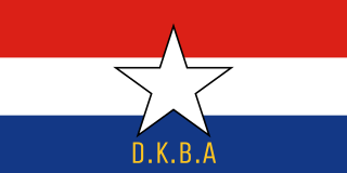
The Democratic Karen Buddhist Army was an insurgent group of Buddhist soldiers and officers in Myanmar that split from the predominantly Christian-led Karen National Liberation Army (KNLA), one of the largest rebel factions in Myanmar. Shortly after splitting from the KNLA in December 1994, the DKBA signed a ceasefire agreement with the government of Myanmar in exchange for military and financial assistance; provided that it supported government offensives against the KNU and its allies.
The 2010–2012 Myanmar border clashes were a series of skirmishes between the Tatmadaw on one side, and the DKBA-5 and the Karen National Liberation Army (KNLA) on the other. The clashes erupted along the border with Thailand shortly after Myanmar's general election on 7 November 2010. An estimated 10,000 refugees have fled into nearby neighbouring Thailand to escape the violent conflict. There was concern that due to discontent with the elections, and speculations of electoral fraud, that the conflict could escalate into a civil war.

Mae La, Beh klaw ,(S'gaw Karen: မဲၣ်လးဒဲကဝီၤ, ဘဲကျီး) is a refugee camp in Thailand. It was established in 1984 in Tha Song Yang District, Tak Province in the Dawna Range area and houses 50,000 Karen refugees; the number continues to rise as of June 2019. Mae La is the largest refugee camp for Karen refugees in Thailand. Over 90% are the persecuted ethnic Karen. The camps are overseen and run by the Thailand Burma Border Consortium (TBBC), a union of 11 international non-governmental organizations that provide food, shelter and non food items to the Burmese refugees and displaced people.
Kawmoora was a stronghold of the rebel Karen National Liberation Army, the armed wing of the Karen National Union. It was located on a large sandbank linked to Myanmar through a narrow strip of land fortified by a 50-metre (160 ft)-long border wall. Kawmoora was completely surrounded by Thailand.

The Karen conflict is an armed conflict in Kayin State, Myanmar. It is part of the wider internal conflict in Myanmar between the military government and various minority groups. Karen nationalists have been fighting for an independent state, known as Kawthoolei, since 1949. The Karen National Union (KNU) and its Karen National Liberation Army (KNLA) are the most prominent Karen rebel groups. Hundreds of thousands of civilians have been displaced by the conflict, many of whom fled to neighbouring Thailand and survive in refugee camps.

The Mon National Liberation Army is a Mon insurgent group in Myanmar (Burma). It is the armed wing of the New Mon State Party (NMSP), and has been fighting government forces since 1949, though under different names. The NMSP signed the Nationwide Ceasefire Agreement (NCA) on 15 October 2015 with several other insurgent groups and the government of Myanmar.
The Fall of Manerplaw occurred on 27 January 1995, when the village of Manerplaw was captured by the Tatmadaw and the Democratic Karen Buddhist Army (DKBA). Manerplaw was the headquarters of two armed opposition groups, the Karen National Union (KNU) and the All Burma Students' Democratic Front (ABSDF). The final military assault by the Tatmadaw, aided by positional information provided by the DKBA, was met with little resistance by the KNLA, whose leaders had ordered a tactical retreat.

Thuzana, also known as the Myainggyi-ngu Sayadaw, was a Karen Theravada Buddhist monk based in Myaing Gyi Ngu, Kayin State, Myanmar. He was the leader of the Democratic Karen Buddhist Army (DKBA), an ethnic insurgent group, until its dissolution in 2010.
The Karen–Mon conflict is a series of armed clashes between the ethnic rebel armies of the Karen and Mon peoples. The Karen National Liberation Army and the Mon National Liberation Army have clashed sporadically since 1988, mostly around the Myanmar–Thailand border at Three Pagodas Pass.

The People's Defence Force is the armed wing of the National Unity Government (NUG) in Myanmar. The armed wing was formed by the NUG from youths and pro-democracy activists on 5 May 2021 in response to the coup d'état that occurred on 1 February 2021 that put the military junta and their armed wing the Tatmadaw in power. The military junta designated it as a terrorist organisation on 8 May 2021. In October 2021, NUG's Ministry of Defence announced that it had formed a central committee to coordinate military operations across the country.

The Myanmar civil war, also called the Myanmar Spring Revolution and the People's Defensive War, is an ongoing civil war following Myanmar's long-running insurgencies which escalated significantly in response to the 2021 military coup d'état and the subsequent violent crackdown on anti-coup protests.
The following is a timeline of major events during the Myanmar civil war (2021–present), following the 2021 military coup d'état and protests. It was also a renewed intensity in existing internal conflict in Myanmar.
Operation 1107 is an ongoing joint military operation launched on 7 November 2023, by the Karenni National People's Liberation Front, Karenni Army, and Karenni Nationalities Defence Force against the Tatmadaw military junta in Myanmar, during the Myanmar civil war. It was launched in support of the concurrent Operation 1027 by other rebel forces in Myanmar.
The Battle of Kawkareik or Siege of Kawkareik occurred in late October 2022 when the Karen National Liberation Army (KNLA) escalated fighting in southeastern Myanmar and besieged the district-level capital town of Kawkareik. At the time, it appeared to be a significant first seizure of a major town by anti-junta forces since the renewed civil war.