
Andhra Pradesh is a state in the southern coastal region of India. It is the seventh-largest state with an area of 162,970 km2 (62,920 sq mi) and the tenth-most populous state with 49,577,103 inhabitants. It has shared borders with Telangana, Chhattisgarh, Odisha, Tamil Nadu, Karnataka, and the Bay of Bengal. It has the second-longest coastline in India at about 974 km (605 mi). After existence as Andhra State and unified Andhra Pradesh, the state took its present form on 2 June 2014, when the new state of Telangana was formed through bifurcation. visakhapatnam serves as the executive capital of the state while kurnool and amaravati both represents legislative and judiciary capital. Visakhapatnam is the largest city in the state. Water sharing disputes and asset division with Telangana are not yet resolved. Telugu, one of the classical languages of India used by the majority of people, is the first official language.

Nellore is a city located on the banks of Penna River, in Nellore district of the Indian state of Andhra Pradesh. It serves as the headquarters of the district, as well as Nellore mandal and Nellore revenue division. It is the fourth most populous city in the state. It is at a distance of 700 km from Visakhapatnam and about 170 km north of Chennai, Tamil Nadu and also about 380 km east-northeast of Bangalore, Karnataka.

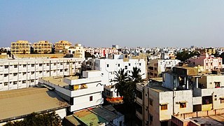
Chittoor is a city and district headquarters in Chittoor district of the Indian state of Andhra Pradesh. It is also the mandal and divisional headquarters of Chittoor mandal and Chittoor revenue division respectively. The city has a population of 153,756 and that of the agglomeration is 175,647.

Chiranjeevi is an Indian actor, film producer and former politician. He is regarded as one of the most successful and influential actors in the history of Indian cinema. In a career spanning over four decades, he starred in over 150 feature films predominantly in Telugu, as well as some films in Hindi, Tamil and Kannada. Chiranjeevi won the Andhra Pradesh state's highest film award, the Raghupathi Venkaiah Award, three Nandi Awards, and nine Filmfare Awards South including the Lifetime Achievement Award. In 2006, he was honoured with the Padma Bhushan, India's third-highest civilian award, for his contributions to Indian cinema. In 2013, CNN-IBN named him as one of "the men who changed the face of the Indian Cinema".

Srikakulam is a city and the headquarters of Srikakulam district in the Indian state of Andhra Pradesh. As of 2011 census, it has a population of 165,735. There are many other places of Buddhist Tourism such as Salihundam, Kalinga Patnam, Dabbaka Vaani Peta, Nagari Peta, Jagati Metta, Singupuram etc. in Srikakulam District. The Buddhist heritage site of Salihundam has some unique features. It has a beautiful star atop a stupa, rock cut massive stupas inside chaitya grihas, brick stupas with wheel pattern plan, votive stupas, inscriptions on the steps leading to the stupas and museum housing over two dozen sculpted statue and figurines of Buddha, Jain Teerthankars and other deities
Vijayawada, formerly known as Bezawada, is the second largest city in the Indian state of Andhra Pradesh. It is located on the banks of the Krishna River surrounded by the hills of the Eastern Ghats, known as the Indrakeeladri Hills. The city is home to the important Hindu shrine of Kanaka Durga Temple. It geographically lies on the center spot of Andhra Pradesh. The city has been described as the commercial, political, cultural and educational capital of Andhra Pradesh. It is the administrative headquarters of NTR district. The Prakasam Barrage across the Krishna River connects the Southern part of Vijayawada with the North Eastern part of Andhra Pradesh state's capital Amaravati.

Rayalaseema is a geographic region in the Indian state of Andhra Pradesh. It comprises four southern districts of the State prior to districts reorganisation in 2022 namely Kurnool, Anantapur, YSR and Chittoor districts. Four new districts were created from these namely Sri Sathya Sai Nandyal, Annamayya and Tirupati The As of 2011 census of India, the western four districts of the region had a population of 15,184,908 and covers an area of 71,060 km2 (27,440 sq mi).

Kurnool is a city in the state of Andhra Pradesh, India. It formerly served as the capital of Andhra State (1953–1956). And is probably going to serve as the judicial capital of Andhra Pradesh in 2024. The city is often referred to as "The Gateway of Rayalaseema". Kurnool is also known as The City of Gem Stones. It also serves as the district headquarters of its Kurnool district. As of 2011 census, it is the fifth most populous city in the state with a population of 484,327. It is located on the banks of the Tungabhadra river. Although the area has been inhabited for thousands of years, modern Kurnool was founded in the 16th century CE with the construction of the Konda Reddy Fort.

Vizianagaram, also known as Vijayanagaram, is a city and the headquarters of the Vizianagaram district in the Indian state of Andhra Pradesh. It is located in the Eastern Ghats, about 24 km (15 mi) west of the Bay of Bengal and 40 km (25 mi) north-northeast of Visakhapatnam. The city has a population of 228,025 and was established as the capital of the Vizianagaram estate by Raja Vijayaram Raj from the Pusapati dynasty. The rulers had a notable role in the history of the region in the 18th century and were patrons of education and arts.
Kavali is a town in Nellore district of Andhra Pradesh of India. It also serves as headquarters of Kavali mandal and Kavali revenue division.It is one of the few cities from Andhra Pradesh which were selected for Atal Mission for Rejuvenation and Urban Transformation (AMRUT) Scheme.

Srikakulam district is one of the twenty-six districts of the Indian state of Andhra Pradesh, located in the Uttarandhra region of the state, with its headquarters located at Srikakulam. It is one of the six districts, located in the extreme northeastern direction of the state. It was formerly known as Chicacole, and was under Ganjam district till 1936 April 1, then merged under Vizagapatam district. Srikakulam district forms the core area of Kalinga where most of its historical capitals like Kalinganagari, pithunda, Dantapuram are located.

Bobbili is a town in Vizianagaram district of the Indian state of Andhra Pradesh.

Narsipatnam is a census town in Anakapalle district of the Indian state of Andhra Pradesh. It was upgraded from a gram panchayat into municipality in 2012. The town is spread over an area of 42 km2 (16 sq mi) The resting place of the revolutionary Indian freedom fighter Alluri Sitarama Raju is located in Krishna Devi Peta village of From Narsipatnam to labasingi Village 30 kms only.. labasingi most popular winter tourism place..so many Tourists enjoy -2 degree's temparature there.. Narsipatnam town is 43 km away from Tuni. And it is 72 km away from Visakhapatnam.
Podaturpet is a Town under Pallipattu(Pallipet) Taluk in Thiruvallur district in the Indian state of Tamil Nadu.

Tuni is a city in Kakinada district of the Indian state of Andhra Pradesh. It is a second biggest city in Kakinada district. And It is the 15th most populated city in the state. Freedom fighter Alluri Sitaramaraju studied here. It is a major commercial marketing center for more than 200+ surrounding villages in the district. Tuni is a border point for the district of Kakinada. It is known for mango production, with nearly 250 varieties being exported from the area. Tuni City is also known as "Mango City". Tuni is also famous for the production of betel leaves and jute bags. A variety of cashew nuts are also produced in Tuni.
Ramachandrapuram is a town in Konaseema district of the Indian state of Andhra Pradesh. The town is a Municipality which serves as the headquarters of Ramachandrapuram mandal and Ramachandrapuram revenue division.

Pathapatnam is a town in Srikakulam district of the Indian state of Andhra Pradesh. It is located in Pathapatnam mandal of Palakonda revenue division. Pathapatnam is located on the border of Srikakulam district of Andhra Pradesh and Gajapati district of Odisha. Parlakhemundi, the headquarters of Gajapati District, can be considered as twin town of Pathapatnam because of its close proximity. It is located around 65 km from srikakulam. It was the old capital of Paralakhemundi Gajapati Maharajah of his erstwhile kingdom.

The Economy of Andhra Pradesh is primarily dependent on agriculture, which directly and indirectly employs 62% of the population. GSDP as per the first revised estimate, for the year 2022-23 is ₹13,17,728 crore. The state is ranked 1st in the country for the year 2021-22 in terms of the Gross State Domestic Product (GSDP) growth at constant prices with growth rate of 11.43%.
Public Sector Undertakings (Banks) are a major type of government-owned banks in India, where a majority stake (i.e., more than 50%) is held by the Ministry of Finance (India) of the Government of India or State Ministry of Finance of various State Governments of India. The shares of these government-owned-banks are listed on stock exchanges. Their main objective is social welfare.

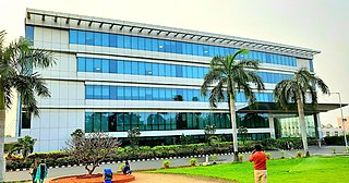
Amaravati is the capital of the Indian state of Andhra Pradesh. It is located on the banks of the river Krishna in Guntur district.

