Baublitz Commercial Airport

Last updated
Baublitz Commercial Airport
Summary
Airport typePublic
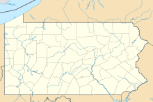
Serves Brogue, Pennsylvania
Elevation  AMSL 750 ft / 229 m
Coordinates 39°51′8.365″N76°29′10.872″W / 39.85232361°N 76.48635333°W / 39.85232361; -76.48635333
Map
USA Pennsylvania location map.svg
Airplane silhouette.svg
9W8
Location of Baublitz Commercial Airport in Pennsylvania
Usa edcp location map.svg
Airplane silhouette.svg
9W8
9W8 (the United States)
Runways
Direction LengthSurface
ftm
10/282,493760Turf
Source: FAA [1]

Baublitz Commercial Airport( FAA LID : 9W8) is a public-use general aviation airport located 1 mile South of Brogue, Pennsylvania. [1] The airport opened in 1958, but only became public-use in the 1970s. [2]
Contents

Incidents

In November of 2019, a 1946 Luscombe aircraft crashed in a field 0.5 miles away from the airport. The owner of the plane – who was uninjured in the crash – disappeared shortly thereafter, although the owner of the plane was later identified by the FAA. [2] [3]

See also

Related Research Articles

<span class="mw-page-title-main">Santa Monica Airport</span> Airport in Santa Monica, California

Santa Monica Airport is a general aviation airport largely in Santa Monica, California, United States, in the Greater Los Angeles area. It is one of the United States' oldest airports, and has been one of the world's foremost general aviation airports.

<span class="mw-page-title-main">Green Bay–Austin Straubel International Airport</span> Airport serving Green Bay, Wisconsin, USA

Green Bay–Austin Straubel International Airport is a county-owned public-use airport in Brown County, Wisconsin, United States, which serves Northeastern Wisconsin. It is the fourth busiest of eight commercial service airports in Wisconsin in terms of passengers served. The airport is located 7 nautical miles southwest of downtown Green Bay, in the village of Ashwaubenon. It is included in the Federal Aviation Administration (FAA) National Plan of Integrated Airport Systems for 2023–2027, in which it is categorized as a non-hub primary commercial service facility. The airport sits on portions of land encompassing Green Bay and the Oneida Nation of Wisconsin's Indian reservation. It has two runways and is used for commercial air travel and general aviation. There are two concourses with six gates each. The airport is named for Lt. Col. Austin Straubel, the first aviator from Brown County to die in his country's service on February 3, 1942, after having served for thirteen years in the United States Army Air Corps. The airport name was officially changed to Green Bay–Austin Straubel International Airport on August 17, 2016.

<span class="mw-page-title-main">Wilkes-Barre/Scranton International Airport</span> Airport in Pennsylvania, U.S.

Wilkes-Barre/Scranton International Airport is mostly in Pittston Township, Pennsylvania, and spans the border between Luzerne County and Lackawanna County. It is owned and operated by the two counties; it is about 7 miles from Scranton and 8 miles from Wilkes-Barre. It is the fifth-largest airport in Pennsylvania by passenger count and calls itself "your gateway to Northeastern Pennsylvania and the Pocono Mountains".

<span class="mw-page-title-main">McClellan–Palomar Airport</span> Municipal airport serving the city of Carlsbad, California, United States

McClellan–Palomar Airport is a public airport three miles (5 km) southeast of Carlsbad in San Diego County, California. It is owned by the County of San Diego. The airport is used for both general aviation and commercial aviation. As of March 2013, the airport was the fourth-busiest single runway airport in the United States.

<span class="mw-page-title-main">Pullman–Moscow Regional Airport</span> Airport in Whitman County, Washington

Pullman–Moscow Regional Airport is a public airport in the northwest United States, located in Whitman County, Washington, two miles (3 km) east of Pullman, Washington and four miles (6 km) west of Moscow, Idaho. The airport is accessed via spurs from State Route 270, and has a single 7,101-foot (2,164 m) runway, headed northeast–southwest (5/23), which entered service in October 2019. The former runway (6/24) was 6,730 feet (2,051 m) and aligned with Moscow Mountain twelve miles (20 km) to the northeast, the highest summit in the area.

<span class="mw-page-title-main">Sawyer International Airport</span> Airport in Michigan, United States

Sawyer International Airport is a county-owned, public-use airport in Marquette County, Michigan, United States. It is located 17 nautical miles south of the central business district of the city of Marquette. It is included in the Federal Aviation Administration (FAA) National Plan of Integrated Airport Systems for 2021–2025, in which it is categorized as a non-hub primary commercial service facility.

<span class="mw-page-title-main">Chicago Executive Airport</span> Airport in Cook County, IL, US

Chicago Executive Airport, formerly Palwaukee Municipal Airport, is a public airport 18 miles (33 km) northwest of Chicago, in the village of Wheeling in Cook County, Illinois, United States. It is owned by the City of Prospect Heights and the Village of Wheeling.

<span class="mw-page-title-main">Floyd Bennett Memorial Airport</span> Airport in Queensbury, New York

Floyd Bennett Memorial Airport is a county-owned, public-use airport in Warren County, New York, United States. It is located three nautical miles (6 km) northeast of the central business district of Glens Falls, in the town of Queensbury. This airport is included in the National Plan of Integrated Airport Systems for 2011–2015, which categorized it as a general aviation facility.

<span class="mw-page-title-main">Monroe County Airport (Indiana)</span> Airport in Bloomington, Indiana

Monroe County Airport is a county-owned public-use airport located four nautical miles southwest of the central business district of Bloomington, a city in Monroe County, Indiana, United States. Commercial service has been available at different points in the airport's history but as of today and for the future, no scheduled service is available.

<span class="mw-page-title-main">Charlevoix Municipal Airport</span> Airport

Charlevoix Municipal Airport is a city-owned, public-use airport located one nautical mile (2 km) southwest of the central business district of Charlevoix, a city in Charlevoix County, Michigan, United States. It is mostly used for general aviation, but also offers passenger service to Beaver Island via Island Airways and Fresh Air Aviation.

<span class="mw-page-title-main">Danbury Municipal Airport</span> Airport in Connecticut, United States of America

Danbury Municipal Airport is a public use general aviation and commercial airport located three miles (5 km) southwest of the central business district of Danbury, in Fairfield County, Connecticut, United States. The airport opened in 1930. It is currently run by the City of Danbury under the management of Michael Safranek. It is included in the Federal Aviation Administration (FAA) National Plan of Integrated Airport Systems for 2017–2021, in which it is categorized as a regional reliever airport facility.

Southwest Michigan Regional Airport is a public use airport located two nautical miles (4 km) northeast of the central business district of Benton Harbor, a city in Berrien County, Michigan, United States. The airport is owned by the cities of Benton Harbor and St. Joseph, Michigan. It is included in the Federal Aviation Administration (FAA) National Plan of Integrated Airport Systems for 2017–2021, in which it is categorized as a regional general aviation facility.

<span class="mw-page-title-main">Felts Field</span> Airport near Spokane, Washington

Felts Field is a public airport in the northwest United States, located five miles (8 km) northeast of downtown Spokane, in Spokane County, Washington. It is owned by Spokane City-County.

<span class="mw-page-title-main">Zamperini Field</span> Airport in Torrance, California, US

Zamperini Field is a public airport three miles (5 km) southwest of downtown Torrance, in Los Angeles County, California, United States.

<span class="mw-page-title-main">Clare Municipal Airport</span> Airport in Clare, Michigan

Clare Municipal Airport is a public airport located one mile (2 km) east of downtown Clare, a city in Clare County, Michigan, United States. The airport became active in 1941. It serves general aviation for Clare and the surrounding area. It is included in the Federal Aviation Administration (FAA) National Plan of Integrated Airport Systems for 2017–2021, in which it is categorized as a local general aviation facility.

<span class="mw-page-title-main">Aeroflex–Andover Airport</span> Airport in Sussex County, New Jersey, United States

Aeroflex–Andover Airport is a public-use airport located two nautical miles (3.704 km) north of Andover within Kittatinny Valley State Park in Sussex County, New Jersey, United States. The airport is publicly owned by the New Jersey Forest Fire Service and used as a base for aerial wildfire suppression.

Anderson Municipal Airport is a public use airport three miles east of Anderson in Madison County, Indiana. The National Plan of Integrated Airport Systems for 2011–2015 categorized it as a general aviation facility. The airport currently has no scheduled air service however, is one of the busiest general aviation airports in the State of Indiana given its high volume of flight training and charter traffic.

<span class="mw-page-title-main">Joliet Regional Airport</span> Airport

Joliet Regional Airport is a public use airport located four nautical miles (7 km) west of the central business district of Joliet, a city in Will County, Illinois, United States. It is owned by the Joliet Park District.

Menominee Regional Airport is a public use airport located 1 mile (2 km) northwest of the central business district of Menominee, Michigan, a city in Menominee County, Michigan, United States. It is included in the Federal Aviation Administration (FAA) National Plan of Integrated Airport Systems for 2021–2025, in which it is categorized as a local general aviation facility.

<span class="mw-page-title-main">Alan Kulwicki plane crash</span> Aircraft accident

On the evening of April 1, 1993, NASCAR champion Alan Kulwicki was killed in an aviation accident when the Swearingen Merlin III twin turboprop he was traveling in crashed near Blountville, Tennessee, while on approach to the nearby Tri-Cities Regional Airport. All four people on board, including two executives of the Hooters restaurant chain, were killed.

References

  1. 1 2 "9W8 Baublitz Commercial". nfdc.faa.gov. Retrieved 21 October 2021.
  2. 1 2 Argento, Mike (22 November 2019). "A small plane crashed. Then, the pilot disappeared". York Daily Record. Retrieved 21 October 2021.
  3. VerHeist, Megan (25 November 2019). "Pilot In Pennsylvania Plane Crash 'Nowhere To Be Found': Report". Bel Air, MD Patch. Retrieved 21 October 2021.