The Montebello Islands, also known as the Monte Bello Islands, are an archipelago of around 174 small islands lying 20 km (12 mi) north of Barrow Island and 130 km (81 mi) off the Pilbara coast of north-western Australia. The islands form a marine conservation reserve of 58,331 ha administered by the Western Australian Department of Environment and Conservation. The islands were the site of three British atmospheric nuclear weapons tests in 1952 and 1956.
Louis Claude de Saulces de Freycinet was a French Navy officer. He circumnavigated the earth, and in 1811 published the first map to show a full outline of the coastline of Australia.
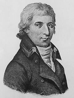
Nicolas Thomas Baudin was a French explorer, cartographer, naturalist and hydrographer.

Jean-Baptiste Louis Claude Théodore Leschenault de La Tour was a French botanist and ornithologist.
East Montalivet Island and West Montalivet Island are islands off coast of the Kimberley region, in the state of Western Australia, in the Indian Ocean. They are often referred to together as the Montlivet Islands, although this is not a gazetted name.
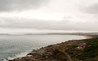
Encounter Bay is a bay in the Australian state of South Australia located on the state's south central coast about 100 kilometres (62 mi) south of the state capital of Adelaide. It was named by Matthew Flinders after his encounter on 8 April 1802 with Nicolas Baudin, the commander of the Baudin expedition of 1800–03. It is the site of both the mouth of the River Murray and the regional city of Victor Harbor. It is one of four "historic bays" located on the South Australian coast.

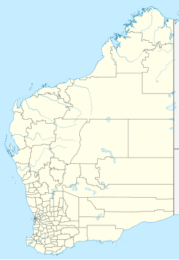
Cape Leeuwin is the most south-westerly mainland point of the Australian continent, in the state of Western Australia.

Hamelin Bay is a bay and a locality on the southwest coast of Western Australia between Cape Leeuwin and Cape Naturaliste. It is named after French explorer Jacques Félix Emmanuel Hamelin, who sailed through the area in about 1801. It is south of Cape Freycinet.
St Alouarn Islands are a group of islands and rocks south-east of Cape Leeuwin in Western Australia, approximately 11 km south of Augusta in Flinders Bay.

Geographe Bay is in the south-west of Western Australia around 220 km southwest of Perth.

Cape Naturaliste is a headland in the south western region of Western Australia at the western edge of the Geographe Bay. It is the northernmost point of the Leeuwin-Naturaliste Ridge which was named after the cape. Also the Leeuwin-Naturaliste National Park, Cape Naturaliste Lighthouse and the Cape to Cape hiking track were named after this location.

Cape Freycinet is a point on the coast between Cape Leeuwin and Cape Naturaliste in the south west of Western Australia.

Captain Matthew Flinders was a British navigator and cartographer who led the first inshore circumnavigation of mainland Australia, then called New Holland. He is also credited as being the first person to utilise the name Australia to describe the entirety of that continent including Van Diemen's Land, a title he regarded as being "more agreeable to the ear" than previous names such as Terra Australis.
The Baudin expedition of 1800 to 1803 was a French expedition to map the coast of New Holland. Nicolas Baudin was selected as leader in October 1800. The expedition started with two ships, Géographe, captained by Baudin, and Naturaliste captained by Jacques Hamelin, and was accompanied by nine zoologists and botanists, including Jean-Baptiste Leschenault de la Tour, François Péron and Charles-Alexandre Lesueur as well as the geographer Pierre Faure.

Géographe was a 20-gun Serpente-class corvette of the French Navy. She was named Uranie in 1797, and renamed Galatée in 1799, still on her building site. Her builder refused to launch her, as he had not been paid to that time. Finally launched in June 1800, she was renamed Géographe on 23 August 1800.
Naturaliste was one of the two-vessel Salamandre-class of galiotes à bombes of the French Navy. Under Jacques Hamelin, and together with Géographe she took part in the exploration of Australia of Nicolas Baudin.

A Voyage to Terra Australis: Undertaken for the Purpose of Completing the Discovery of that Vast Country, and Prosecuted in the Years 1801, 1802, and 1803, in His Majesty's Ship the Investigator was a sea voyage journal written by English mariner and explorer Matthew Flinders. It describes his circumnavigation of the Australian continent in the early years of the 19th century, and his imprisonment by the French on the island of Mauritius from 1804–1810.

Allen Island, also known as Allens Island or Allen's Island, is one of the South Wellesley Islands, in Queensland's Gulf of Carpentaria. It was named by Matthew Flinders after John Allen, a Derbyshire miner who was a member of the party of naturalists that accompanied the 1801–1803 voyage of HMS Investigator under Flinders. Flinders landed a party of botanists on the island on 20 November 1802 to search for plants.
Cape Hamelin is a headland seven kilometres south of Hamelin Bay in the capes region of south western Western Australia.
Peter David Monteath is an Australian historian and academic. He is a professor in Modern European History at Flinders University in South Australia. Monteath's research interests are in modern European and Australian history. He has a particular interest in prisoners of war, internment, and the German presence in Australia and has written extensively on these subjects.