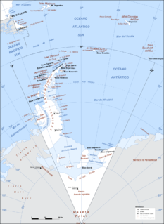
Argentine Antarctica is a sector of Antarctica claimed by Argentina as part of its national territory consisting of the Antarctic Peninsula and a triangular section extending to the South Pole, delimited by the 25° West and 74° West meridians and the 60° South parallel. This region overlaps with British and Chilean claims in Antarctica; however, all claims are suspended by the Antarctic Treaty System, of which Argentina is a founding signatory and permanent consulting member, with the Antarctic Treaty Secretariat being based in Buenos Aires.

Athene Glacier is a glacier, 10 miles (16 km) long, flowing east and merging with the terminus of Casey Glacier where it discharges into Casey Inlet, on the east coast of the Antarctic Peninsula. It was photographed from the air by the Falkland Islands Dependencies Survey (FIDS) in August 1947, and by the Ronne Antarctic Research Expedition in December 1947. It was surveyed by FIDS in November 1960, and was named by the UK Antarctic Place-Names Committee after Athene (Athena), the daughter of Zeus and goddess of the city of Athens in Greek mythology.
Prioress Island is a narrow island lying 0.5 nautical miles (0.9 km) east of Host Island in the Wauwermans Islands, in the Wilhelm Archipelago. Shown on an Argentine government chart of 1954. Named by the United Kingdom Antarctic Place-Names Committee (UK-APC) in 1958 after one of the characters in Geoffrey Chaucer's Canterbury Tales.

Bagshawe Glacier is a glacier which drains the northeast slopes of Mount Theodore and discharges into Lester Cove, Andvord Bay west of Mount Tsotsorkov, on the west coast of Graham Land, Antarctica.
Davies Top is a conspicuous isolated peak 2,360 metres (7,740 ft) high on the east side of Wakefield Highland, near the head of Lurabee Glacier in northern Palmer Land. It was photographed from the air by the Ronne Antarctic Research Expedition on December 22, 1947, and surveyed by the Falkland Islands Dependencies Survey (FIDS) in November 1960. It was named by the UK Antarctic Place-Names Committee after Anthony G. Davies of FIDS, who was Medical Officer at Horseshoe Island and Stonington Island, 1960.

Deloncle Bay is a bay, 1.5 nautical miles (3 km) long, indenting the northwest coast of Kiev Peninsula in Graham Land between Loubat Point and Glandaz Point, and opening on Lemaire Channel opposite Booth Island. It was discovered by the Belgian Antarctic Expedition, 1897–99. Recharted by the French Antarctic Expedition, 1903–05, it was named by Jean-Baptiste Charcot for François Deloncle, a French diplomat.

Suárez Glacier also known as Petzval Glacier is a glacier flowing into the small cove between Skontorp Cove and Sturm Cove on the west coast of Graham Land. It was first mapped by Scottish geologist David Ferguson in 1913-14. The 5th Chilean Antarctic Expedition (1950–51) remapped it and named it for Lieutenant Commander Francisco Suárez V., Operations Officer on the transport ship Angamos.
Stickle Ridge is a ridge rising to about 720 m, west of Saint Martha Cove on James Ross Island. The weathered red lavas of the ridge were examined by British Antarctic Survey (BAS) geologists during the 1985-86 season. Named descriptively by the United Kingdom Antarctic Place-Names Committee (UK-APC) after the spiny nature of the ridge.

Grubb Glacier is a glacier flowing into Lester Cove, Andvord Bay, to the west of Bagshawe Glacier, on the west coast of Graham Land, Antarctica. The glacier appears on an Argentine government chart of 1952. It was named by the UK Antarctic Place-Names Committee in 1960 for Thomas Grubb, an Irish optician who designed and introduced the first aplanatic camera lens, in 1857.
Miethe Glacier is a glacier 3 nautical miles (6 km) long, flowing northwest into Gerlache Strait to the south of Mount Banck, on the west coast of Graham Land, Antarctica. The glacier appears on an Argentine government chart of 1952. It was named by the UK Antarctic Place-Names Committee in 1960 for Adolf Miethe, a German chemist who introduced the first panchromatic emulsion for photographic plates in 1903.
Mink Peak is a prominent peak standing 2 nautical miles (4 km) north of Cleveland Mesa, at the east end of the Watson Escarpment in Antarctica. It was mapped by the United States Geological Survey from surveys and U.S. Navy air photos, 1960–64, and was named by the Advisory Committee on Antarctic Names for Harold D. Mink, a utilitiesman with the wintering parties at Byrd Station in 1962 and 1966.
Manciple Island is an island lying between Reeve Island and Host Island in the Wauwermans Islands, in the Wilhelm Archipelago of Antarctica. It was shown on an Argentine government chart of 1952. The island was named by the UK Antarctic Place-Names Committee in 1958 after the Manciple, one of the characters in Geoffrey Chaucer's The Canterbury Tales.

Sjogren Glacier is a glacier 12.5 miles (20 km) long in the south part of Trinity Peninsula, flowing southeast from Detroit Plateau to enter Prince Gustav Channel at the head of Sjögren Inlet, south of the terminus of Boydell Glacier. Discovered in 1903 by the Swedish Antarctic Expedition under Nordenskjold. He named it Hj. Sjogren Fiord after a patron of the expedition. The true nature of the feature was determined by the Falkland Islands Dependencies Survey (FIDS) in 1945.
Thomas Cove is the cove south of Haigh Point, Danco Coast. It was first surveyed by the Falkland Islands Dependencies Survey (FIDS) in 1956-57. The cove was named in association with Haigh Point, by the United Kingdom Antarctic Place-Names Committee (UK-APC) in 1985. It was named after Joan Ena Thomas, who was the personal assistant to the Secretary of the UK-APC Polar Regions Section at the Foreign and Commonwealth Office, from 1948-62.
Host Island is an island lying immediately southeast of Manciple Island in the Wauwermans Islands, in the Wilhelm Archipelago, Antarctica. It was shown on an Argentine government chart of 1950. The island was named by the UK Antarctic Place-Names Committee in 1958 after The Host, one of the characters in Chaucer's The Canterbury Tales.
The Kershaw Peaks are a group of five main peaks, the highest at 820 metres (2,700 ft), standing west of the mouth of Miethe Glacier on the west coast of Graham Land, Antarctica. They were shown on an Argentine government chart of 1952, and were named by the UK Antarctic Place-Names Committee in 1960 for Dennis Kershaw of the Falkland Islands Dependencies Survey, assistant surveyor at the Arthur Harbour station in 1956 and at the Danco Island station in 1957.
Vidaurre Rock is a rock which breaks the surface at low water lying 0.05 nautical miles (0.1 km) east of Acuna Rocks in the Duroch Islands, Trinity Peninsula. It was named by the fourth Chilean Antarctic Expedition, 1949-50.
Labbé Rock is a rock lying about 0.7 nautical miles (1.3 km) northwest of Largo Island in the Duroch Islands of Antarctica. The name was conferred by the first Chilean Antarctic Expedition (1947) for First Lieutenant Custodio Labbé Lippi, navigation officer of the transport ship Angamos.

The Lajarte Islands are a group of islands fringing the north coast of Anvers Island, close west of Cape Grönland and 1.5 km east-northeast of Lapteva Island, in the Palmer Archipelago, Antarctica.


