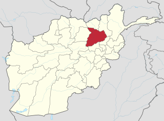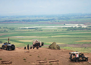
Puli Hisar or Pul-e-Hesar is a district in Baghlan Province, Afghanistan. It was created in 2005 from part of Andarab District.

Farang Gharu or Firing wa Gharu is a district in Baghlan Province, Afghanistan. It was created in 2005 from part of Khost wa Fereng District.

Guzargahi Nur or Gozargah-e-Noor is a district in Baghlan Province, Afghanistan. It was created in 2005 from part of Khost wa Firing District.

Khwaja Hijran is a district in the Baghlan Province of Afghanistan. The district was created in 2005 from part of Andarab District. The name of the district has already been changed and its new one is Jalga. It has a population of about 23,000, and its main village is Pansíri.

Andarab district is located in the southern part of Baghlan Province, Afghanistan. The estimated population of Andarab in 2004 was roughly 120,642. Tajiks make up the entire population of the district. The district centre is the village of Andarab.

Baghlani Jadid is a district of Baghlan Province in northern Afghanistan. It has a population of about 119,607.

Dahana i Ghuri district is located in the most southwestern part of Baghlan province, Afghanistan. The capital is Dahana i Ghuri. Its population is about 3,400 people. It is connected with Baghlan and Puli Khumri with an all-weather primary road.

Dushi district is located in the central part of Baghlan Province, Afghanistan. It lies on the major Kabul-Kunduz highway. The population of the district was estimated to be around 57,160 in 2004. Hazaras are around 88% of the population and make up the majority in the district, followed by small minorities of Tajiks and Pashtuns The centre of the district is Dushi.

Khinjan District is located in the southern part of Baghlan province in the Hindu Kush mountains. The capital is the town of Khenjan. The main Kabul-Kunduz highway passes through the district from south to west. Ethnic Hazara makes up around 85% of the total population while the Pashtuns, Tajeks and Uzbeks, each at 5%, makes up the remaining 15% of the population.

Khost wa Fereng or Khost wa Fring is the easternmost district of Baghlan province, Afghanistan in the Hindu Kush mountains. Its capital is Khost wa Fereng. The population of the district was estimated to be around 60300 in 2011-2012, of which ethnic Tajiks made up 90% and Hazaras 10% of the total population.

Nahrin District is a district in the central part of Baghlan Province in Afghanistan. To the west lie the major towns of Baghlan and Puli Khumri. The district centre is Nahrin. The population of the district was estimated to be around 57,509 in 2004, of which 60% are Tajiks, 35% Pashtun and 5% Uzbeks.

Tala wa Barfak is a district of Afghanistan situated in the most southwestern part of Baghlan Province. The capital is Taleh va Barfak.
The Ali abad District is situated in the southern part of Kunduz Province, Afghanistan. It borders the Baghlan Province to the south, Chahar dara District to the west, Kunduz and Khan Abad districts to the north and Takhar Province to the east.
Baghlan was a district in Baghlan Province, Afghanistan. The main town of the district was also known as Baghlan. In 2005, Baghlan was annexed into the district of Baghlani Jadid, also in Baghlan Province.
Puli Khumri, also spelled Pul-i-Khumri or Pol-e Khomri, is a district of Baghlan Province, Afghanistan. The population of the district was estimated to be around 191,640 in 2004. Tajiks are around 50% of the population and make up the majority in the district, followed by 30% Pashtuns, 10% Hazaras and 10% Uzbeks. The capital city is Puli Khumri.
Qataghan Province, also spelled Kataghan, was a province of Afghanistan which became defunct in 1963, when it was divided into the current Baghlan Province, Kunduz Province, and Takhar Province. From the 19th century to 1963 Qataghan and neighboring Badakhshan Province were united into a single province called Qataghan-Badakhshan Province. It was ruled by a single governor and was divided into two separate provinces in 1963. The capital of Qataghan Province was Baghlan, now a city in the north of Baghlan Province.

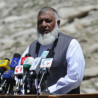
Mohammad Akbar Barakzai is a politician in Afghanistan, serving as the Governor of Baghlan from 2009 to 2010.

Munshi Abdul Majid is an Afghan politician. He is an ethnic Pashtun from Baghlan Province. In the 1990s he served as an official in the Afghan Interior Ministry; he is also known as a writer and orator in Persian and Pashto.


