Related Research Articles

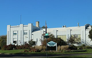
Polk County is a county in the U.S. state of Wisconsin. As of the 2020 census, the population was 44,977. Its county seat is Balsam Lake. The county was created in 1853.

Outagamie County is a county in the northeast region of the U.S. state of Wisconsin. As of the 2020 census, the population was 190,705. Its county seat is Appleton.

Laona is a town in Forest County, Wisconsin, United States. The population was 1,212 at the 2010 census. The census-designated place of Laona is located in the town. The unincorporated community of Blackwell Junction is also located partially in the town.

Elroy is a city in Juneau County, Wisconsin, United States, along the Baraboo River and at the east end of the Elroy-Sparta Bike Trail. The population was 1,442 at the 2010 census.

Lodi is a city in Columbia County, Wisconsin, United States. The population was 3,189 at the 2020 census. Lodi is part of the Madison Metropolitan Statistical Area.

Watersmeet is an unincorporated community and census-designated place (CDP) in Watersmeet Township, Michigan. As of the 2010 census, the CDP had a population of 428, out of a total population in the township of 1,417. The community was platted in 1884, designated as a station of the Milwaukee Lake Shore and Western Railroad.

The Elroy-Sparta State Trail is a 32.5-mile (52.3 km) Wisconsin State rail trail between Elroy and Sparta, Wisconsin. Considered to be the first rail trail when it opened in 1967, it was designed for foot, bicycle, equestrian and light motorized traffic. Designated a multi-use trail, it offers recreational access to the routes and is open to the public. The trail is part of the larger Wisconsin bike trail system operated by the state of Wisconsin. It passes through rural scenery and three tunnels. It is one of six connecting trails in west-central Wisconsin. It was added to the Rails-to-Trails Conservancy hall of Fame in September 2008. It is one of the most popular trails in Wisconsin.

The Chicago, St. Paul, Minneapolis and Omaha Railway or Omaha Road was a railroad in the U.S. states of Nebraska, Iowa, Minnesota, Wisconsin and South Dakota. It was incorporated in 1880 as a consolidation of the Chicago, St. Paul and Minneapolis Railway and the North Wisconsin Railway. The Chicago and North Western Railway (C&NW) gained control in 1882. The C&NW leased the Omaha Road in 1957 and merged the company into itself in 1972. Portions of the C. St. P. M. and O. are part of the Union Pacific Railroad network. This includes main lines from Wyeville, Wisconsin, to St. Paul, Minnesota, and St. Paul to Sioux City, Iowa.
Bear trap or beartrap may refer to:

The Military Ridge State Trail is a 40-mile (64 km) long, recreational rail trail in Wisconsin.

Manitowish is an unincorporated community located within the town of Mercer, Iron County, Wisconsin, United States. It is located at the junction of U.S. Route 51, Wisconsin Highway 47 and Wisconsin Highway 182.
Hayes or Hayes Station is a former settlement in Fresno County, California. It was located 18 miles (29 km) southwest of Mendota, next to Silver Creek and slightly northeast of that waterway's junction with Panoche Creek. The Panoche road exit on I-5 lies about one mile ENE of the location.

Minnesota Junction is an unincorporated community located, in the town of Oak Grove, in Dodge County, Wisconsin, United States. Minnesota Junction is located on Wisconsin Highway 26. It is located at latitude 43.452 and longitude -88.697 at 925 feet above mean sea level.
Francis Creek is a stream in Manitowoc County, Wisconsin, in the United States.
Lake Creek is a stream in Calhoun and Pocahontas counties, Iowa, in the United States. It is a tributary of the North Raccoon River.

Eli is an unincorporated community in Cherry County, Nebraska, United States. Its population is approximately 60-75 people, but exact census information has not been collected. It is one mile (1.6 km) north of U.S. Route 20 and 2.5 miles (4.0 km) south of the Nebraska-South Dakota border. The nearest town is Merriman, 11.8 miles (19.0 km) to the west. It is also 12.8 miles (20.6 km) west of Cody.
Pierson Creek is a stream in Woodbury County and Cherokee County, in the US state of Iowa. It is a tributary of the Little Sioux River.
Houghton Point is a cape in Bayfield County, Wisconsin, in the United States.
Wedges Creek is a stream in Clark County, Wisconsin, in the United States.
Beartrap Hollow is a tributary of White Deer Hole Creek in Lycoming County, Pennsylvania, in the United States. It is approximately 1.5 miles (2.4 km) long and flows through Washington Township. The watershed of the stream has an area of 0.42 square miles (1.1 km2). The stream is not designated as an impaired waterbody. Much of the stream's length is on South White Deer Ridge and it is near Tiadaghton State Forest.
References
- ↑ U.S. Geological Survey Geographic Names Information System: Beartrap Creek
- ↑ Chicago and North Western Railway Company (1908). A History of the Origin of the Place Names Connected with the Chicago & North Western and Chicago, St. Paul, Minneapolis & Omaha Railways. p. 42.
- ↑ "Bear Trap Creek Trail". cnyhiking.com. Retrieved 2021-09-15.
Coordinates: 46°38′26″N90°42′41″W / 46.64056°N 90.71139°W