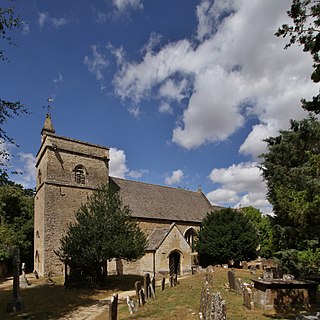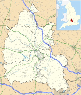
South Stoke is a village and civil parish on an east bank of the Thames, about 1.5 miles (2.4 km) north of Goring-on-Thames in South Oxfordshire. It includes less than 1 mile (1.6 km) to its north the hamlet and manor house of Littlestoke.

Bampton, also called Bampton-in-the-Bush, is a settlement and civil parish in the Thames Valley about 4 1⁄2 miles (7 km) southwest of Witney in Oxfordshire. The parish includes the hamlet of Weald. The 2011 Census recorded the parish's population as 2,564.

Bletchingdon is a village and civil parish 2 miles (3 km) north of Kidlington and 6 miles (10 km) southwest of Bicester in Oxfordshire, England. Bletchingdon parish includes the hamlet of Enslow just over 1 mile (1.6 km) west of the village. The 2011 Census recorded the parish's population as 910.

Finmere is a village and civil parish in Oxfordshire, south of the River Great Ouse. It is almost 4 miles (6 km) west of Buckingham in Buckinghamshire and just over 4 miles (6 km) east of Brackley in Northamptonshire. The 2011 Census recorded the parish's population as 466.

Kingston Blount is a village about 4 miles (6.4 km) southeast of Thame in South Oxfordshire, England. The village is a spring line settlement at the foot of the Chiltern Hills escarpment. The ancient pre-Roman Ridgeway and Icknield Way pass through the parish. The Ridgeway is now a National Trail.

Noke is a small village and civil parish in Oxfordshire about 5 miles (8 km) northeast of Oxford. It is on the southeast edge of Otmoor and is one of the "Seven Towns of Otmoor".

Middleton Stoney is a village and civil parish about 2 1⁄2 miles (4 km) west of Bicester, Oxfordshire. The 2011 Census recorded the parish's population as 331.

Deddington Castle is an extensive earthwork in the village of Deddington, Oxfordshire, all that remains of an eleventh century motte-and-bailey castle, with only the earth ramparts and mound now visible.

Buckden Towers, formerly known as Buckden Palace, is a 12th-century fortified manor house, located on High Street, Buckden, Cambridgeshire, England.

Oddington is a village and civil parish about 5 miles (8 km) south of Bicester in Oxfordshire, England. The village is close to the River Ray on the northern edge of Otmoor. The 2011 Census recorded the parish's population as 129.

Seacourt is a deserted medieval village near Botley in Oxfordshire. It was part of Berkshire until the 1974 boundary changes transferred it to Oxfordshire.

Lew is a small village and civil parish located about 2.5 miles (4 km) southwest of Witney in the West Oxfordshire district, in the county of Oxfordshire, England. Since 2012 it has been part of the Curbridge and Lew joint parish council area, sharing a parish council with the adjacent civil parish of Curbridge.

Fringford is a village and civil parish in Oxfordshire, about 4 miles (6.4 km) northeast of Bicester. The parish is bounded to the east by the Roman road that linked Alchester Roman Town with Roman Towcester, to the south by a brook that joins the River Bure, to the north mostly by a brook that is a tributary of the River Great Ouse, and to the west by field boundaries. Fringford village is in the north of the parish, surrounded on two sides by a bend in the tributary of the Great Ouse.
Newton Purcell with Shelswell is a civil parish in Oxfordshire, England. It was formed in 1932 by merger of the parishes of Newton Purcell and Shelswell.

Newton Purcell is a village in Newton Purcell with Shelswell civil parish in Oxfordshire, 4.5 miles (7 km) southeast of Brackley in neighbouring Northamptonshire.

Shelswell is a hamlet in Oxfordshire about 4 miles (6.4 km) south of Brackley in neighbouring Northamptonshire.

FitzHarris Castle was a medieval castle located near Abingdon, Oxfordshire, England.

South Moreton Castle was an 11th-century castle in the village of South Moreton, Oxfordshire, England. The name can also refer to a nearby siege-castle, probably from the 12th century.

Middleton Park is a rural park in the parish of Middleton Stoney, Oxfordshire, England, about 2 1⁄2 miles (4 km) west of Bicester. The grounds are Grade II listed and include several historic buildings, notably a Grade I listed country house with Grade II* listed service wing and lodges.


