
Acton is a town in Middlesex County, Massachusetts, United States, approximately 21 miles (34 km) west-northwest of Boston along Massachusetts Route 2 west of Concord and about ten miles (16 km) southwest of Lowell. The population was 24,021 in April 2020, according to the United States Census Bureau. It is bordered by Westford and Littleton to the north, Concord and Carlisle to the east, Stow, Maynard, and Sudbury to the south and Boxborough to the west. Acton became an incorporated town in 1735. The town employs the Open Town Meeting form of government with a town manager and an elected, five-member select board. Acton was named the 11th Best Place To Live among small towns in the country by Money Magazine in 2015, and the 16th best in 2009 and in 2011. The local high school, Acton-Boxborough Regional High School, was named a Blue Ribbon School by the U.S. Department of Education in 2009.

Brewster is a town in Barnstable County, Massachusetts, United States, Barnstable County being coextensive with Cape Cod. The population of Brewster was 10,318 at the 2020 census.

Fresh Pond is a reservoir and park in Cambridge, Massachusetts. Prior to the Pond's use exclusively as a reservoir, its ice had been harvested by Boston's "Ice King", Frederic Tudor, and others, for shipment to North American cities and to tropical areas around the world. Fresh Pond is bordered by Fresh Pond Parkway, Huron Avenue, Grove Street, Blanchard Road, and Concord Avenue.

Alewife Brook Reservation is a Massachusetts state park and urban wild located in Cambridge, Arlington, and Somerville. The park is managed by the state Department of Conservation and Recreation and was established in 1900. It is named for Alewife Brook, which was also historically known as Menotomy River, a tributary of the Mystic River.

The Erie National Wildlife Refuge is an 8,777-acre (3,552 ha) National Wildlife Refuge located in Crawford County, Pennsylvania. Named after the Erie tribe, it was established to provide waterfowl and other migratory birds with nesting, feeding, brooding, and resting habitat.

Waquoit Bay is a public national estuary, which is typically used as a research reserve. It is a part of Nantucket Sound and is located on the southern shore of Cape Cod in Massachusetts, USA. This bay forms the border of the towns of Falmouth and Mashpee, Massachusetts.
Beartown State Forest is a publicly owned forest with recreational features located in the towns of Great Barrington, Monterey, Lee, and Tyringham, Massachusetts. The state forest's more than 10,000 acres (4,000 ha) include 198 acres (80 ha) of recreational parkland. It is managed by the Massachusetts Department of Conservation and Recreation.
Beaver Brook Reservation is a public recreation area covering 303 acres (123 ha) on the dividing line between the town of Belmont and the city of Waltham, Massachusetts. The state park is managed by the Massachusetts Department of Conservation and Recreation.

The Tualatin River National Wildlife Refuge is a 1,856 acres (751 ha) wetlands and lowlands sanctuary in the northwestern part of the U.S. state of Oregon. Established in 1992 and opened to the public in 2006, it is managed by the United States Fish and Wildlife Service. Located in southeastern Washington County, 15 miles (24 km) southwest of Portland, the refuge is bordered by Sherwood, Tualatin and Tigard. A newer area, extending into northern Yamhill County, is located further west near the city of Gaston surrounding the former Wapato Lake.
Wekepeke is the name of an aquifer and brook in Sterling, Massachusetts, United States. The aquifer has a land surface area of 11.5 square miles (30 km2).

Waquoit Bay National Estuarine Research Reserve (WBNERR) encompasses open waters, barrier beaches, marshlands and uplands on the south shore of Cape Cod in the towns of Falmouth and Mashpee. The park is managed by the Department of Conservation and Recreation (DCR) and the National Oceanic and Atmospheric Administration.

Stony Brook Reservation is a woodland park in Boston and Dedham, Massachusetts, a unit of the Metropolitan Park System of Greater Boston, part of the state park system of Massachusetts. It was established in 1894 as one of the five original reservations created by the Metropolitan Park Commission. The park is served by the Stony Brook Reservation Parkways, a road system that was entered into the National Register of Historic Places in 2006.

Stony Brook is a stream largely running through Lincoln and Weston, Massachusetts, then forming the Weston/Waltham boundary, and emptying into the Charles River across from the Waltham/Newton boundary. It has two tributaries, Cherry Brook and Hobbs Brook, and its watershed includes about half of Lincoln and Weston as well as parts of Lexington and Waltham. Since 1887, it has been the water supply for Cambridge, along with the Hobbs Brook Reservoir.

Weir River is a short stream and estuary that empties into Hingham Bay, part of Boston Harbor in Massachusetts, United States. The name is attributed to the location of a fishing weir in the stream. The river gives its name to a larger watershed and Weir River Farm, a park and nature reserve owned by The Trustees of Reservations.
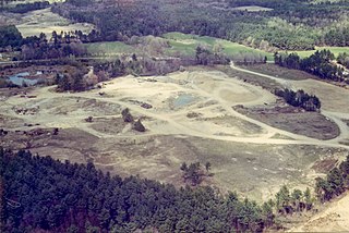
The Charles-George Reclamation Trust Landfill is a hazardous waste site located in the town of Tyngsborough, Massachusetts which is part of the Environmental Protection Agency's Superfund program. It is now the site of a 2.6 MW solar farm.
The Belgrade Lakes are a chain of lakes around Belgrade, Maine. The flow sequence is from East Pond to North Pond to Great Pond to Long Pond to Messalonskee Lake and thence via Messalonskee Stream to the Kennebec River at Waterville. The lakes have long been an important resort area for fishing, boating, and swimming; and shoreline development includes residences for individuals employed in the cities of Waterville and Augusta.

Stony Brook Wildlife Sanctuary is a wildlife sanctuary in Norfolk, Massachusetts. The 107-acre sanctuary, owned by the Massachusetts Audubon Society, is adjacent to the 140-acre Bristol Blake State Reservation. The two areas are "cooperatively managed" by Mass Audubon and the Department of Conservation and Recreation (DCR).

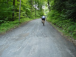
Mount Misery is a 284-foot hill and public conservation land in Lincoln, Massachusetts, on Route 117 and on the Bay Circuit Trail near the Sudbury River. Containing 227 acres (92 ha), Mount Misery is the largest piece of conservation land in the town and contains seven miles of public hiking trails through hills, wetlands and agricultural fields.

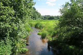
Mill Brook is a watercourse, about 3 miles (4.8 km) long, in Massachusetts, United States. It is sourced from Flints Pond in Lincoln, Massachusetts, and empties into the Concord River, to the southwest of Old North Bridge in Concord.

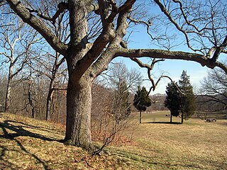
Flints Pond is a body of water in Lincoln, Massachusetts, United States. Named for Flint House, on the land of which it was situated, it is the town's major water supply, with Tower Road Well being the supplemental source.

