Related Research Articles

The Catskill Mountains, also known as the Catskills, are a physiographic province of the larger Appalachian Mountains, located in southeastern New York. As a cultural and geographic region, the Catskills are generally defined as those areas close to or within the borders of the Catskill Park, a 700,000-acre (2,800 km2) forest preserve forever protected from many forms of development under New York state law.

The Beaver Kill, sometimes written as the Beaverkill or Beaverkill River, is a tributary of the East Branch Delaware River, a main tributary of the Delaware River, approximately 44 miles (71 km) long, in the U.S. state of New York. The kill drains a 300-square-mile (780 km2) area of the Catskill Mountains and has long been celebrated as one of the most famous trout streams in the United States. Its preservation helped establish many of the basic conservation principles of rivers in the United States.

Esopus Creek is a 65.4-mile-long (105.3 km) tributary of the Hudson River that drains the east-central Catskill Mountains in the U.S. state of New York. From its source at Winnisook Lake on the slopes of Slide Mountain, the Catskills' highest peak, it flows across Ulster County to the Hudson at Saugerties. Many tributaries extend its watershed into neighboring Greene County and a small portion of Delaware County. Midway along its length, it is impounded at Olive Bridge to create Ashokan Reservoir, the first of several built in the Catskills as part of New York City's water supply system. Its own flow is supplemented 13 miles (21 km) above the reservoir by the Shandaken Tunnel, which carries water from the city's Schoharie Reservoir into the creek.

Brown's Station was a hamlet in the Esopus Valley of southeastern Ulster County, New York, United States. It was submerged by the waters of the Ashokan Reservoir, an artificial lake built between 1906 and 1915 to supply fresh water to New York City.
Beaverkill may refer to:
West Kill Mountain, or Westkill Mountain, is located in Greene County, New York. The mountain is named after the West Kill stream which flows along its northern side, and is part of the Devil's Path range of the Catskill Mountains. To the east, West Kill Mountain faces Southwest Hunter Mountain across 800-foot-deep (240 m) Diamond Notch; to the west, West Kill faces North Dome across Mink Hollow.

Indian Head Mountain is a 3,573 ft (1,089 m) mountain located in the southeast corner of Greene County, New York. The mountain, named for the appearance of its profile, is part of the Devil's Path range of the Catskill Mountains. To the northwest, Indian Head is separated from Twin Mountain by Jimmy Dolan Notch; to the southeast, Indian Head is flanked by Plattekill Mountain.

Twin Mountain is a mountain located in Greene County, New York. Twin gets its name from its two summits; the lower, 3,590-ft (1,090 m) peak is about .5 miles (0.8 km) to the southeast of the higher. The mountain is part of the Devil's Path range of the Catskill Mountains. To the northwest, Twin Mtn. is separated from Sugarloaf Mountain by Pecoy Notch; to the southeast, Twin Mtn. is separated from Indian Head Mountain by Jimmy Dolan Notch.

Sugarloaf Mountain is a mountain located in Greene County, New York. The mountain is part of the Devil's Path range of the Catskill Mountains. To the northwest, Sugarloaf is separated from Plateau Mountain by Mink Hollow Notch; to the southeast, Sugarloaf is separated from Twin Mountain by Pecoy Notch.
Mount Sherrill is a mountain located in Greene County, New York, and is named after Eliakim Sherrill, and is part of the Catskill Mountains. Mount Sherrill is flanked to the east by North Dome, and to the west by Balsam Mountain.

Balsam Mountain is one of the High Peaks of the Catskill Mountains in the U.S. state of New York. Its exact height has not been determined, so the highest contour line, 3,600 feet (1,100 m), is usually given as its elevation. It is located in western Ulster County, on the divide between the Hudson and Delaware watersheds. The summit and western slopes of the peak are within the Town of Hardenburgh and its eastern slopes are in Shandaken. The small community of Oliverea is near its base on that side. Most of the mountain is publicly owned, managed by the New York State Department of Environmental Conservation as part of the state Forest Preserve, part of the Big Indian-Beaverkill Range Wilderness Area in the Catskill Park. The summit is on a small corner of private land.
Big Indian Mountain is a mountain located in Ulster County, New York. The mountain is part of the Catskill Mountains. It is flanked to the northwest by Eagle Mountain, to the southeast by Fir Mountain, and to the southwest by Doubletop Mountain.

Eagle Mountain is a mountain located in Ulster County, New York. The mountain is part of the Catskill Mountains. Eagle Mountain is flanked to the north by Haynes Mountain, to the southwest by Doubletop Mountain and Graham Mountain, and to the southeast by Big Indian Mountain.
Fir Mountain is a mountain located in Ulster County, New York. The mountain is part of the Catskill Mountains. Fir Mountain is flanked to the northwest by Big Indian Mountain, and to the southeast by Spruce Mountain.

Balsam Cap is a mountain located in Ulster County, New York. The mountain is part of the Catskill Mountains. Balsam Cap is flanked to the north by Friday Mountain, and to the southwest by Rocky Mountain.
Friday Mountain is a mountain located in Ulster County, New York. The mountain is part of the Catskill Mountains. Friday Mountain is flanked to the north by Cornell Mountain, and to the south by Balsam Cap.

Cornell Mountain is a mountain located in Ulster County, New York. The mountain is part of the Burroughs Range of the Catskill Mountains. Cornell Mountain is flanked to the northeast by Wittenberg Mountain, to the southwest by Friday Mountain, and to the west by 4,180-foot (1,270 m) Slide Mountain — the highest peak in the Catskills.

Wittenberg Mountain, locally "the Wittenberg," is a mountain located in Ulster County, New York. The mountain is part of the Burroughs Range of the Catskill Mountains. Wittenberg is flanked to the southwest by Cornell Mountain and to the northeast by Terrace Mountain.
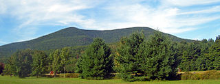
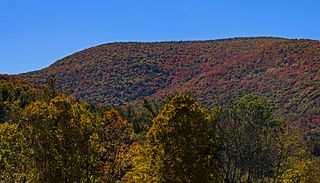
Mount Tremper, officially known as Tremper Mountain and originally called Timothyberg, is one of the Catskill Mountains in the U.S. state of New York. It is located near the hamlet of Phoenicia, in the valley of Esopus Creek.

Plattekill Creek is a 16.7-mile-long (26.9 km) tributary of Esopus Creek in the Catskill Mountains in the U.S. state of New York. From its source on the southern slopes of Kaaterskill High Peak, it flows across Ulster and Greene counties to the Esopus at Mount Marion. The name is a Dutch word meaning "flat brook".
References
- ↑ "A Great Catskill Lake Planned". The Sun. October 11, 1903. p. 19. Retrieved December 20, 2020.
| | This article about a location in Ulster County, New York is a stub. You can help Wikipedia by expanding it. |