Beckwith Island

Last updated

Ferry terminal in Cedar Point (Tiny, Ontario) to Christian Island, with Beckwith Island on the right. Hope and Beckwith Islands.JPG
Ferry terminal in Cedar Point (Tiny, Ontario) to Christian Island, with Beckwith Island on the right.

Beckwith Island is the eastern of three islands in southeastern Georgian Bay in Ontario, Canada. Beckwith Island and the attached "Little Beckwith" are part of the Beausoleil First Nation. [1]

Contents

Geography

The island's highest elevation is 226 meters (741 feet) above sea level. Like its populated neighbour Christian Island to the west, and Hope Island to the northwest, the uninhabited island is part of an Ojibwa reserve. [2] On the mainland, Cedar Point lies directly south of the island and Thunder Beach is located to the southeast of Beckwith Island.

Flora and fauna

The island is an ecologically sensitive island of over 800 acres (324 ha), featuring sandy beaches and dunes, juniper bushes, as well as the rare and protected three-pronged awn grass, plus forests of oak, maple, birch and conifer trees and no development of any kind except for simple outhouses to serve boaters, campers and picnickers.

Accessibility

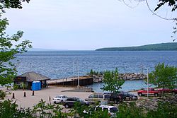
Beckwith Island is undeveloped, though there are two boat anchorage points. One on the north and another on the south side of the islands where the narrows of the two islands meet. Sandy beaches are at both anchorage points. [3]

Related Research Articles

<span class="mw-page-title-main">Lake Huron</span> One of the Great Lakes of North America

Lake Huron is one of the five Great Lakes of North America. Hydrologically, it comprises the easterly portion of Lake Michigan–Huron, having the same surface elevation as Lake Michigan, to which it is connected by the 5-mile-wide (8.0 km), 20-fathom-deep Straits of Mackinac. It is shared on the north and east by the Canadian province of Ontario and on the south and west by the U.S. state of Michigan. The name of the lake is derived from early French explorers who named it for the Huron people inhabiting the region.

Leith is an unincorporated community in Ontario, Canada, named after Leith, Scotland. It is located on the eastern shore of the Owen Sound Bay, an inlet (sound) on the south shore of Georgian Bay on Lake Huron. Owen Sound Bay is a broad valley that cuts through the Niagara Escarpment. The valley preceded the last great Ice Age, but was broadened by the action of the glacial ice, then by the erosive forces of the Sydenham and Pottowatomi rivers. During his preliminary survey of Lake Huron in 1815, Captain William Fitzwilliam Owen named it "Owen's Sound" for his brother, Admiral Sir Edward William Campbell Rich Owen.

<span class="mw-page-title-main">Georgian Bay</span> Large bay of Lake Huron, Ontario, Canada

Georgian Bay is a large bay of Lake Huron, in the Laurentia bioregion. It is located entirely within the borders of Ontario, Canada. The main body of the bay lies east of the Bruce Peninsula and Manitoulin Island. To its northwest is the North Channel.

<span class="mw-page-title-main">Lake St. Clair</span> Lake bordering Ontario, Canada and Michigan, US

Lake St. Clair is a freshwater lake that lies between the Canadian province of Ontario and the U.S. state of Michigan. It was named in 1679 by French Catholic explorers after Saint Clare of Assisi, on whose feast day they first saw the lake.

<span class="mw-page-title-main">Christian Island</span>

Christian Island is a large island in Georgian Bay close to the communities of Penetanguishene and Midland, Ontario. The island, with its neighbours Hope Island and Beckwith Island, is a 5,428.1 hectares Ojibwa reserve, known as Christian Island Indian Reserve No. 30. Together with the 7.5 hectares Christian Island Indian Reserve No. 30A located at Cedar Point, Ontario and the 3.1 hectares Chippewa Island Indian Reserve located in Twelve Mile Sound, 27.5 kilometres (17.1 mi) north of Christian Island, it forms the land base for the Beausoleil First Nation. Christian Islands' highest elevation is 209 metres above sea level.

<span class="mw-page-title-main">St. Margarets Bay, Nova Scotia</span>

St. Margarets Bay is a bay located on the Atlantic coast of Nova Scotia, Canada on the border of Halifax County and Lunenburg County.

<span class="mw-page-title-main">Imperial Towers</span> Group of lighthouses on Lake Huron, Canada

The Imperial Towers of Ontario were six of the earliest lighthouses built on Lake Huron and Georgian Bay, all constructed primarily of stone, by the Province of Canada. The origin of the designation Imperial is not certain, but some historians speculate that because the towers were public construction built under the colonial administration while Canada was a self-governing colony of Britain, the name would assure at least some funding from the British Empire's Board of Trade.

<span class="mw-page-title-main">Hope Island (Ontario)</span>

Hope Island is the northern of three islands in south eastern Georgian Bay, of Lake Huron, in the Canadian province of Ontario. It has an elevation of 187 meters above sea level and is currently uninhabited and not presently slated for development. It was named by Henry Bayfield after he surveyed it in the 19th century. Like its neighbours, Beckwith Island and Christian Island, the uninhabited island is part of the Beausoleil First Nation.

<span class="mw-page-title-main">Vivonne Bay (South Australia)</span> Body of water

Vivonne Bay is a bay in the Australian state of South Australia located on the south coast of Kangaroo Island about 61 kilometres (38 mi) from Kingscote, the island's main town, and which was named by the members of Baudin expedition to Australia who visited the bay in January 1803. In a survey of 10,000 beaches by Professor Andrew Short, director of Sydney University's marine studies centre, the beach at Vivonne Bay was adjudged as one of the best in Australia.

<span class="mw-page-title-main">Giants Tomb Island</span>

Giants Tomb Island is an island with no permanent residents located in Southern Georgian Bay in Ontario, Canada. It measures approximately five kilometres from north to south and two kilometres from east to west.

Beausoleil First Nation is an Ojibwe First Nation band government located in Simcoe County, Ontario, Canada. The main settlement of the Beausoleil First Nation is on Christian Island, Ontario, Canada in southern Georgian Bay. As of 2018, the total number of status Native Americans registered with the First Nation is 2,587. The on-reserve population is 614.

<span class="mw-page-title-main">Quarry Island</span>

Quarry Island is a 200-acre (81-hectare) island located in Southeastern Georgian Bay in Ontario, Canada. The island name is derived from its mining history. Stone from the island was used for the bridge piers on the Canadian Pacific Railway and other projects.

<span class="mw-page-title-main">Nipissing Great Lakes</span> Prehistoric proglacial lake

Nipissing Great Lakes was a prehistoric proglacial lake. Parts of the former lake are now Lake Superior, Lake Huron, Georgian Bay and Lake Michigan. It formed about 7,500 years before present (YBP). The lake occupied the depression left by the Labradorian Glacier. This body of water drained eastward from Georgian Bay to the Ottawa valley. This was a period of isostatic rebound raising the outlet over time, until it opened the outlet through the St. Clair valley.

<span class="mw-page-title-main">Pondalowie Bay</span> Body of water

Pondalowie Bay is a bay in the Australian state of South Australia located on the west coast of the south-west tip of Yorke Peninsula in Spencer Gulf about 12 kilometres west of Marion Bay. The coastline of Pondalowie Bay is both within the gazetted locality of Inneston and the Innes National Park.

Smooth Island is an island in the Georgian Bay of Lake Huron, in Ontario.

<span class="mw-page-title-main">Anchor Bay (Michigan)</span> Freshwater bay, part of Lake St. Clair in Michigan

Anchor Bay is a freshwater bay forming the northern region of Lake St. Clair in the U.S. state of Michigan. It generally encompasses the waters north of a line between Huron Point and the Middle Channel of the St. Clair River. It covers over 90 square miles (230 km2) and a depth of from 1 to 11 feet, which is unusually shallow for its immense size.

Hardwicke Bay is a bay in the Australian state of South Australia located on the west coast of Yorke Peninsula in Spencer Gulf.

Saugeen and Cape Croker Fishing Islands 1 is a First Nations reserve consisting of 89 islands in Lake Huron off the western coast of the Bruce Peninsula in Ontario. They extend north of Chief's Point 28 for 11 miles (18 km) up to Pike Bay. These islands are shared between the Chippewas of Nawash Unceded First Nation and Saugeen First Nation.

<span class="mw-page-title-main">Thirty Thousand Islands</span>

The Thirty Thousand Islands are the world's largest freshwater archipelago, and are located mainly along the east side of Georgian Bay, part of the Great Lakes, in Ontario, Canada.

References

  1. "Missing boater found dead near Beausoleil First Nation". Barrie. 2022-09-04. Retrieved 2023-01-12.
  2. Thompson, Thomas S. (1878). Thompson's Coast Pilot and Sailing Directions for the North-western Lakes: From Ogdensburg to Buffalo, Chicago, Green Bay, Georgian Bay and Lake Superior, Including All the River Navigation ... Also a Description of Lights and Light-houses ... Harbors Completed, and in Progress of Construction ... Cor. and Rev. from the Original Copies of Thompson's Coast Pilot and the Latest U.S. Surveys, with the Explanation of Nautical Terms. W.A. Scripps.
  3. Barnet, James (1887). Barnet's Coast Pilot for the Lakes, on Both Shores: Michigan, Superior, Huron, St. Clair, Erie and Ontario; Green Bay, Georgian Bay, Grand and Little Traverse Bays; Straits of Mackinaw; the Rivers St. Mary, St. Clair, Detroit, Niagara and St. Laurence. Courses and Distances, Sailing Directions, Etc. Rearranged, Rev. and Additions Made from the Latest United States Coast Survey Charts. Also, a Description of All the Lights and Lighthouses. With a Valuable Appendix, and an Alphabetically-arranged Index of the Names of Places.

Coordinates: 44°51′24″N80°06′45″W / 44.8568°N 80.1125°W / 44.8568; -80.1125