
A postal code is a series of letters or digits or both, sometimes including spaces or punctuation, included in a postal address for the purpose of sorting mail.
A Postal Index Number refers to a six-digit code in the Indian postal code system used by India Post. On 15 August 2022, the PIN system celebrated its 50th anniversary.
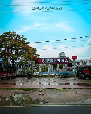
Sheikhpura is a town and a municipality in Sheikhpura district in the Indian state of Bihar. Sheikhpura is also an administrative headquarter of Sheikhpura district.
Bhatpara is a city and a municipality of North 24 Parganas district in the Indian state of West Bengal. It is a part of the area covered by Kolkata Metropolitan Development Authority (KMDA).
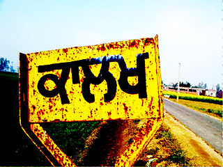
Kalakh is a village in Ludhiana district, Punjab, India.

Kaviyoor is a village located in Thiruvalla taluk in Pathanamthitta of Kerala in India, situated on the western bank of the Manimala River. It comes under Thiruvalla sub-district & Thiruvalla constituency.
Parbatsar is a town and a municipality in Didwana Kuchaman District in the Indian state of Rajasthan. The SDM of Parbatsar is Balbir Singh Meel and the MLA is Ramniwas Gawriya.
Nandiambakkam is a suburb in northern part of Chennai, Tiruvallur district, Tamil Nadu, India. It is a northern part of Chennai city. It has a population of around 17,000 people. The neighbourhood is served by Nandiambakkam railway station, of the Chennai Suburban Railway Network, and the following MTC bus services: Minjur–Madras High court, Minjur-Ennore, and Minjur-CMBT.
Rajakilpakkam is a neighbourhood area of Chennai to the south of the city, officially a part of Tambaram Municipal Corporation from November 3, 2021, formerly a part of Sembakkam municipality, in Tamil Nadu, India. Its post code is 600073.
Magod is a small village in South Gujarat in the Valsad district. It has been there for a period of approximately 350 years. It is a fertile area which is heavily used for agriculture.
Kattupakkam is a suburb of Chennai, in Tiruvallur district, Tamil Nadu, India. It is located in the western side of the city.
Pala Kastali is a village in Block Jawan Sikandarpur, Aligarh district of Uttar Pradesh, India. It is 5 km from Aligarh. The village has most population of Bais Rajput. Pala Kastali's Pin Code is 202122. Nearest railway station is Manzurgarhi and nearest Airport is Agra Airport. School near the village is Blackdale public school.
Zankhvav is a small town-cum-railway station in Surat District, Gujarat, India. It falls under Surat Metropolitan Region. It is 60 km (37 mi) from district town of Surat. The nearest town, Kosamba, is 17 km (11 mi) away.
Ponniammanmedu is a developing residential area in North Chennai, a metropolitan city in Tamil Nadu, India. Ponniammanmedu comes under Tiruvallur district.
Jawahar Nagar, named after the first Prime Minister of India, Jawaharlal Nehru, is a developed residential area in North Chennai, a metropolitan city in Tamil Nadu, India.

Balel Pipariya is a City in the Amreli district, Gujarat, India.
Bodhan is a village in the Mandvi taluka in the Surat district of Gujarat state, India. It is located 32km east of the district headquarters, Surat, and 255km from the state capital, Gandhinagar.
Vesu is a suburban area located in South West Zone, of Surat. Vesu is the newest area to develop in terms of public transport infrastructure, residential complexes, business parks and shopping arcades.
Khergam is a small town and a Gram Panchayat in the Navsari district of Gujarat, India. Recently established as the headquarters of the newly created Khergam Taluka, Khergam is a well-connected and diverse town known for its harmonious community spirit and local delicacies.
Sahuwala is a village located in Bhadra Tehsil, within the Hanumangarh district in the state of Rajasthan, India. It is located near Haryana in the northern part of Rajasthan. It belongs to the Bikaner Division. Sahuwala has a few schools which are well rated and utilized by locals. The Sahuwala pincode is 335511.