Related Research Articles

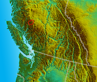
The Niut Range is 3600 km2 in area. It is a subrange of the Pacific Ranges of the Coast Mountains of British Columbia, although in some classifications it is considered part of the Chilcotin Ranges. The Niut is located in the angle of the Homathko River and its main west fork, Mosley Creek. It is isolated, island-like, by those rivers from its neighbour ranges, as both streams have their source on the Chilcotin Plateau in behind the range. Razorback Mountain is its highest peak.
Babine Lake Marine Provincial Park is a provincial park in British Columbia, Canada. The park was established by Order-in-Council in 1993, comprising two sites at Pendleton Bay totalling 36.9 hectares. Another was established in the same year at Smithers Landing, comprising approximately 157.8 hectares. Three more sites were added in 2001, Hook (Deep) Bay, Pierre Creek, Pinkut Creek and Sandpoint. All sites combined comprise approximately 492 hectares.

Bligh Island Marine Provincial Park is a provincial park in British Columbia, Canada.
Eneas Lakes Provincial Park is a provincial park in British Columbia, Canada, located west of the town of Peachland, to the south of Peachland Creek. The park is approximately 1036 ha. in size and was established in 1968. The Eneas Lakes lie at the head of Finlay Creek.
Garden Bay Marine Provincial Park is a provincial park in British Columbia, Canada at the northwest end of the Sechelt Peninsula on the lower Sunshine Coast, near the community of Madeira Park. Established in 1969, it contains approximately 163 ha.
Kickininee Provincial Park is a provincial park in British Columbia, Canada, located just south of the town of Summerland in that province's Okanagan region. Originally established in 1970 with approximately 7 acres (28,000 m2) of upland and 113.5 acres (0.459 km2) of foreshore, the park today comprises approximately 48.76 ha.
Puntchesakut Lake Provincial Park is a provincial park in British Columbia, Canada. It is approximately 16.7m deep and has trout as the main fish source.
Todagin South Slope Provincial Park is a provincial park in British Columbia, Canada, located on the west side of Todagin Creek to the east of Kinaskan Lake in the Stikine Country, to the south of the community of Dease Lake. Created in 2001, it contains c. 3557 ha.
The Red Bluff First Nation is a Dakelh First Nations government located in the northern Fraser Canyon region of the Canadian province of British Columbia. It is a member of the Carrier-Chilcotin Tribal Council, which includes both Tsilhqot'in and Carrier (Dakelh) communities.

The Lil'wat First Nation, a.k.a. the Lil'wat Nation or the Mount Currie Indian Band, is a First Nation band government located in the southern Coast Mountains region of the Interior of the Canadian province of British Columbia. It is a member of the Lillooet Tribal Council, which is the largest grouping of band governments of the St'at'imc or Stl'atl'imx people. Other St'at'imc governments include the smaller In-SHUCK-ch Nation on the lower Lillooet River to the southwest, and the independent N'quatqua First Nation at the near end of Anderson Lake from Mount Currie, which is the main reserve of the Lil'wat First Nation, and also one of the largest Indian reserves by population in Canada.
Deserters Canyon is a canyon on the Finlay River in the Northern Interior of British Columbia, Canada. It is located just upstream (north) from the head of the Finlay Arm of Lake Williston, the reservoir created by WAC Bennett Dam on the lower Peace River.
The Nazko First Nation is a First Nations government of the Dakelh people in the north-central Interior of British Columbia. Its reserves are located around the community of Nazko, British Columbia, which is 120 km west of Quesnel and southwest of Prince George.
The Tahltan First Nation, also known as the Tahltan Indian Band, is a band government of the Tahltan people. Their main community and reserves are located at Telegraph Creek, British Columbia. Their language is the Tahltan language, which is an Athabaskan language also known as Nahanni, is closely related to Kaska and Dunneza. Their Indian and Northern Affairs Canada band number is 682. The Tahltan First Nation is joined with the Iskut First Nation in a combined tribal council-type organization known as the Tahltan Nation.
The Hartley Bay Indian Band, also known as the Hartley Bay First Nation, Hartley Bay Band, Gitga'at Nation and Gitga'at First Nation, is the band government of the Gitga'ata people of Hartley Bay, British Columbia, Canada.
The Cadwallader Range, originally named the Cadwallader Mountains, is a sub-range of the Pacific Ranges of the Coast Mountains in the Bridge River-Lillooet Country of the South-Central Interior of British Columbia, Canada, located between the south end of Anderson Lake (E) and the Hurley River. According to the provincial basemap, the precise alpine boundaries of the range are McGilliray Pass, at its eastern extremity and beyond which is the Bendor Range, and the pass between Noel and Sockeye Creeks on its west, which is immediately north of the lower end of Birkenhead Lake. The officially unnamed range west of that has been called the Noel Range, after its main peak Mount Noel. At the foot of the range along its northeast flank is Cadwallader Creek, scene of the historic and once-rich Bralorne and Pioneer Mines and the ghost town of Bralorne.
The Bridge River Rapids, also known as the Six Mile Rapids, the Lower Fountain, the Bridge River Fishing Grounds, and in the St'at'imcets language as Sat' or Setl, is a set of rapids on the Fraser River, located in the central Fraser Canyon at the mouth of the Bridge River six miles north of the confluence of Cayoosh Creek with the Fraser and on the northern outskirts of the District of Lillooet, British Columbia, Canada.
The Scowlitz First Nation or Scowlitz Indian Band is the band government of Skaulits subgroup of the Stó:lō people located on Harrison Bay in the Upper Fraser Valley region between Chehalis (E) and Lake Errock, British Columbia, Canada (W). They are a member government of the Stó:lō Tribal Council.

Camborne is a locality and former galena-mining town on the east side of the Incomappleux River, northeast of the head of Beaton Arm of Upper Arrow Lake, in the West Kootenay region of southern British Columbia.
The Quaal River is a river in the Kitimat Ranges of the Coast Mountains in British Columbia, Canada, flowing south into Kitkiata Inlet in the North Coast region.
Kitkiata Inlet is an inlet on the North Coast of British Columbia, Canada, off the west side of Douglas Channel. Kitkiata Creek flows into the inlet from the north at 53°38′18″N129°16′20″W. Up it at 53°42′51″N129°17′27″W is Kitkiata Lake.
References
Coordinates: 57°56′00″N129°38′00″W / 57.93333°N 129.63333°W