Beiginis

Last updated

Beiginis
Native name:
Beiginis [1]
Tiny Cove on Beginish Island.jpg
Cove on Beginish Island
Island of Ireland location map.svg
Red pog.svg
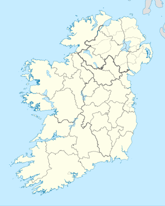
Beiginis
Inishbofin (Ireland)
Geography
Location Atlantic Ocean
Coordinates 52°06′56″N10°30′26″W / 52.11556°N 10.50722°W / 52.11556; -10.50722 Coordinates: 52°06′56″N10°30′26″W / 52.11556°N 10.50722°W / 52.11556; -10.50722
Area34 acres (14 ha)
Highest elevation14 m (46 ft)
Administration
Province Munster
County Kerry
Demographics
Population0

Beginish (from Irish : Beiginis, meaning 'little island') is one of the Blasket Islands of County Kerry, Ireland.

Contents

Geography

It is a low-lying island (14 metres high) with an area of 13.8 hectares in Blasket Sound, between Great Blasket Island and the mainland. [2] It has a large colony of Arctic terns. The island is also the main birthing site for grey seals.

There is at least one other island in County Kerry called Beginish: it lies at the mouth of the River Ferta about 1 km from Valentia Island. The Island lies to the north of Valentia Harbour.

See also

Related Research Articles

<span class="mw-page-title-main">County Kerry</span> County in Ireland

County Kerry is a county in Ireland. It is located in the South-West Region and forms part of the province of Munster. It is named after the Ciarraige who lived in part of the present county. The population of the county was 155,258 at the 2022 census,

<span class="mw-page-title-main">Peig Sayers</span> Irish writer (1873–1958)

Máiréad "Peig" Sayers was an Irish author and seanchaí born in Dún Chaoin, County Kerry, Ireland. Seán Ó Súilleabháin, the former Chief archivist for the Irish Folklore Commission, described her as "one of the greatest woman storytellers of recent times".

<span class="mw-page-title-main">Blasket Islands</span> Uninhabited islands off the west coast of County Kerry, Ireland

The Blasket Islands are an uninhabited group of islands off the west coast of the Dingle Peninsula in County Kerry, Ireland. The last island to hold a significant population, Great Blasket Island, was abandoned in 1954 due to population decline and is best known for a number of gifted Irish language writers who vividly described their way of life and who kept alive old Irish folk tales of the land.

<span class="mw-page-title-main">Valentia Island</span> Irish island off the Iveragh Peninsula, County Kerry

Valentia Island is one of Ireland's most westerly points. It lies off the Iveragh Peninsula in the southwest of County Kerry. It is linked to the mainland by the Maurice O'Neill Memorial Bridge at Portmagee. A car ferry also departs from Reenard Point to Knightstown, the island's main settlement, from April to October. Another, smaller village named Chapeltown sits at roughly the midpoint of the island, three kilometres from the bridge. Valentia Island's permanent population is 665. It is about 11 kilometres long by almost three kilometres wide, making it the fifth-biggest island off the Irish coast.

<span class="mw-page-title-main">Iveragh Peninsula</span> Peninsula in County Kerry, Ireland

The Iveragh Peninsula is located in County Kerry in Ireland. It is the largest peninsula in southwestern Ireland. A mountain range, the MacGillycuddy's Reeks, lies in the centre of the peninsula. Carrauntoohil, its highest mountain, is also the highest peak in Ireland.

<span class="mw-page-title-main">Knightstown, County Kerry</span> Village on Valentia Island, County Kerry, Ireland

Knightstown is a village and the largest settlement on Valentia Island, County Kerry, in Ireland. It lies within the townland of Farranreagh, at the eastern tip of the island. As of the CSO census of 2016, Knightstown had a population of 243.

Michael O'Connell is an Irish former Gaelic footballer. Throughout his 25-year club career, he played for Young Islanders, winning seven South Kerry Championship titles during a golden age for the club; he also played for divisional side South Kerry, and experienced success in the County Championship. At inter-county level, he captained Kerry to win the 1959 All-Ireland Championship; he later claimed a further three All-Ireland medals, as well as Munster Championship and National League successes.

<span class="mw-page-title-main">Dunquin</span> Village in Munster, Ireland

Dunquin is a Gaeltacht village in west County Kerry, Ireland. Dunquin lies at the most westerly tip of the Dingle Peninsula, overlooking the Blasket Islands. At 10°27'16"W, it is the most westerly settlement of Ireland and of Eurasia, excluding Iceland. Nearby Dunmore Head is the most westerly point of mainland Ireland. The town is linked to Dingle via the R559 regional road. In summer a ferry connects the village with the main island of the Blasket Islands.

<span class="mw-page-title-main">Puffin Island (County Kerry)</span>

Puffin Island is an uninhabited steep rocky island lying off the coast of the Iveragh Peninsula, County Kerry, Ireland.

<span class="mw-page-title-main">Inishvickillane</span> Island off the coast of County Kerry, Ireland

Inishvickillane or Inishvickillaun is one of the Blasket Islands of County Kerry, Ireland.

<span class="mw-page-title-main">Great Blasket Island</span> Island in Ireland

The Great Blasket is the principal island of the Blaskets, County Kerry, Ireland. It was home to a small fishing community of Irish speakers until the island was abandoned in 1954 when living there became unsustainable.

<span class="mw-page-title-main">Maurice O'Sullivan</span> Irish author (1904–1950)

Muiris Ó Súilleabháin, anglicised as Maurice O'Sullivan, was an Irish author famous for his Irish-language memoir of growing up on the Great Blasket Island and in Dingle, County Kerry, off the western coast of Ireland.

Robin Ernest William Flower was an English poet and scholar, a Celticist, Anglo-Saxonist and translator from the Irish language. He is commonly known in Ireland as "Bláithín".

<span class="mw-page-title-main">Geokaun</span>

Geokaun Mountain is the highest mountain on Valentia Island, County Kerry.

<span class="mw-page-title-main">Beginish Island</span>

Beginish is an island in Valentia Harbour, in south west Kerry Kerry, Ireland.

<span class="mw-page-title-main">Wild Atlantic Way</span> Irish coastal 2,500 km road route

The Wild Atlantic Way is a tourism trail on the west coast, and on parts of the north and south coasts, of Ireland. The 2,500 km driving route passes through nine counties and three provinces, stretching from County Donegal's Inishowen Peninsula in Ulster to Kinsale, County Cork, in Munster, on the Celtic Sea coast.

<span class="mw-page-title-main">Chapeltown, County Kerry</span>

Chapeltown is a village on Valentia Island in the south-west of County Kerry. It is the second major settlement on the Island, the other being Knightstown 4 kilometers away. Chapeltown is located in the centre of the Island, approximately 3 kilometers from the bridge which links the island to the mainland at Portmagee.

<span class="mw-page-title-main">R565 road (Ireland)</span> Road in Ireland

The R565 road is a regional road in Ireland. It is a road on the Iveragh Peninsula and Valentia Island in County Kerry. The road is part of the Wild Atlantic Way.

<span class="mw-page-title-main">R566 road (Ireland)</span> Road in Ireland

The R566 road is a regional road in Ireland. It is a road on the Iveragh Peninsula in County Kerry. Part of the road is on the Wild Atlantic Way.

<span class="mw-page-title-main">Church Island (Valentia Harbour)</span>

Church Island is a medieval Christian monastery and National Monument located in Valentia Harbour, Ireland.

References

  1. Emerald Green: An Ecocritical Study of Irish Literature, Timothy Wenzell; ProQuest, 2008; see books.google.it (accessed on 2015-02-18)
  2. Townlands.ie - Beginish