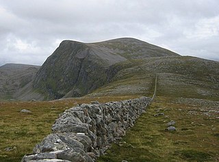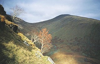
Beinn Dearg is a mountain in the Inverlael area of the Highlands of Scotland. It is most frequently climbed by following the River Lael up Gleann na Sguaib. Starting from near the head of Loch Broom, a path follows the glen to a bealach, which is about a kilometre north of the summit. From this bealach, the neighbouring peaks of Con a' Mheall and Meall na Ceapraichean may also be climbed. Eididh nan Clach Geala, which lies about 3 km north of Beinn Dearg, is also added in to complete a round of 4 Munros.

Beinn Dearg Mòr is a Corbett located in the middle of the Fisherfield Forest, near Dundonnell and Northwest Highlands in Scotland. It rises to an elevation of 906 metres (2,972 ft) above sea level.

Beinn a' Chlachair is a mountain in the Grampian Mountains of Scotland. It lies north of Loch Laggan, near the remote hamlet of Kinloch Laggan.

Beinn Airigh Charr is a mountain in the Northwest Highlands of Scotland. It lies in Wester Ross, on the northern side of Loch Maree, near to the village of Poolewe.

Beinn Tarsuinn is a mountain in the Northwest Highlands of Wester Ross, Scotland. It lies in the heart of the remote Dundonnell and Fisherfield Forest.

Beinn na Lap is a mountain in the Grampian Mountains of Scotland. It lies at the northern end of Rannoch Moor, near to Corrour railway station.

Beinn Dearg is a mountain in the Grampian Mountains of Scotland. It lies north of the village of Blair Atholl in Perthshire.

Beinn nan Aighenan is a mountain in the Grampian Mountains of Scotland. It lies in Argyll and Bute, north of the village of Taynuilt.

Beinn Eunaich is a mountain in the Grampian Mountains of Scotland, located north of the village of Dalmally in Argyll and Bute.

Beinn Talaidh is a peak on the Isle of Mull, Scotland, located in the mountainous centre of the Island.

Beinn Ruadh is a mountain of Argyll and Bute in Scotland. Part of the Grampian Mountains, it lies between Loch Eck and Loch Long in Argyll Forest Park.

Beinn Bhreac is a mountain in Argyll and Bute, Scotland. It is part of the Luss Hills, a southern subrange of the Grampian Mountains.

Creach-Beinn is a mountain in the south of the Isle of Mull, Scotland. It rises above the northern shore of Loch Spelve.

Beinn Iutharn Mhor is a mountain in the Grampian Mountains of Scotland. It lies north of Glen Shee on the Aberdeenshire and Perthshire border.

Beinn a' Chochuill is a mountain in the Grampian Mountains of Scotland, located east of Loch Etive in Argyll and Bute.

Beinn Bheoil is a mountain in the Grampian Mountains of Scotland, located on the western shore of Loch Ericht in Highland.

Beinn na h-Uamha is a mountain in the Northwest Highlands of Scotland. It lies in the Ardgour area of Lochaber, west of the village of Corran.

Beinn na h-Eaglaise is a mountain in the Northwest Highlands of Scotland. It lies in Wester Ross, south of the village of Torridon.

Beinn nan Caorach is a mountain in the Northwest Highlands of Scotland, It is located near the village of Corran in Lochalsh.

Beinn Bharrain is a mountain on the Isle of Arran, Scotland, located in the far northwest of the Island.


