Related Research Articles
Uranus Glacier is a glacier on the east coast of Alexander Island, Antarctica, 30 kilometres long and 10 km (6 mi) wide at its mouth, flowing east into George VI Sound immediately south of Fossil Bluff. Along the south face of the glacier is an east–west escarpment called Kuiper Scarp.
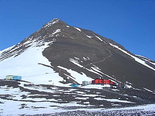
Syrtis Hill is a prominent snow-free conical terraced hill, rising to about 500 m, on the northwest corner of the Two Step Cliffs massif overlooking Viking Valley, in the southeast portion of Alexander Island, Antarctica. The hill is an important snow-free landmark and the site of biological and geological research. Named by United Kingdom Antarctic Place-Names Committee in 1993 after Syrtis Major Planum, the prominent dark feature on the planet Mars, first described by the Dutch astronomer Huygens in 1659. This hill was most likely named in association with nearby Mars Glacier and Planet Heights.
Ablation Point, also known as Punta Ablación, is the eastern extremity of a hook-shaped rock ridge marking the north side of the entrance to Ablation Valley, on the east coast of Alexander Island, Antarctica. It was first photographed from the air on 23 November 1935 by Lincoln Ellsworth and mapped from these photographs by W.L.G. Joerg. It was roughly surveyed in 1936 by the British Graham Land Expedition (BGLE) and resurveyed in 1949 by the Falkland Islands Dependencies Survey (FIDS). It was named by FIDS for nearby Ablation Valley. The site lies within Antarctic Specially Protected Area (ASPA) No.147.
Belemnite Point is the eastern extremity of a mainly ice-free, hook-shaped ridge, midway between Lamina Peak and Ablation Point and 2 nautical miles (4 km) inland from George VI Sound on the east coast of Alexander Island, Antarctica. It was first photographed from the air on November 23, 1935, by Lincoln Ellsworth and mapped from these photos by W.L.G. Joerg. Roughly surveyed in 1936 by the British Graham Land Expedition and resurveyed in 1949 by the Falkland Islands Dependencies Survey (FIDS), it was so named by FIDS because of belemnite fossils found in the outcropping marine strata.
Bertoglio Glacier is a glacier 7 nautical miles (13 km) long, flowing from the Conway Range eastward between Cape Lankester and Hoffman Point to the Ross Ice Shelf. It was mapped by the United States Geological Survey from tellurometer surveys and Navy air photos from 1959 to 1963.
Blodwen Peak(71°20′S68°22′W) is a peak on Alexander Island, the largest island of Antarctica.

Dewar Nunatak is a mainly snow-covered nunatak rising to 520 metres (1,700 ft) in the middle of Shambles Glacier, on the east coast of Adelaide Island. It was named by the UK Antarctic Place-Names Committee in 1963 for Graham J.A. Dewar, a British Antarctic Survey geologist at Adelaide station, 1961–63.
Grotto Glacier is a glacier on the east coast of Alexander Island, Antarctica, which flows east into George VI Sound between Belemnite Point and Ablation Point. It is 46 km (29 mi) long, 6 km (4 mi) wide where it emerges from the coastal mountains, and 13 km (8.1 mi) wide at its mouth. It was first photographed from the air on 23 November 1935, by Lincoln Ellsworth and mapped from these photographs by W.L.G. Joerg. It was roughly surveyed in 1936 by the British Graham Land Expedition and resurveyed in 1949 by the Falkland Islands Dependencies Survey (FIDS). The glacier was so named by the FIDS because a sledge dog was rescued from a grotto-like crevasse in the glacier.
Triton Point is a rocky headland at the east end of the high ridge separating Venus Glacier and Neptune Glacier on the east coast of Alexander Island, Antarctica. Lincoln Ellsworth first observed the coast in this vicinity from the air by on 23 November 1935, and it was roughly mapped from photos obtained on that flight by W.L.G. Joerg. The British Graham Land Expedition roughly surveyed Triton Point in 1936 by the Falkland Islands Dependencies Survey more accurately defined it in 1949. The United Kingdom Antarctic Place-Names Committee named it for its association with nearby Neptune Glacier, Triton being one of the satellites of the planet Neptune, the eighth planet of the Solar System.
Pagoda Ridge is a ridge with a small peak resembling a pagoda at the summit, located between Phobos Ridge and Deimos Ridge on the north side of Saturn Glacier, in southeast Alexander Island, Antarctica. The feature was mapped from trimetrogon air photography taken by the Ronne Antarctic Research Expedition, during 1947 and 1948, and from surveying by the Falkland Islands Dependencies Survey, 1948–50. This descriptive name was applied by the United Kingdom Antarctic Place-Names Committee.
Elephant Ridge is a sharp curved ridge in Antarctica, orientated generally west–east, and extending for about 0.5 nautical miles (1 km), with the highest point at the center rising to 6,999 metres (22,963 ft). The northern slopes are snow and ice free, and the central point is situated about 0.7 nautical miles (1.3 km) south-southeast of Khufu Peak and 0.9 nautical miles (1.7 km) southwest of Giza Peak. Uranus Glacier forms the southern boundary of the feature. Elephant Ridge is referred to as "Man Pack Hill" in scientific reports in the early 1960s, and is locally known descriptively as "The Elephant". The summit resembles an elephant's head, with the ridge forming the trunk.
Eros Glacier is a glacier on the east coast of Alexander Island, Antarctica, 7 nautical miles (13 km) long and 2 nautical miles (4 km) wide at its mouth, flowing southeast from the Planet Heights into George VI Sound immediately north of Fossil Bluff. It was probably first seen on November 23, 1935, by Lincoln Ellsworth, who flew directly over the glacier and obtained photos of features north and south of it. The mouth of the glacier was observed and positioned by the British Graham Land Expedition in 1936 and the Falkland Islands Dependencies Survey (FIDS) in 1948 and 1949. The glacier was mapped in detail from air photos taken by the Ronne Antarctic Research Expedition, 1947–48, by D. Searle of the FIDS in 1960. It was named by the UK Antarctic Place-Names Committee after the minor planet Eros in association with nearby Pluto Glacier and Uranus Glacier.
Pearce Dome is a dome shaped mountain rising to about 789 m that is snow and ice free on the north slopes and is situated about 0.5 nautical miles (0.9 km) west-northwest of Khufu Peak and 0.6 nautical miles (1.1 km) due east of Blodwen Peak, situated on the east coast of Alexander Island overlooking George VI Sound and the George VI Ice Shelf, Antarctica. The feature was referred to descriptively as The Snow Dome in scientific reports in the early 1960s, and referred to as Dome by those working in the area. Named for C.J. Pearce, a Falkland Islands Dependencies Survey Meteorologist who spent the first winter season (1961) at Fossil Bluff along with B.J. Taylor and J.P. Smith.
Giza Peak is a peak rising to about 600 metres (2,000 ft) on the east side of the Fossil Bluff massif, eastern Alexander Island, Antarctica. For many years this peak was known to the British Antarctic Survey (BAS) workers as "Sphinx," a name already in use. To avoid duplication, the UK Antarctic Place-Names Committee in 1987 applied the name Giza Peak to this feature in reference to the site of the colossal statue of the Sphinx at El Giza, Egypt.
Hayes Peak is an isolated, low rock peak, 2,060 metres (6,760 ft) high, rising above the ice surface just south of Bermel Escarpment, in the Thiel Mountains of Antarctica. The name was proposed by Peter Bermel and Arthur B. Ford, co-leaders of the United States Geological Survey (USGS) Thiel Mountains party which surveyed these mountains in 1960–61. The peak was named for Philip T. Hayes, a USGS geologist in the McMurdo Sound dry valley area during 1958–59.
Himalia Ridge is a ridge running east–west on the north side of the Ganymede Heights massif, north-east of Jupiter Glacier, in the east of Alexander Island, Antarctica. It was photographed from the air by the Ronne Antarctic Research Expedition in 1947 and mapped from these photographs by D. Searle of the Falkland Islands Dependencies Survey in 1960. The ridge was named by the UK Antarctic Place-Names Committee following British Antarctic Survey geological work, 1983–84, after Himalia, a satellite of the planet Jupiter, in association with Jupiter Glacier.
McArthur Glacier is a glacier between the Christie Peaks and Swine Hill, flowing west from Palmer Land, Antarctica, into George VI Sound. It was named by the UK Antarctic Place-Names Committee for Alistair H. McArthur, a British Antarctic Survey geophysicist at Stonington Island, 1967–68.
Mariner Hill is a prominent snow-free conical hill, rising to about 500 metres (1,600 ft) midway between Syrtis Hill and Two Step Cliffs, situated in the southeastern portion of Alexander Island, Antarctica. It was named by the UK Antarctic Place-Names Committee in 1993 after Mariner 9, the NASA probe which was the first spacecraft to orbit the planet Mars, in 1971.
Spartan Glacier is a short valley glacier lying between Callisto Cliffs and Tombaugh Cliffs on the east side of Alexander Island, Antarctica. The glacier was first mapped by the Overseas Surveys Directorate from satellite imagery supplied by U.S. National Aeronautics and Space Administration in cooperation with U.S. Geological Survey. Named by United Kingdom Antarctic Place-Names Committee after the British dog team known as "The Spartans," used in ascending this glacier, 1969. This is one of the few glaciers in Antarctica to be named after a dog team.
Khufu Corrie is a cirque roughly 0.3 nautical miles (0.6 km) across formed between Drune Hill to the north and Khufu Peak to the south on the east coast of Alexander Island, Antarctica. It was referred to as the "Fossil Bluff Glacier" in scientific reports in the early 1960s, Fossil Bluff being nearby, and is sometimes referred to today as "Moraine Corrie" and "Moraine Corrie Valley". The name is derived from Khufu Peak.
References
- ↑ "Belemnite Valley". Geographic Names Information System . United States Geological Survey, United States Department of the Interior . Retrieved 30 May 2011.
![]() This article incorporates public domain material from "Belemnite Valley". Geographic Names Information System . United States Geological Survey.
This article incorporates public domain material from "Belemnite Valley". Geographic Names Information System . United States Geological Survey.
| | This Alexander Island location article is a stub. You can help Wikipedia by expanding it. |