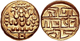
Dakshina Kannada district is located in the state of Karnataka in India, with its headquarters in the coastal city of Mangalore. It is part of the larger Tulu Nadu region. The district covers an area nestled in between the Western Ghats to its east and the Arabian Sea to its west. Dakshina Kannada receives abundant rainfall during the Indian monsoon. It is bordered by Udupi district to the north, Chikmagalur district to the northeast, Hassan district to the east, Kodagu to the southeast and Kasaragod district of Kerala to the south. According to the 2011 census of India, Dakshina Kannada district had a population of 2,083,625. It is the only district in Karnataka state to have all modes of transport like road, rail, water and air due to the presence of a major hub, Mangalore. This financial district is also known as the Cradle of Indian banking.

Belle is a village in the southern state of Karnataka, India. It is located in the Kaup taluk of Udupi district. The village is known for its historic Moodu-Belle Mahalingeshwara Temple dedicated to Shiva.

Kateel or Kateelu is a temple town in the Dakshina Kannada district of the Indian state of Karnataka. It is considered one of the holiest Hindu temple towns in India. It is situated on the banks of the river Nandini.
Kottar is a locality and a bazaar area of Nagercoil, Tamil Nadu state, in the southernmost part of Peninsular India; though a part of Nagercoil today, it is the original town around which the city of Nagercoil grew. It was an ancient trade centre of both Pandyans and Cheras at various times. The ancient mercantile centre of Kottar was established on the banks of the Pahrali River (Pazhayar).
Talapady is a village near Mangaluru city in Ullal taluk of Dakshina Kannada district of Karnataka state in India. Talapady borders the states of Karnataka and Kerala. National Highway 66 passes through Talapady which is 14 km (9 mi) south of Mangalore city. The Karnataka-Kerala checkpost border is situated at Talapady. Another village Thalapady, Kasargod which is situated near Talapady in Manjeswar crossing Kerala border.

The Alupa dynasty was an ancient ruling dynasty of India. The kingdom they ruled was known as Alvakheda Arusasira and its territory spanned the coastal districts of the modern Indian state known as Karnataka. The Alupas in their prime were an independent dynasty, centuries after reigning due to the dominance of Kadambas from Banavasi, they became feudatory to them. Later they became the vassals of the Chalukyas, Rashtrakutas, Hoysalas with the change in political scenario of Southern India. Their influence over coastal Karnataka lasted for about 1200 years. There is evidence that the Alupas followed the law of matrilineal inheritance (Appekatt/Aliyasantana) since the Alupa king Soyideva was succeeded by his nephew Kulasekhara Bankideva. The legendary king who is credited with introducing matrilineality in South Canara Kheda is named Bhuta Alupa Pandya The descendants of this dynasty still survive to this date and have spread in the karavali region and they are widely referred to as the Bunt. The Bunts follow Matrilineality instead of the common Patrilineality, and are said to be Nagavanshi Kshatriyas by their maternal origin. They can be identified with their surnames such as Shetty, Rai, Hegde, Alva, Chowta etc. Even though most Bunt are Hindus by faith now, The sizeable section of the community still follows Jainism and they are called Jain Bunt The last Alupa king to have ruled is Kulasekharadeva Alupendradeva whose inscription dated 1444 CE have been found in Mudabidri Jain Basadi.
Kinnigoli is a major suburb in the outskirts of Mangaluru International Airport Tehsil. It is located approximately 32 km from Mangaluru International Airport City, 5 km from Kateel, 8 km from Mulki and 17 km from the Mangaluru International Airport.
Karopady is a small village in Dakshina Kannada district, Karnataka, in far southern India. It is the border village between Karnataka and Kerala. Kasaragod District is the neighbouring district in Kerala State.
Bhabhanpura is a village on the outskirts of Varanasi city, located 7 km away from the heart of the city. Total population of the village is 2,992.

Shett is a surname and title of the Daivajna subcaste of Konkani people, residing along the coast of the Konkan region in western India. It is also an honorific used by them in Goa, Damaon, Konkan division of Maharashtra, and Kanara subregion of Karnataka.
Kinnya or Kinya is a village in Dakshina Kannada district of Karnataka state, India. The ancient Talapady Durga Parameshwari Temple is in this village. The village Kinnya lies near Arabian Sea Shared Border with Thalapady, Kotekar, Naringana And Manjanady Village. Total Population 6800, Native Language is Tulu and some kannada although there are now a decent amount Beary speaking families living here. It is located 23 km south of Mangalore city. In local Tulu language Kinya means small. The Durga Parameshwari Temple was recently renovated in the year 2015. Shree Durga Parameshwari temple is the family deity (Kuladevi) of many people who are the natives of undivided South Canara District. The village code is 02699400 as per Karnataka Administrative atlas 2001 published by DCO of Karnataka state. Pincode of Kinya village post office is 575023.

The Diocese of Mangalore is a Latin Church ecclesiastical jurisdiction or diocese of the Catholic Church located in the city of Mangalore, India. The diocese is a suffragan in the ecclesiastical province of the metropolitan Archdiocese of Bangalore. At present, it comprises the whole civil districts of Dakshina Kannada and Udupi in Karnataka state. The area of the Diocese was collectively referred to as South Canara during the Company rule in India, in the subsequent British India after Direct rule from London commenced & in the early post-independence Bombay state, prior to the States Reorganisation Act (1956). It was established as a separate Apostolic Vicariate from the Apostolic Vicariate of Verapoly in 1853, and was promoted to a diocese on 1 September 1886.
Tenkayedapadavu is a panchayat village in the southern state of Karnataka, India. Administratively, it is under Mangalore taluk of Dakshina Kannada district in Karnataka. It is located at a distance of 26 km from Mangalore city. There are two villages in the gram panchayat, Tenkayedapadavu and Badagayedapadavu. The village Tenka Yedapadav is the part of Yedapadavu, divided for easier administration of village. The Post name is "Shibrikere" which means "Shabari lake". In Yedapadav there are 2 temples, the Shri Rama Mandira and the Shri Adishakthi Durga Parameshwari Temple. There are also 2 primary and secondary level schools, and one Pre-University college named "Swami Vivekananda Pre-University college, Yedapadavu". Shri Krishna Janmastami & Ramanavami are two festivals that are held in the village, with the people taking to celebrate "Masaru Kuduke ustava" in a grand manner. Yedapadav is the middle village for Ganjimatt and Moodbidiri and also Kuppe Padavu.

Karkala, also known as Karla in Tulu language, is a town and the headquarters of Karkala taluk in the Udupi district of Karnataka, India. Located about 60 km from Mangalore in the Tulu Nadu region of the state, it lies near the foothills of the Western Ghats. Karkala has a number of natural and historical landmarks, and is a major tourist and transit destination due to its strategic location along the way to Hebri, Sringeri, Kalasa, Horanadu, Udupi, Kollur, Subrahmanya and Dharmasthala.

Sanoor is a village in the southern state of Karnataka, India. During the British Raj, the village was headed by the Patels (Patler). Since independence, it has been administered by a mandala Panchayati raj. The nearest court is in Karkala, 5 kilometres (3.1 mi) from the village center. Sanoor has several primary schools and a government pre-university college. The Tulu language is widely spoken; other languages spoken in the village are Konkani and Kannada. The Bunt and Billava were early ethnic communities, with the Marathi, Konkani and Brahmins arriving later. With Portuguese settlement, villagers converted to Catholicism. Local Muslims belong to the Moplah community, are known as Beary and speak the Beary dialect of Tulu. The Beary, living in the region for over a thousand years, may be descended from Arab traders.
Kanajaru or Kanajar is a small village approximately 78 km north of Mangalore, 18 km west of Karkala and 33 km east of Udupi. Kanajaru is part of Karkala Taluk in Udupi District, Karnataka, India.
Mudarangadi is a village in Kaup Taluk in Udupi District of Karnataka State, India. It belongs to Mysore division. It is located 26 km south of District headquarters Udupi and 352 km from State capital Bangalore.

The Church of Most Holy Saviour also known as Agrar Church is a historic Roman Catholic Church situated in Bantwal, India. The church was built in 1702, but it is believed that the existence of church was prior to this. It is one of the oldest churches in Dakshina Kannada district. This church comes under Roman Catholic Diocese of Mangalore. At present Rev. Fr. Dr Peter Dsouza serves as the parish priest of the Most Holy Saviour Church.
Santhoor is a village in Udupi taluk, Karnataka state, India. This village comes under Mudrangadi Gram Panchayat, Kapu Taluk.

St. Joseph Church, Belman is a Roman Catholic church and Parish is located in Belmannu, Karkala taluk, Udupi district, Karnataka, India. Formerly part of the Diocese of Mangalore, it became part of the Diocese of Udupi after Udupi became a separate diocese on 15 October 2011. The parish is part of the Archdiocese of Bangalore. It observes the Latin rite, with mass celebrated in Konkani with bilingual Kannada masses held on certain feast days.


