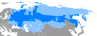
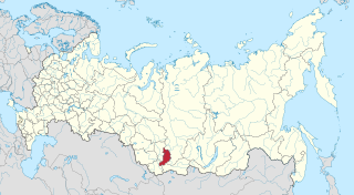
The Ob River, also Ob', is a major river in western Siberia, Russia, and is the world's seventh-longest river. It forms at the confluence of the Biya and Katun Rivers which have their origins in the Altay Mountains. It is the westernmost of the three great Siberian rivers that flow into the Arctic Ocean.

The Lena is the easternmost of the three great Siberian rivers that flow into the Arctic Ocean. With a mean annual discharge of 588 cubic kilometers per year, it is the second largest of the Arctic rivers. It is the largest river whose catchment is entirely within the Russian territorial boundaries. Permafrost underlies most of the catchment, with 77% of the catchment containing continuous permafrost.

The Indigirka River is a river in the Sakha Republic in Russia between the Yana River and the Kolyma River. It is 1,726 kilometres (1,072 mi) long. The area of its basin is 360,000 square kilometres (140,000 sq mi). The river flows into the Kolyma Bay, East Siberian Sea. It freezes up in October and stays under the ice until May–June.

Achinsk is a city in Krasnoyarsk Krai, Russia, located on the right bank of the Chulym River near its intersection with the Trans-Siberian Railway, 184 kilometers (114 mi) west of Krasnoyarsk. Population: 109,155.
The Obsha is a river in Sychyovsky District of Smolensk Oblast and Oleninsky, Belsky, and Zharkovsky Districts of Tver Oblasts, Russia. It is a left tributary of the Mezha. It is 153 kilometres (95 mi) long, and the area of its basin 2,080 square kilometres (800 sq mi). The town of Bely is located on the banks of the Obsha.

Yaya is a river in Siberian Russia, a left tributary of Chulym River, that flows through Kemerovo and Tomsk oblasts. It is 380 kilometres (240 mi) long. It originates in Kuznetsk Alatau.
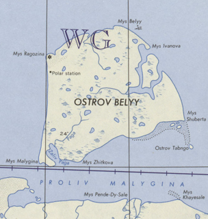
Bely Island is a relatively large island in the Kara Sea off the tip of the Yamal Peninsula, Siberia, Russia. Close to the island's northwest tip, there is the Russian Experiment Station Popov Station.

Zalesie is a village in the administrative district of Gmina Chodecz, within Włocławek County, Kuyavian-Pomeranian Voivodeship, in north-central Poland. It lies approximately 8 kilometres (5 mi) south-east of Chodecz, 33 km (21 mi) south of Włocławek, and 82 km (51 mi) south-east of Toruń.
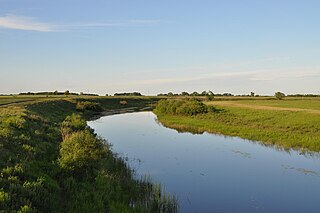
Chulym is a river in the endorheic drainage basin of Lake Chany in the southeastern part of the West Siberian Plain in Russia. The river is 392 kilometres (244 mi) long, with a drainage basin of 17,900 square kilometres (6,900 sq mi).
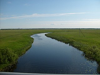
The Kargat is a river in Novosibirsk Oblast, Russia. It is a right tributary of the Chulym River. The Kargat is 387 kilometres (240 mi) in length, with a drainage basin of 7,200 square kilometres (2,800 sq mi)
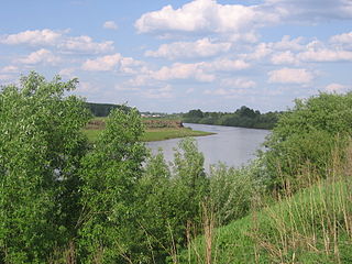
Inya is a river in Kemerovo and Novosibirsk Oblasts of Russia. It is a right tributary of the Ob River. It is 663 kilometres (412 mi) long, with a drainage basin of 17,600 square kilometres (6,800 sq mi).
Świerczów is a village in the administrative district of Gmina Stąporków, within Końskie County, Świętokrzyskie Voivodeship, in south-central Poland. It lies approximately 7 kilometres (4 mi) south-east of Stąporków, 18 km (11 mi) south-east of Końskie, and 26 km (16 mi) north of the regional capital Kielce.
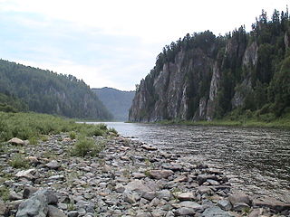
Kiya is a river in Tomsk and Kemerovo Oblasts of Russia. It is a tributary of the Chulym, and is 548 kilometres (341 mi) long, with a drainage basin of 32,200 square kilometres (12,400 sq mi). The river has its sources in the Kuznetsky Alatau and flows in a northwesterly direction to its mouth in the Chulym River some 40 kilometres (25 mi) upriver from the town of Asino.
Jasionka is a village in the administrative district of Gmina Trzebownisko, within Rzeszów County, Subcarpathian Voivodeship, in south-eastern Poland. It lies approximately 4 kilometres (2 mi) north of Trzebownisko and 10 km (6 mi) north of the regional capital Rzeszów.
Buczek is a village in the administrative district of Gmina Białogard, within Białogard County, West Pomeranian Voivodeship, in north-western Poland. It lies approximately 10 kilometres (6 mi) north-east of Białogard and 122 km (76 mi) north-east of the regional capital Szczecin.
Stare Bielice is a village in the administrative district of Gmina Biesiekierz, within Koszalin County, West Pomeranian Voivodeship, in north-western Poland. It lies approximately 7 kilometres (4 mi) north-east of Biesiekierz, 5 km (3 mi) west of Koszalin, and 132 km (82 mi) north-east of the regional capital Szczecin.
The Aktay or Aqtay is a river in Tatarstan, Russian Federation, a left-bank tributary of the Volga River, falling into the Kuybyshev Reservoir near Izmeri. It is 89 kilometres (55 mi) long, and its drainage basin covers 1,016 square kilometres (392 sq mi).

The Anuy River is a 327-kilometre (203 mi) long left tributary of the Ob River originating in the Altai mountains of Siberia, Russia.

Veslyana River – is a river in Perm Krai and Komi Republic, Russia, a left tributary of the Kama River, which in turn is a tributary of the Volga River. It starts in the southeastern portion of Ust-Kulomsky District of the Komi Republic, about 7 kilometres (4 mi) from the border with Perm Krai. It flows through the Gaynsky District of Perm Krai and into the Kama River 1,193 kilometres (741 mi) from its mouth, 145 metres (476 ft) above sea level, near the rural locality of Ust-Veslyana. The river is 266 kilometres (165 mi) long, and the area of its drainage basin is 7,490 square kilometres (2,890 sq mi).