
Charing Cross Road is a street in central London running immediately north of St Martin-in-the-Fields to St Giles Circus, which then merges into Tottenham Court Road. It leads from the north in the direction of Charing Cross at the south side of Trafalgar Square. It connects via St Martin's Place and the motorised east side of the square.

The Jubilee line is a London Underground line that runs between Stanmore in suburban north-west London and Stratford in east London, via the Docklands, South Bank and West End. Opened in 1979, it is the newest line on the Underground network, although some sections of track date back to 1932 and some stations to 1879.

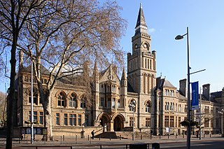
St Giles Circus is a road junction in the St Giles district of the West End of London at the eastern end of Oxford Street, where it connects with New Oxford Street, Charing Cross Road and Tottenham Court Road, which it is more often referred to owing to the location of Tottenham Court Road Underground station directly under the junction. It is near to Soho, Covent Garden, Bloomsbury and Fitzrovia.

Shaftesbury Avenue is a major road in the West End of London, named after The 7th Earl of Shaftesbury. It runs north-easterly from Piccadilly Circus to New Oxford Street, crossing Charing Cross Road at Cambridge Circus. From Piccadilly Circus to Cambridge Circus, it is in the City of Westminster, and from Cambridge Circus to New Oxford Street, it is in the London Borough of Camden.

Old Street is a 1-mile (1.6 km) street in inner north-east Central London, England that runs west to east from Goswell Road in Clerkenwell, in the London Borough of Islington, via St Luke's and Old Street Roundabout, to the crossroads where it meets Shoreditch High Street (south), Kingsland Road (north) and Hackney Road (east) in Shoreditch in the London Borough of Hackney.

Brompton Road is a street located in the southern part from Knightsbridge and in the eastern part from Brompton in the Royal Borough of Kensington and Chelsea and partly the City of Westminster in London.
Ealing was a local government district from 1863 to 1965 around the town of Ealing which formed part of the built up area of London until 1965, where it became part of Greater London.

The A316, known in parts as the Great Chertsey Road, is a major road in England, which runs from the A315 Chiswick High Road, Turnham Green, Chiswick to join head-on the M3 motorway at Sunbury-on-Thames. Its initial London section Chiswick Lane heads south – following this it is a mostly straight dual carriageway aligned WSW.

Union Street is a major street in the London Borough of Southwark. It runs between Blackfriars Road to the west and Borough High Street to the east. Southwark Bridge Road crosses in the middle.

The West Cross Route (WCR) is a 0.75 mile segment of dual carriageway of the A3220 route in West London running north–south between the northern elevated roundabout junction with the western end of Westway (A40) and the southern Holland Park Roundabout. It runs through Shepherd's Bush to its west and Notting Hill to its east.
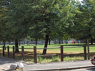
Bingfield Park is a small park area located in the Caledonian Ward and parish of St. Michaels area of the London Borough of Islington. The Park has existed since about 1970 when the Beaconsfield Buildings were purchased by the Greater London Council and demolished. These Buildings were preceded by small holdings and cottages and known as Strouds Vale and bordered on to the areas known as Sutton Gardens, Belle Isle and Copenhagen fields.

The London to Brighton Way, also called the London to Portslade Way, is a Roman road between Stane Street at Kennington Park and Brighton in Sussex. The road passes through Streatham and Croydon, then through the Caterham Valley gap in the North Downs. It passes through Godstone and Felbridge, then follows an almost straight line through Ardingly, Haywards Heath, Burgess Hill and Hassocks to the South Downs at Clayton. At Hassocks it crosses the Sussex Greensand Way at a large Roman cemetery. It climbs the South Downs escarpment, crossing the ridgeway and connecting with other local tracks. South of Pyecombe the route is uncertain, and may have continued to Brighton or to Portslade.

Whitfield Street is a street in the London Borough of Camden that runs from Warren Street in the north to Windmill Street in the south. The street is crossed by Grafton Way, Maple Street, Howland Street, Wayland Street, and Goodge Street. Whitfield Place starts and ends in Whitfield Street on its eastern side. Hertford Place, Chitty Street and Scala Street all join Whitfield Street on its western side.

Marylebone Lane is one of the original streets of the Marylebone district of the City of Westminster, London. It runs from Oxford Street in the south to Marylebone High Street in the north, its winding shape following the course of the River Tyburn that it once ran alongside and pre-dating the grid pattern of the other streets in the area. Today the lane is largely composed of small shops, cafes and restaurants with some small apartment blocks. There are some larger commercial buildings at the southern end near Oxford Street.

Temple Place is a street in the City of Westminster that runs parallel with Victoria Embankment along the River Thames. The name of the street refers to the Knights Templar who once lived in the Temple area of London.

The Bemerton Estate is a social housing estate to the north of Bingfield Street and west of Caledonian Road, in the London Borough of Islington. It was built in the late 1960s and early 1970s, and named after Bemerton Street, the northern part of which it replaced.

Portland Road is a road in Notting Hill, in the Royal Borough of Kensington and Chelsea that was built as a speculative development in the 1850s. The road has been noted for its division into three sections of different wealth: the section between Holland Park Avenue and Clarendon Cross/Hippodrome Place being one of the most expensive places to buy a house in London, a section of terraced houses further north being also very expensive but less so than the lower reaches of the road, and a section at the northern end that was once slums and is now working class social housing and is described as being north of an "invisible line" that divides it from the privately owned sections of the road.
Grenville Place is a street in the Royal Borough of Kensington and Chelsea, London, that connects Cornwall Gardens and Launceston Place in the north with Cromwell Road in the south. It is crossed in its northern part by Cornwall Mews South, and joined on its western side by Emperor's Gate (twice). it is joined on its eastern side by Southwell Gardens.

Catherine Street, originally known as Brydges Street, is a street in the City of Westminster, London. It runs from Russell Street in the north to Aldwych in the south. It is crossed midway by Tavistock Street and joined on the western side near Aldwych by the eastern end of Exeter Street.

Chepstow Place is a street in London that runs from the junction of Westbourne Grove and Pembridge Villas in the north to Pembridge Square in the south. It is crossed by Dawson Place and joined on its eastern side by Rede Place. The east side is in the City of Westminster and the west side in the Royal Borough of Kensington and Chelsea.


