Caledonian Road, London

Last updated

UK road A5203.svg
A5203
King's Cross, Caledonian Road, N1 - geograph.org.uk - 608168.jpg
The Caledonian Road at the junction with Northdown Road
Route information
Length2.6 mi (4.2 km)
Major junctions
South end Kings Cross
Major intersections
North end Holloway
Location
Country United Kingdom
Primary
destinations
King's Cross
Barnsbury
Holloway
Road network
UK road A5202.svg A5202 UK road A5204.svg A5204

Caledonian Road in the London Borough of Islington, England, connects North London, from Camden Road near its junction with Holloway Road, and central London's Pentonville Road in the south. A mile and a half long, it is known colloquially as the Cally and forms the entirety of the A5203.

Contents

Character

The road is mostly residential from Camden Road until it reaches Caledonian Road Underground station. Residential developments have been constructed around the station including student accommodation. South of the station near the bridge carrying the North London line is Pentonville Prison. South of the prison the road is lined with shops and cafes including several Ethiopian restaurants. The area is poor compared to the north end and the shops serve the council estates bordering the road and the more affluent Barnsbury area of mostly Georgian terraces to the east. The road crosses the Regents Canal at Thornhill Bridge and to the south are trendy shops and restaurants that have opened as a result of the King's Cross Central developments. The road ends at Pentonville Road near King's Cross railway station and the border with Camden. Housmans Bookshop, specialist radical book and magazine retailers established in 1945, is at No.5, as are the offices of Peace News and London Greenpeace, the people behind the McLibel Trial.

In August 2013, the railway bridge over the road was repainted to remove the word "Ferodo" (one of many such bridges advertising the company name) and replaced it with the street's informal name, "The Cally". [1] As of September 2016, Phil Coy's "your right to continued existence [cally colour chart]" was installed under "The Cally" bridge. The work illuminates the underside of the bridge with one colour at a time, with each colour's name simultaneously displayed on a dot matrix screen. [2] The palette of 191 colour names was developed in consultation with local community groups with reference to the Caledonian Road's history.

The road was the subject of an hour-long episode in the 2012 BBC and Open University co-production, The Secret History of Our Streets , which chose the Caledonian Road as a typical London example. The road is mentioned in the song "Up The Bracket" by The Libertines.[ citation needed ]

History

The Metropolitan Cattle Market as seen in 1855 Die Gartenlaube (1855) b 089.jpg
The Metropolitan Cattle Market as seen in 1855

The road was constructed in pursuance of an act of Parliament, the Battle Bridge and Holloway Road (Middlesex) Act 1825 (6 Geo. 4. c. clvi), obtained by the Battle Bridge and Holloway Road Company. [3] The company built the Caledonian Road in 1826 as a toll road to link the New Road with Holloway Road (which is part of the Great North Road) and provide a new link to the West End from the north.

Originally known as Chalk Road, its name was changed after the Royal Caledonian Asylum for the children of poor exiled Scots, was built in the area in 1828. The building has since been demolished and its site is occupied by local authority housing, the Caledonian Estate built 1900–7.

The first residential buildings on the road were Thornhill Terrace (numbers 106–146), which were built in 1832, and other terraces, which were built in the 1840s. From around 1837 to 1849, cottages in gardens were built between Brewery Road and the site of the railway which were part of the failed Experimental Gardens or French Colony founded by a philanthropist, Peter Baume. [4] Due to poor lighting and roads, the cottages declined into slums.

Pentonville Prison was built in 1842 immediately to the south of the asylum. Cattle drovers passed along the road on their way to Smithfield until 1852 when the City of London Corporation transferred the Metropolitan Cattle Market to the Caledonian Market. [5]

In the mid 20th century, many communities were attracted to Caledonian Road by its relatively low property prices. An Irish community grew there; and in 1955, a cache of weapons belonging to the Irish Republican Army was discovered in the cellar of No. 257 Caledonian Road. [6]

In the 21st century much of the commercial and residential property on the road has come under the ownership of notorious rogue landlord Andrew Panayi, one of England's biggest private landlords, who owns at least 200 properties on Caledonian Road alone. [7] Panayi, who featured on the documentary The Secret History of Our Streets in 2012, has boasted publicly of his exploitation of tenants in the area, claiming "if there's milk in the cow, milk it". [8] Although he has been accused and convicted on a number of occasions for a litany of offenses – including illegally leasing substandard properties, revenge evictions and building residential properties without council permission – Panayi still operates on the Caledonian Road. [9] [10] [11]

Buildings

Caledonian Road Methodist Church Caledonian Road Methodist Church - geograph.org.uk - 412204.jpg
Caledonian Road Methodist Church

The road has a number of architecturally important or interesting buildings. Its listed buildings include an Italianate Methodist Chapel built in 1870; [12] the Caledonian Estate, an early Edwardian flatted estate; Pentonville Prison; [13] and the Flying Scotsman, a 1901 public house and offices. [14] Caledonian Road Underground station is also Grade II listed.

University College London's controversial New Hall building attracted negative responses from some architectural critics on its completion for its purported failure to accommodate its Victorian facade with the building behind. [15] It was awarded the 2013 Carbuncle Cup for the ugliest building in the United Kingdom. [16] A Chapter Students accommodation located immediately south of New Hall has not attracted anywhere near as much controversy.

The road passes near to Islington Council social housing estates such as Bemerton, Barnsbury and Boston Estates and Tiber Gardens.

Safety

Transport

Train

Buses

Related Research Articles

<span class="mw-page-title-main">Barnsbury</span> Human settlement in England

Barnsbury is an area of north London in the London Borough of Islington, within the N1 and N7 postal districts.

<span class="mw-page-title-main">London Borough of Islington</span> London borough in United Kingdom

The London Borough of Islington is a London borough which forms part of Inner London, England. Islington has an estimated population of 215,667. It was formed in 1965, under the London Government Act 1963, by the amalgamation of the metropolitan boroughs of Islington and Finsbury.

<span class="mw-page-title-main">Holloway, London</span> Human settlement in England

Holloway is an area of north London in the London Borough of Islington, England, 3.3 miles (5.3 km) north of Charing Cross, which follows the line of the Holloway Road (A1). At the centre of Holloway is the Nag's Head commercial area which sits between the more residential Upper Holloway and Lower Holloway neighbourhoods. Holloway has a multicultural population and includes the Emirates Stadium, home of Arsenal F.C.. Until 2016, it was the site of Holloway Prison, the largest women's prison in Europe. Before 1965, it was in the historic county of Middlesex.

<span class="mw-page-title-main">Tufnell Park</span> Human settlement in England

Tufnell Park is an area in north London, England, in the London boroughs of Islington and Camden.

<span class="mw-page-title-main">King's Cross, London</span> Area of central London in England

King's Cross is a district in the London Boroughs of Camden and Islington, on either side of Euston Road in north London, England, 1.5 miles (2.4 km) north of Charing Cross, bordered by Barnsbury to the north, Clerkenwell to the southeast, Angel to the east, Holborn and Bloomsbury to the south, Euston to the west and Camden Town to the northwest. It is served by two major rail termini, St Pancras and King's Cross. King's Cross station is the terminus of one of the major rail routes between London and the North.

<span class="mw-page-title-main">Islington</span> District of London, England

Islington is an inner-city area of north London, England, within the wider London Borough of Islington. It is a mainly residential district of Inner London, extending from Islington's High Street to Highbury Fields, encompassing the area around the busy High Street, Upper Street, Essex Road, and Southgate Road to the east.

<span class="mw-page-title-main">Pentonville Road</span> Road in central London

Pentonville Road is a road in Central London that runs west to east from Kings Cross to City Road at The Angel, Islington. The road is part of the London Inner Ring Road and part of the boundary of the London congestion charge zone.

<span class="mw-page-title-main">Metropolitan Borough of Islington</span> Former local authority of London, England

Islington was a civil parish and metropolitan borough in London, England. It was an ancient parish within the county of Middlesex, and formed part of The Metropolis from 1855. The parish was transferred to the County of London in 1889 and became a metropolitan borough in 1900. It was amalgamated with the Metropolitan Borough of Finsbury to form the London Borough of Islington in Greater London in 1965.

<span class="mw-page-title-main">Pentonville</span> Human settlement in England

Pentonville is an area in North London, located in the London Borough of Islington. It is located 1.75 miles (2.82 km) north-northeast of Charing Cross on the Inner Ring Road. Pentonville developed in the northwestern edge of the ancient parish of Clerkenwell on the New Road. It is named after Henry Penton, the developer of the area.

<span class="mw-page-title-main">Holloway Road</span> North London shopping street

Holloway Road is a road in London, 3 kilometres (1.9 mi) in length. It is one of the main shopping streets in North London, and carries the A1 road as it passes through Holloway, in the London Borough of Islington. The road starts in Archway, near Archway Underground station, then heads south-east, past Upper Holloway railway station, Whittington Park, past the North London campus of London Metropolitan University near Nag's Head, past Holloway Road Underground station, and the main campus of the university, and then becomes Highbury Corner, near Highbury & Islington station.

<span class="mw-page-title-main">Liverpool Road</span> Street in Islington, London

Liverpool Road is a street in Islington, North London. It covers a distance of 1+14 miles (2.0 km) between Islington High Street and Holloway Road, running roughly parallel to Upper Street through the area of Barnsbury. It contains several attractive terraces of Georgian houses and Victorian villas, many of which are listed buildings. There are a number of pubs, small businesses and restaurants along its route, as well as some secluded garden squares. The vast majority of the street is residential, with a bustling shopping and business area at the southern, Angel, end.

<span class="mw-page-title-main">Islington South and Finsbury (UK Parliament constituency)</span> Parliamentary constituency in the United Kingdom, 1974–present

Islington South and Finsbury is a constituency created in 1974 and represented in the House of Commons of the UK Parliament since 2005 by Emily Thornberry of the Labour Party. Thornberry served as Shadow Foreign Secretary from 2016 until 2020 and as Shadow Attorney General for England and Wales from 2021 to 2024.

<span class="mw-page-title-main">Caledonian Road tube station</span> London Underground station

Caledonian Road is a station on the Piccadilly line of the London Underground, between King's Cross St. Pancras and Holloway Road, and in Travelcard Zone 2. It was opened on 15 December 1906 by the Great Northern, Piccadilly and Brompton Railway. The building was designed by Leslie Green.

<span class="mw-page-title-main">Upper Holloway</span> Human settlement in England

Upper Holloway is an area in the London Borough of Islington, London, centred on the upper part of Holloway Road and Junction Road, forming part of North London.

<span class="mw-page-title-main">Metropolitan Cattle Market</span>

The Metropolitan Cattle Market, just off the Caledonian Road in the parish of Islington was built by the City of London Corporation and was opened in June 1855 by Prince Albert. The market was supplementary to the meat market at Smithfield and was established to remove the difficulty of managing live cattle at that latter site.

<span class="mw-page-title-main">York Way</span> Street in central London

York Way is a major road in the London Borough of Islington, running north for one mile from the junction of Pentonville Road and Euston Road, adjacent to King's Cross railway station towards Kentish Town and Holloway. At its northern end, the road becomes Brecknock Road. For its entire length York Way forms the boundary between the London Boroughs of Islington and Camden.
<span class="mw-page-title-main">A1 in London</span> Section of road in London

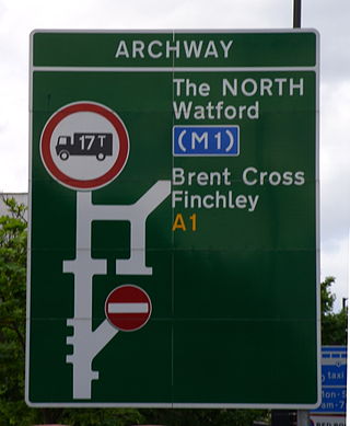
The A1 in London is the southern part of the A1 road. It starts at Aldersgate in the City of London, passing through the capital to Borehamwood on the northern fringe of Greater London, before continuing to Edinburgh. The road travels through the City and three London boroughs: Islington, Haringey and Barnet, which include the districts of Islington, Holloway, Highgate, Hendon and Mill Hill, and travels along Upper Street and Holloway Road, crossing the North Circular Road in Hendon, a district in the London Borough of Barnet.
<span class="mw-page-title-main">Camden Road</span> Road in London, England

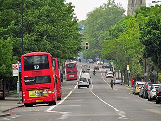
Camden Road is a main road in London running from the junction of Camden High Street and Camden Town Underground station up to Holloway Road. It is part of the A503 which continues east as Tollington Road.

<span class="mw-page-title-main">James Bunstone Bunning</span> English architect

James Bunstone Bunning was an English architect. He held the post of architect to the City of London from 1843 until his death, and is probably best remembered for his design for the Coal Exchange.
<span class="mw-page-title-main">Cloudesley Square</span> Square in Islington, London, England

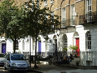
Cloudesley Square is a square in the Barnsbury district of Islington, North London. It is bounded by Georgian terraced houses, all of which are listed buildings. The central area is occupied by the Gothic Revival former Holy Trinity Church, designed by Charles Barry.

References

  1. "Welcoming the Cally bridge to the Cally Road | Team Cally". Archived from the original on 4 March 2016. Retrieved 4 April 2014.{{cite web}}: CS1 maint: bot: original URL status unknown (link)
  2. your right to continued existence [cally colour chart] (8 June 2016). "Art installation shines a light on The Cally's colourful past and present". Islington Council Media. Islington Council.
  3. Wheatley, Henry Benjamin (1891). London, Past and Present: Its History, Associations, and Traditions. J. Murray. p.  317.
  4. Hibbert, Christopher; Weinreb, Ben; Keay, John; Keay, Julia (2011). The London Encyclopaedia (3rd ed.). Pan Macmillan. ISBN   978-0-230-73878-2.
  5. "Islington: Growth, Holloway and Tollington". British History Online. Retrieved 11 October 2017.
  6. Bullman, Joseph; Hegarty, Neil; Hill, Brian (2012). The Secret History of Our Streets: London. Ebury Publishing. ISBN   978-1-4464-1759-1.
  7. "Landlord forced to submit 140 applications to prove flats are lawful". The Guardian. 26 December 2016. Retrieved 1 March 2021.
  8. "The Secret History of Our Streets: Caledonian Road". BBC Two. 13 July 2015. Retrieved 1 March 2021.
  9. "Notorious landlord forced to pay back £70,000 rent after illegally leasing Islington flat". Evening Standard. London. 22 October 2015. Retrieved 1 March 2021.
  10. "Generation rent v the landlords: 'They can't evict millions of us'". The Guardian. 22 August 2015. Retrieved 1 March 2021.
  11. "Landlord forced to submit 140 applications to prove flats are lawful". The Guardian. 26 December 2016. Retrieved 1 March 2021.
  12. Historic England. "Details from listed building database (1205354)". National Heritage List for England . Retrieved 2 October 2015.
  13. Historic England. "Details from listed building database (1195491)". National Heritage List for England . Retrieved 2 October 2015.
  14. Historic England. "Details from listed building database (1195703)". National Heritage List for England . Retrieved 2 October 2015.
  15. Wainwright, Oliver (29 August 2013). "'Prison-like' student housing wins Carbuncle Cup for worst building". The Guardian.
  16. Woodman, Ellis (29 August 2013). "Carbuncle Cup winner 2013: A triumph for the dark side". Building Design. Retrieved 10 June 2018.
  17. "Islington stabbing: Three arrested over Nedim Bilgin's death". BBC News. 30 January 2019. Retrieved 2 October 2022.
  18. Ewan Somerville (6 July 2020). "Islington shooting: Man, 22, gunned down in broad daylight next to children's park named as Imani Allaway-Muir". Evening Standard. Retrieved 3 October 2022.

Sources

Commons-logo.svg Media related to Caledonian Road at Wikimedia Commons

51°32′46″N0°07′05″W / 51.5460°N 0.1180°W / 51.5460; -0.1180