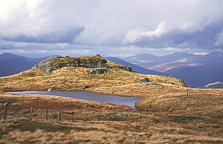
Ben Armine | |
---|---|
Creag a' Choire Ghlais | |
Ben Armine summit | |
Highest point | |
Elevation | 705 m (2,313 ft) [1] |
Prominence | 243 m (797 ft) |
Listing | Graham, Marilyn |
Geography | |
Location | Sutherland, Scotland |
Parent range | Northwest Highlands |
OS grid | NC695273 |
Topo map | OS Landranger 16 |
Ben Armine (705 m) is a remote hill in Sutherland in the far north of Scotland. It lies in inland, north of the village of Lairg.
Sutherland is a historic county, registration county and lieutenancy area in the Highlands of Scotland. Its county town is Dornoch. Sutherland borders Caithness and Moray Firth to the east, Ross-shire and Cromartyshire to the south and the Atlantic to the north and west. Like its southern neighbour Ross-shire, Sutherland has some of the most dramatic scenery in the whole of Europe, especially on its western fringe where the mountains meet the sea. These include high sea cliffs, and very old mountains composed of Precambrian and Cambrian rocks.
Lairg is a village and parish in Sutherland, Scotland. It has a population of 891 and is at the south-eastern end of Loch Shin.
The best known summit of a range of hills lying southeast of Ben Klibreck, its southern neighbour Creag Mhor is slightly higher. [2]
Ben Klibreck is a Scottish mountain located in central Sutherland. It is an isolated hill, rising above a large area of moorland. The highest point, Meall nan Con, rises to 962 m (3,165 ft) and is therefore the second most northerly Munro after Ben Hope. The western side of the hill is a fairly uniform steep, heathery slope, while the eastern side has a series of large, grassy corries and has been described as having more character.
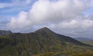
Ben Vorlich is a mountain located in the southern part of the Highlands of Scotland. Due to its prominence when seen from the lower ground of the Central Belt, Ben Vorlich is one of the most commonly seen of Munros, Scotland's peaks of 3000ft height or above. It lies in an area of land bounded to the north by Loch Earn, and to the west by Loch Lubnaig. The town of Callander lies to the south.
Ben Vorlich is a Scottish mountain situated between the northernmost section of Loch Lomond and Loch Sloy. It is one of the Arrochar Alps, though it lies separate from the other peaks in the range, as indicated by the large topographic prominence. It is the highest point of the historic county of Dunbartonshire.
Sgurr nan Conbhairean is a mountain in the Northwest Highlands, Scotland, lying north of Loch Cluanie between Glen Shiel and Glen Moriston.
Beinn a' Chlachair is a mountain in the Grampian Mountains of Scotland. It lies north of Loch Laggan, near the remote hamlet of Kinloch Laggan.
Ben Aden (887m) is a mountain in the Northwest Highlands of Scotland. It lies on the Knoydart peninsula in Lochaber.
Beinn Dearg is a mountain in the Grampian Mountains of Scotland. It lies north of the village of Blair Atholl in Perthshire.
Beinn nan Aighenan is a mountain in the Grampian Mountains of Scotland. It lies in Argyll and Bute, north of the village of Taynuilt.
Ben Vuirich is a mountain in the Grampian Mountains of Scotland. It is located in Perthshire, north of the town of Pitlochry.
Glas Bheinn Mhor is a mountain in the Grampian Mountains of Scotland, south of Glen Etive. The Argyll and Bute and Highland border straddles its summit.
Meall Corranaich is a mountain in the Grampian Mountains of Scotland. It lies on the northern shore of Loch Tay in Perthshire, and is part of the Ben Lawers group.
Ben Tirran is a mountain in the Grampian Mountains of Scotland. It lies in the vast Mounth area of the eastern Highlands in Angus, on the northern side of Glen Clova.
Beinn Bheoil is a mountain in the Grampian Mountains of Scotland, located on the western shore of Loch Ericht in Highland.
Carn Dearg is a remote mountain in the Grampian Mountains of Scotland. It lies east of Rannoch Moor, on the border of Highland and Perthshire.
Creag nan Damh is a mountain in the Northwest Highlands of Scotland, southeast of the village of Shiel Bridge in the Kintail area.
Sgurr a' Gharaidh is a mountain in the Northwest Highlands of Scotland. It lies in Wester Ross, north of Loch Carron.
Beinn nan Eun is a mountain in the Northwest Highlands of Scotland. It is located in Easter Ross, several miles northwest of Dingwall.
Scaraben is a hill in the Northwest Highlands of Scotland. It lies in the Caithness region, in the far north.
Glas Bheinn is a mountain in the Northwest Highlands of Scotland. It lies in the Assynt area of Sutherland, in the far north of the country.
Beinn a' Choin is a mountain in the Grampian Mountains of Scotland. It lies on the border of the Sterling region and Argyll at the northern end of Loch Lomond.
Stob an Aonaich Mhoir is a remote mountain in the Grampian Mountains of Scotland. It lies in Perthshire, on the eastern shore of Loch Ericht.
This Highland location article is a stub. You can help Wikipedia by expanding it. |