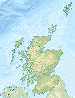
Lochore Welfare Junior Football and Athletic Club are a Scottish football club from the village of Crosshill, Fife. The club currently compete in the East of Scotland League First Division Conference B. Originally formed in 1934, the club are based at Central Park and their present home colours are black and white.

The East Neuk or East Neuk of Fife is an area of the coast of Fife, Scotland.

Kennoway is a village in Fife, Scotland, near the larger population centres in the area of Leven and Methil. It is about three miles inland from the Firth of Forth, north of Leven. This position gave it importance in the old days while travelling by coach, for the stage road ran through Kennoway from the ferry at Pettycur, through Ceres, and on to St Andrews. The street known as "The causeway" was also added to part of the fife Pilgrim Way in 2019 due ties with S.t Kenneth, the Causeway being part of one of the designated conservation areas by Fife Council
The Rural Municipality of Alexander is a rural municipality in the Eastern region of Manitoba, Canada. The office is located in St. Georges, Manitoba. The town of Powerview-Pine Falls lies adjacent to the municipality, as does the Sagkeeng First Nation Indian reserve. The Chevrefils District and Broadlands are located in the R.M.

Middle Harbor Shoreline Park (MHSP) is located on San Francisco Bay and the Port of Oakland entrance channel, west of downtown Oakland, California. It is owned and operated by the Port of Oakland. The park entrance is at the intersection of 7th Street and Middle Harbor Road. It is open seven days a week from 8 a.m. to dusk.

Lochore is a former mining village in Fife, Scotland. It takes its name from the nearby Loch Ore. It is largely joined to the adjacent villages of Ballingry to the north and Crosshill to the south.
Ballingry ; Scots: Ballingry, Bingry, Scottish Gaelic: Baile Iongrach) is a small town in Fife, Scotland. It is near the boundary with Perth and Kinross, north of Lochgelly. It has an estimated population (2004) of 5,740. The once separate villages of Ballingry, Lochore, Crosshill, and Glencraig are now somewhat joined together as the part of the Benarty area. Ballingry, along with its neighbour Lochgelly, is one of Fife's 'regeneration areas' and is classed as in need of regeneration economically and socially.

Florida is an unincorporated community in Lafayette Township, Madison County, Indiana.
Simpkins is an unincorporated community in Northampton County, Virginia, United States.
Lumphinnans is a small, former mining village. It consists of no more than half a dozen streets, along the B981 road, from west to east between the towns of Cowdenbeath and Lochgelly, in central Fife.

Benarty Hill, locally simply Benarty, rises above and to the west of Ballingry, in the west of Fife, Scotland. The summit ridge forms the boundary with Perth and Kinross. It is a prominent feature of the view from the M90 motorway, and from Kinross and Loch Leven. The lower slopes are steep on all sides, but the extensive heath around the summit is relatively flat.

Portmoak is a parish in Kinross-shire, Scotland. It consists of a group of settlements running north to south they are Glenlomond, Wester Balgedie, Easter Balgedie, Kinnesswood, Kilmagadwood and Scotlandwell.

Nightingale is a hamlet in southern Alberta, Canada within Wheatland County. It is located 4 kilometres (2.5 mi) west of Highway 21, approximately 53 kilometres (33 mi) east of Calgary.
Glencraig is a very small former mining village in Scotland, situated in the Benarty area of Fife, between Crosshill and Lochgelly. The village's population has decreased significantly since the decline of the coal-mining industry during the 1970s and 1980s.

Kingskettle or simply Kettle is a small village and parish in Fife, Scotland. It is situated in the Howe of Fife, around a mile south of Ladybank. The railway station was permanently closed in 1967. The village was the home to children's musical group The Singing Kettle and the shop of the same name. In 2015 the band split up and the shop closed down.
Dundee Synagogue in Dundee, Scotland was the place of worship of the Tayside and Fife Jewish Community, which was established in 1878 under its former name of the Dundee Hebrew Congregation. The synagogue building, designed by Ian Imlach, was located on St Mary Place. It was opened in 1978 to replace the former synagogue building at 15 Meadow Street that was demolished in 1973.

Fife Heritage Railway is a heritage railway run by The Kingdom of Fife Railway Preservation Society, formed in 1992, which aims to showcase the heritage of the railways of Fife and restore locomotives and rolling stock that once worked in Fife. They are based in Levenmouth, Scotland which has been their base since 2003.
Humbug Park also previously known as Crossgates Greyhound Stadium is a football ground and former greyhound racing track on Inverkeithing Road in Crossgates, Fife, Scotland.
Catherine Place is an unincorporated community in Madison County, in the U.S. state of Missouri.


