Bendigo Airport (Pennsylvania)

Last updated
Bendigo Airport
Bendigo Airport July 2007.JPG
Ground view looking SW
Summary
Airport typePublic
OwnerHelen Bendigo
OperatorPaul Bendigo
Serves Tower City, Pennsylvania
Elevation  AMSL 791 ft / 241 m
Coordinates 40°33′31″N076°33′34″W / 40.55861°N 76.55944°W / 40.55861; -76.55944
Map
USA Pennsylvania relief location map.svg
Airplane silhouette.svg
74N
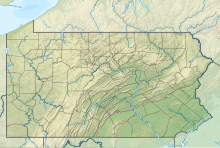
Location of airport in Pennsylvania
Usa edcp relief location map.png
Airplane silhouette.svg
74N
74N (the United States)
Runways
Direction LengthSurface
ftm
5/232,325709 Asphalt/Concrete

Bendigo Airport( FAA LID : 74N) is a public-use airport located in Dauphin County, Pennsylvania, United States. It is two miles (3 km) south of the central business district of Tower City in Schuylkill County. This airport is privately owned by Helen Bendigo.
Contents

Facilities

Bendigo Airport covers an area of 41 acres (17 ha) and contains one runway:

See also

Related Research Articles

<span class="mw-page-title-main">Allegheny County Airport</span> Airport in West Mifflin, Pennsylvania, USA

Allegheny County Airport is in West Mifflin, Pennsylvania, United States, 7 miles (11 km) southeast of Pittsburgh. It is the fifth-busiest airport in Pennsylvania following Philadelphia, Pittsburgh, Allentown, and Harrisburg. The airport is owned by the Allegheny County Airport Authority and is the primary FAA-designated reliever airport for Pittsburgh International Airport. Allegheny County Airport was dedicated on September 11, 1931.

<span class="mw-page-title-main">Arnold Palmer Regional Airport</span> Airport in Pennsylvania

Arnold Palmer Regional Airport is in Westmoreland County, Pennsylvania, United States, two miles (3 km) southwest of Latrobe and about 33 miles (53 km) southeast of Pittsburgh. It was formerly Westmoreland County Airport; it was renamed in September 1999 for Arnold Palmer as part of his 70th birthday celebration. Palmer learned to fly at the airport, and the dedication ceremony included Governor Tom Ridge and a flyover of three A-10s of the Pennsylvania Air National Guard.

<span class="mw-page-title-main">Indiana County–Jimmy Stewart Airport</span> Airport in Pennsylvania, US

Indiana County–Jimmy Stewart Airport is a county-owned public airport two miles (3 km) east of the borough of Indiana, in Indiana County, Pennsylvania. The airport is about 65 miles (105 km) northeast of Pittsburgh and is in the Pittsburgh Combined Statistical Area. It is classified as a business service airport by the Pennsylvania Bureau of Aviation.

Rostraver Airport is a public use airport in Westmoreland County, Pennsylvania, United States.

Franklin County Regional Airport, formerly known as Chambersburg Municipal Airport, is a general aviation airport located three miles (5 km) north of the Borough of Chambersburg, in Franklin County, Pennsylvania, USA. The airport is situated approximately 45 miles southwest of Harrisburg.

<span class="mw-page-title-main">Smoketown Airport</span> Airport in Smoketown, Pennsylvania

Smoketown Airport is an airport open to the public, located in Smoketown, 6.3 miles (10.1 km) east of Lancaster, in Lancaster County, Pennsylvania, USA. The airport is owned by Marlin Horst and managed by Mel Glick. The FAA reports an average of 74 aircraft operations per day and also reports that there are 86 aircraft based on the field. The airport also offers 100LL is available for purchase on the field.

Tallahassee Commercial Airport is a closed, privately owned airport located on US 27, 8 miles (13 km) northwest of the central business district (CBD) of Tallahassee, the county seat of Leon County, Florida, United States. As of January 13, 2011, the FAA reported the airport as "closed indefinitely" due to pending construction.

New Garden Airport, also known as New Garden Flying Field, is a public airport located in Toughkenamon, Chester County, Pennsylvania.

Gettysburg Regional Airport, formerly known as the Gettysburg Airport and Travel Center and as Doersom Airport, is a general aviation airport located two miles (4 km) west of the Gettysburg, in Adams County, Pennsylvania. The airport is situated approximately 38 miles (61 km) south of Harrisburg.

Richland Airport is a public airport in the northwest United States, located two miles (3 km) northwest of the central business district of Richland, a city in Benton County, Washington. It is owned by the Port of Benton.

Pittsburgh–Monroeville Airport is a private airport located one nautical mile (1.8 km) north of the central business district of Monroeville, in Allegheny County, Pennsylvania, United States. The airport is privately owned by the estate of Helen M. Brown and is also known as the Harold W. Brown Memorial Field.

<span class="mw-page-title-main">Doylestown Airport</span> Airport

Doylestown Airport is a public airport in Bucks County, Pennsylvania, owned by the Bucks County Airport Authority (BCAA). It is two nautical miles north of Doylestown, Pennsylvania and has a single fixed-base operator, Leading Edge Aviation, Civil Air Patrol squadron 907, flight training, and aircraft rentals.

Chester County G. O. Carlson Airport is a public airport two miles (3 km) west of Coatesville, in Valley Township, Chester County, Pennsylvania. It is owned by the Chester County Area Airport Authority.

Beaver County Airport or is a county-owned public airport three miles northwest of Beaver Falls, in Beaver County, Pennsylvania.

<span class="mw-page-title-main">Pittsburgh-Butler Regional Airport</span> Airport in Pennsylvania, United States of America

Pittsburgh-Butler Regional Airport, also known as the Butler County Airport or K. W. Scholter Field, is a public airport 5 miles (8 km) southwest of the central business district of Butler, the county seat of Butler County, Pennsylvania, United States. The airport serves the northern suburbs of the Pittsburgh metropolitan area. It is owned by the Butler County Airport Authority.

Pittsburgh Northeast Airport is a privately owned, public use airport in Allegheny County, Pennsylvania, United States. The airport is located 12 nautical miles north-northeast of the central business district of Pittsburgh, in West Deer Township. The airport is located a few miles north of Pittsburgh Mills shopping mall.

<span class="mw-page-title-main">Zelienople Municipal Airport</span> Airport in Fombell, Pennsylvania, US

Zelienople Municipal Airport is a public airport in Beaver County, Pennsylvania, a mile west of Zelienople, a borough in Butler County, Pennsylvania, in the Pittsburgh metropolitan area. The airport is owned by the Borough of Zelienople and operated by the Zelienople Municipal Authority. The National Plan of Integrated Airport Systems for 2011–2015 categorized it as a general aviation facility.

St. Marys Municipal Airport is a city-owned public airport in St. Marys, in Elk County, Pennsylvania.

New Castle Municipal Airport is a small municipal airport located in Union Township, Lawrence County, Pennsylvania serving Lawrence County, Pennsylvania, part of the Pittsburgh metropolitan area. Union Township is an outskirt of New Castle, Pennsylvania hence the name. The airport is located four nautical miles northwest of the central business district of New Castle. The airport is a public-owned airport and is controlled by the Lawrence County Airport Authority.

The Greensburg Jeannette Regional Airport is a privately owned, public use airport which is located three nautical miles (6 km) north of the central business district of Jeannette, a city in Westmoreland County, Pennsylvania, United States.

References