Related Research Articles

Division No. 6 is a census division in Alberta, Canada. Surrounding the City of Calgary, the majority of the division comprises Alberta's Calgary Region, while the northern portion of the division is located within central Alberta. The division also forms the southern segment of the Calgary–Edmonton Corridor. Division No. 6 is the largest census division in Alberta according to population and also has the highest population density.

Carway is a hamlet in southern Alberta, Canada within Cardston County. It is a port of entry into the U.S. state of Montana opposite of Port of Piegan. Just on the other side of the border is the Blackfeet Indian Reservation in Glacier County, Montana.

Aldersyde is a hamlet in Alberta, Canada within the Municipal District of Foothills No. 31. Located between Highway 2 and Highway 2A south of Highway 7, the hamlet is approximately 8 kilometres (5.0 mi) southeast of Okotoks, 10 kilometres (6.2 mi) north of High River and 25 kilometres (16 mi) south of Calgary. A Canadian Pacific Railway line runs through the hamlet.
There are several lakes named Mud Lake within the Canadian province of Alberta.
Abee is a hamlet in Alberta, Canada within Thorhild County. It is located on the Canadian National Railway and Highway 63, approximately 16 kilometers (9.9 mi) northeast of Thorhild and 49 kilometers (30 mi) south of Boyle. It has an elevation of 665 meters (2,182 ft).
Huxley is a hamlet in southern Alberta, Canada within Kneehill County. It is located approximately 160 km (99 mi) northeast of Calgary, Alberta. The first school was built in 1907 and named Ashcroft for John Courtland Ash, the first rancher in the area, predating the surveying of the area into homesteads.
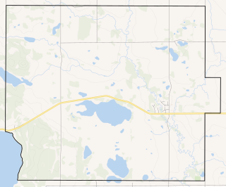
Bircham is a hamlet in southern Alberta, Canada within Kneehill County. It is located approximately 78 km (48 mi) northeast of Calgary and 10 km (6.2 mi) southeast of Acme, along a Canadian National Railway line.
Blackie is a hamlet in Alberta, Canada within the Municipal District of Foothills No. 31. It is located approximately 70 kilometres (43 mi) southeast of Calgary on Highway 799.
Suffield is a hamlet in southern Alberta, Canada within Cypress County. It is located on the Trans-Canada Highway approximately 32 km (20 mi) northwest of Medicine Hat, and just south of CFB Suffield.
Alexander 134 is an Indian reserve of the Alexander First Nation in Alberta, located within Sturgeon County. It is 40 kilometers northwest of Edmonton. In the 2016 Canadian Census, it recorded a population of 1099 living in 272 of its 349 total private dwellings. The reserve has the name of Alexander Arcand, a tribal leader.
Alcomdale is a hamlet in central Alberta, Canada within Sturgeon County. It is located on Highway 44, approximately 34 kilometres (21 mi) northwest of Edmonton's city limits. There is a community hall and public playground within the hamlet, no other services.
Ardley is a hamlet in central Alberta, Canada within Red Deer County. It is located 3 kilometres (1.9 mi) west of Highway 21, approximately 40 kilometres (25 mi) east of Red Deer. The community's name may be a transfer from Ardley, England.
Brant is a hamlet in southern Alberta, Canada within Vulcan County. It is located 6 kilometres (3.7 mi) south of Highway 23, approximately 71 kilometres (44 mi) southeast of Calgary. It is named after the brant goose in the area.
Buford is a hamlet in central Alberta, Canada within Leduc County. It is located 2 kilometres (1.2 mi) south of Highway 39, 23 kilometres (14 mi) west of Leduc.
Dapp is a hamlet in central Alberta, Canada within Westlock County. It is located 4 kilometres (2.5 mi) west of Highway 44, approximately 81 kilometres (50 mi) northwest of St. Albert.
Ensign is a hamlet in southern Alberta, Canada within Vulcan County. It is located approximately 11 kilometres (6.8 mi) south of Highway 23 and 78 kilometres (48 mi) southeast of Calgary.
Falun is a hamlet in central Alberta, Canada within the County of Wetaskiwin No. 10. It is located on Highway 13, approximately 31 kilometres (19 mi) west of Wetaskiwin.
Rivière Qui Barre is a hamlet in central Alberta, Canada, within Sturgeon County. It is located 1 kilometre (0.62 mi) west of Highway 44, approximately 22 kilometres (14 mi) northwest of Edmonton's city limits. It was founded in 1885 by French-speaking settlers, adding a post office in 1895. The name is the French translation of Kipohtakaw, the Cree name of the nearby river.
Connemara is a locality in Alberta, Canada.
Bartstow is a locality in Alberta, Canada.
References
- ↑ "Bennett". Geographical Names Data Base. Natural Resources Canada.
- ↑ Place-names of Alberta. Ottawa: Geographic Board of Canada. 1928. p. 18.
Coordinates: 50°57′32″N113°47′48″W / 50.9588889°N 113.796666°W
| This Calgary Metropolitan Region location article is a stub. You can help Wikipedia by expanding it. |