Knettishall Heath is a 91.7-hectare (227-acre) biological Site of Special Scientific Interest west of Knettishall in Suffolk. A larger area of 176 hectares is the Knettishall Heath Nature Reserve, which is managed by the Suffolk Wildlife Trust.

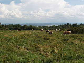
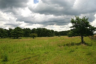
Breckland in Norfolk and Suffolk is a 39,433 hectare Special Protection Area (SPA) under the European Union Directive on the Conservation of Wild Birds. The SPA partly overlaps the 7,544 hectare Breckland Special Area of Conservation. As a landscape region it is an unusual natural habitat of England. It comprises the gorse-covered sandy heath that lies mostly in the south of the county of Norfolk but also in the north of Suffolk. An area of considerable interest for its unusual flora and fauna, it lies to the east of another unusual habitat, the Fens, and to the south west of the Broads. The typical tree of this area is the Scots pine. Breckland is one of the driest areas in England.

Icklingham is a village and civil parish in the West Suffolk district of Suffolk in eastern England. It is located about 7 miles (11 km) north-west of Bury St Edmunds, 4 miles (6.4 km) south-east of Mildenhall and 9 miles (14 km) south-west of Thetford in Norfolk. The village is on the A1101 road between Bury St Edmunds and Mildenhall in the north-west of the county. The area around the village, characterised by a sandy gravel-laden soil, is known as Breckland, though an arm of the fen-like peat follows the River Lark past the village.

Foxhole Heath is an 85.2-hectare (211-acre) biological Site of Special Scientific Interest east of Eriswell in Suffolk. It is a Nature Conservation Review site, Grade I, and part of Breckland Special Area of Conservation and Breckland Special Protection Area under the European Union Directive on the Conservation of Wild Birds.

Wangford Warren and Carr is a 67.8-hectare (168-acre) biological Site of Special Scientific Interest between Brandon and Lakenheath in Suffolk. It is a Nature Conservation Review site, Grade I, and part of the Breckland Special Area of Conservation, and Special Protection Area An area of 15 hectares is managed as a nature reserve by the Suffolk Wildlife Trust

Blaxhall Common is a nature reserve in the parish of Blaxhall in the East Suffolk District of Suffolk. The reserve is owned by Blaxhall Parish Council and managed by Suffolk Wildlife Trust. It is designated a 45.9-hectare (113-acre) biological Site of Special Scientific Interest as Blaxhall Heath. It is part of the Sandlings Special Protection Area under the European Union Directive on the Conservation of Wild Birds, and of the Suffolk Coast and Heaths Area of Outstanding Natural Beauty. A Bronze Age bowl barrow is a Scheduled Monument.

Hucclecote Meadows is a 5.74-hectare (14.2-acre) biological Site of Special Scientific Interest divided into two areas on each side of the M5 road in the Severn Vale, Gloucestershire. It was notified in 1984. The western area is also a Local Nature Reserve.
Poor's Allotment is a 28.57-hectare (70.6-acre) biological Site of Special Scientific Interest in Gloucestershire, notified in 1954. The site is listed in the 'Forest of Dean Local Plan Review' as a Key Wildlife Site (KWS).

Barnham Heath is a 78.6-hectare (194-acre) biological Site of Special Scientific Interest near Barnham, a village south of Thetford in Suffolk. It is a Nature Conservation Review site, Grade 2, and part of the Breckland Special Protection Area under the European Union Directive on the Conservation of Wild Birds

Cavenham–Icklingham Heaths is a 419 hectare biological Site of Special Scientific Interest west of Icklingham in Suffolk. It is a Nature Conservation Review site, Grade I, and part of Breckland Special Area of Conservation and Breckland Special Protection Area under the European Union Directive on the Conservation of Wild Birds. Cavenham Heath is a 203.1 hectare National Nature Reserve.

Deadman's Grave, Icklingham is a 127.3-hectare (315-acre) biological Site of Special Scientific Interest north-east of Icklingham in Suffolk. It is a Nature Conservation Review site, Grade I, and part of Breckland Special Area of Conservation and Breckland Special Protection Area under the European Union Directive on the Conservation of Wild Birds.
Lakenheath Warren is a 588.3-hectare (1,454-acre) biological Site of Special Scientific Interest south-east of Lakenheath in Suffolk, England. It is a Nature Conservation Review site, Grade I, and part of Breckland Special Area of Conservation and Breckland Special Protection Area under the European Union Directive on the Conservation of Wild Birds. The RAF Lakenheath base is located nearby.

Little Heath, Barnham lies south-west of Barnham, Suffolk. Much of the area is now a Site of Special Scientific Interest, which almost surrounds the former chemical weapon store and filling station (FFD1)

Snape Warren is a 48 hectare biological Site of Special Scientific Interest east of Snape in Suffolk. It is part of the Sandlings Special Protection Area under the European Union Directive on the Conservation of Wild Birds, and in the Suffolk Coast and Heaths Area of Outstanding Natural Beauty.

Thetford Heaths is a 270.6-hectare (669-acre) biological and geological Site of Special Scientific Interest in Suffolk. It is a Nature Conservation Review site, Grade I, and parts of it are a national nature reserve, and a Geological Conservation Review, It is part of the Breckland Special Area of Conservation, and Special Protection Area A large part of this dry heathland site is calcareous grassland, and some areas are grazed by sheep or rabbits. There are several nationally rare plants and an uncommon heathland bird, and many lichens and mosses.

Weather and Horn Heaths, Eriswell is a 133.3-hectare (329-acre) biological Site of Special Scientific Interest east of Eriswell in Suffolk. It is a Nature Conservation Review site, Grade I, and part of the Breckland Special Area of Conservation, and Special Protection Area

West Stow Heath is a 44.3-hectare (109-acre) biological Site of Special Scientific Interest west of West Stow in Suffolk. It is part of the Breckland Special Protection Area under the European Union Directive on the Conservation of Wild Birds.
Pillar and Ennerdale Fells is a Site of Special Scientific Interest (SSSI) in Ennerdale, Cumbria, England. Protected for its biological interest, the site is named after Pillar, which at 892 metres (2,927 ft) is the eighth-highest mountain in the Lake District, and other fells in the same range. The area is 425.25 ha.

Bridgham and Brettenham Heaths is a 439.9-hectare (1,087-acre) biological Site of Special Scientific Interest north-east of Thetford in Norfolk, England. It is a Nature Conservation Review site, Grade I, and part of the Breckland Special Area of Conservation and Special Protection Area. Brettenham Heath is a National Nature Reserve.
