A kurgan is a type of tumulus constructed over a grave, often characterized by containing a single human body along with grave vessels, weapons and horses. Originally in use on the Pontic–Caspian steppe, kurgans spread into much of Central Asia and Eastern, Southeast, Western and Northern Europe during the 3rd millennium BC.

The Ili River is a river in Northwest China and Southeastern Kazakhstan. It flows from the Ili Kazakh Autonomous Prefecture of the Xinjiang Uighur Autonomous Region to the Almaty Region in Kazakhstan.

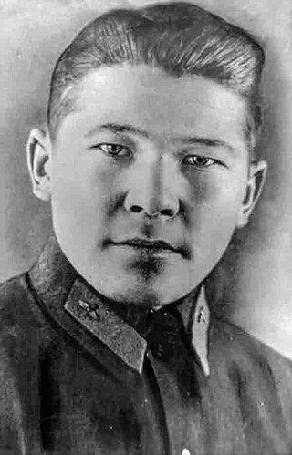
Nurken Abdirovich Abdirov was a Kazakh pilot who was posthumously awarded the title Hero of the Soviet Union on 31 March 1941 for ramming his aircraft into a German tank column after it sustained a direct hit to the engine on 19 December 1942.

The Order of the Badge of Honour was a civilian award of the Soviet Union.

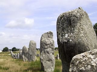
The Carnac stones are an exceptionally dense collection of megalithic sites near the south coast of Brittany in northwestern France, consisting of stone alignments (rows), dolmens, tumuli and single menhirs. More than 3,000 prehistoric standing stones were hewn from local granite and erected by the pre-Celtic people of Brittany and form the largest such collection in the world. Most of the stones are within the Breton municipality of Carnac, but some to the east are within neighboring La Trinité-sur-Mer. The stones were erected at some stage during the Neolithic period, probably around 3300 BC, but some may date to as early as 4500 BC.
German Nikolaevich Kim is Director of the Institute for Asian Studies at Al-Farabi University, Kazakhstan and one of the leading internationally recognized scholars on ethnic Koreans in the former Soviet Union: Koryo-saram.

The Issyk kurgan, in south-eastern Kazakhstan, less than 20 km east from the Talgar alluvial fan, near Issyk, is a burial mound discovered in 1969. It has a height of 6 meters (20 ft) and a circumference of 60 meters (200 ft). It is dated to the 4th or 3rd century BC. A notable item is a silver cup bearing an inscription. The finds are on display in Astana. It is associated with the Saka peoples.
Satbayev University is a technical university located in Almaty, Kazakhstan. The university is the oldest technical university in Kazakhstan, comprising 10 institutions and 27 departments.

Altyn-Emel National Park is a national park in Kazakhstan. It was created in 1996. The park covers about 4,600 km2 (1,800 sq mi) between the Ili River and the Ak-Tau mountain range, near Lake Kapchagai, and consists mostly of desert and rocky terrain.

The Kungey Alatau, also spelled Kungoy Ala-Too, and Kungey Alataw, is a mountain range, which forms the northern Tien Shan with Zailiyskiy Alatau. The word "Alatau" or "Ala-too" means "variegated mountains", a designation indicating a pronounced high-altitude zone of mountains, partly white due to snow, partly dark on snowless areas. The word "Kungey" or "Kyungei" means "the side facing to the South".

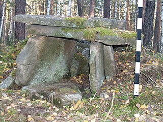
In recent years, many megaliths have been discovered in the Urals: dolmens, menhirs and a large megalithic cultic complex on Vera Island.
The Kazakh National Academy of Arts is the main theatre, film, drama, and fine arts and design school in Almaty, Kazakhstan. The Academy began as the theatrical faculty of the Kurmangazy Institute of Arts, known today as the Kazakh National Conservatory, in 1955. It was named after Temirbek Zhurgenov (1898-1939) in 1989.

The Jarkent Mosque is the central mosque of Jarkent, Kazakhstan. The mosque was built in 1895 to the design of the Chinese architect Hon Piquet using the collected funds of immigrants. The mosque is under state protection since 1982 as a monument of architecture and history of republican significance.
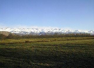
The Ketmen Ridge is a mountain range located in southern Kazakhstan, close to the borders of China and Kyrgyzstan. The ridge is within the territory of the China and Raiymbek districts of the Almaty region. It is located to the east of the Zailiisky Alatau, in the northern Tien Shan mountain range. The total length of the ridge is 310 km (190 mi) and its width is up to 50 km (31 mi). The Ketmen Ridge runs from the Kyungei-Ala-Too Ridge in the west to the Narat Ridge in the east and its northern slopes pass into the Ili Valley. It forms the southern border of the ‘Semirechiya’ region, which surrounds Almaty. The altitude ranges from 3,000 to 3,600 m, with the highest point being Mount Aspan at 3,652 m (11,982 ft).
The Akkainar and Zhartas petroglyphs are located in the Akkainar River valley in Zhambyl district, Almaty Region, Kazakhstan.
The Jambyl Kazakh State Academic Philharmonic is a creative association created on 14 January 1935 by the Decree of the Council of People's Commissars of the Kazakh SSR. It was originally organized by the Kazakh musicologist Akhmet Zhubanov as a regional art and concert organization. Since 1938, it bears the name of the famous Kazakh akyn Zhambyl Zhabayuly.
Almaty State Natural Reserve is a 71,700 ha (177,000-acre) nature reserve in the Almaty Region, Kazakhstan, in the central part of the Trans-Ili Alatau ridge. In 1966, the “Singing Mountain” desert area was added to the reserve, but in January 1983 the natural monument was placed under the jurisdiction of the Kapchagai Hunting Sector. The area is located within the territory of the Altyn-Emel National Park.

Anuar Turlybekuly "Anuarbek" Alimzhanov was a Soviet and Kazakh writer, publicist, public figure and politician. From October 29 to December 26, 1991, he headed the Soviet of Republics of the Supreme Soviet of the USSR, which adopted the Declaration on the termination of the existence of the USSR.
Almaty monuments are works of art, mostly monuments, installed in Almaty, Kazakhstan to commemorate people or historical events.
Akore, known as "Kalininskoye" until 1993, is a settlement in Bukhar-Zhyrau District, Karaganda Region, Kazakhstan. It is the administrative center and only settlement of the Akore rural district. Population: 519 ; 1,079.


