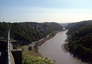
The River Avon is a river in the southwest of England. To distinguish it from a number of other rivers of the same name, it is often called the Bristol Avon. The name 'Avon' is a cognate of the Welsh word afon, meaning 'river'.
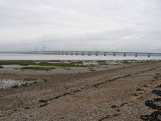
Severn Beach is a village on the Severn Estuary in South Gloucestershire, England. The eastern portal of the Severn Tunnel is on the outskirts of the village. The Severn footpath – on the sea wall – is part of the Severn Way that leads from Gloucester, Slimbridge and the Second Severn Crossing. Extensive sea defences have been constructed and this provides a popular walkway along its length. Originally, the Severn Way finished at Severn Beach, but it has been extended to Bristol.
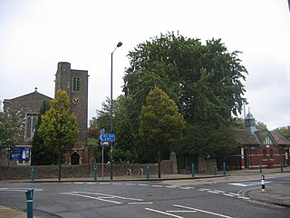
Avonmouth is a port and outer suburb of Bristol, England, facing two rivers: the reinforced north bank of the final stage of the Avon which rises at sources in Wiltshire, Gloucestershire and Somerset; and the eastern shore of the Severn Estuary. Strategically the area has been and remains an important part of the region's maritime economy particularly for larger vessels for the unloading and exporting of heavier goods as well as in industry including warehousing, light industry, electrical power and sanitation. The area contains a junction of and is connected to the south by the M5 motorway and other roads, railway tracks and paths to the north, south-east and east.
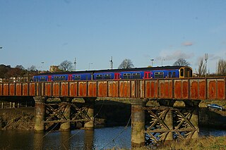
The Severn Beach line is a local railway line in Bristol and Gloucestershire, England, which runs from Bristol Temple Meads to Severn Beach, and used to extend to Pilning. The first sections of the line were opened in 1863 as part of the Bristol Port Railway and Pier; the section through Bristol was opened in 1875 as the Clifton Extension Railway.

The Severn Estuary is the estuary of the River Severn, flowing into the Bristol Channel between South West England and South Wales. Its very high tidal range, approximately 50 feet (15 m), creates valuable intertidal habitats and has led to the area being at the centre of discussions in the UK regarding renewable tidal energy.

Shirehampton is a district of Bristol in England, near Avonmouth, at the northwestern edge of the city.

Lawrence Weston is a post-war housing estate in northwest Bristol, England, between Henbury and Shirehampton.
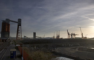
The Avonmouth Docks are part of the Port of Bristol, in England. They are situated on the northern side of the mouth of the River Avon, opposite the Royal Portbury Dock on the southern side, where the river joins the Severn estuary, within Avonmouth.
Sea Mills is a suburb of the English port city of Bristol. It is situated 3.5 miles (6 km) north-west of the city centre, towards the seaward end of the Avon Gorge, lying between the former villages of Shirehampton to the west and Westbury-on-Trym and Stoke Bishop to the east, at the mouth of the River Trym where it joins the River Avon. Sea Mills previously was part of the city ward of Kingsweston. Following a Local Government Boundary Commission review in 2015 ward boundaries were redrawn and Sea Mills is now split between the Stoke Bishop ward and the Avonmouth and Lawrence Weston ward.

Coombe Dingle is a suburb of Bristol, England, centred near where the Hazel Brook tributary of the River Trym emerges from a limestone gorge bisecting the Blaise Castle Estate to join the main course of the Trym. Historically this area formed part of the parish of Westbury on Trym, Gloucestershire, and it is now part of Kingsweston ward of the city of Bristol. South of Coombe Dingle is Sea Mills; to the north is Kings Weston Hill; to the west are Kings Weston House and Shirehampton Park; and to the east, Henbury Golf Club and Westbury on Trym proper.

The Severn Way is a waymarked long-distance footpath in the United Kingdom, which follows the course of the River Severn through Mid Wales and western England.
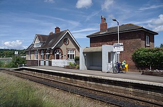
Sea Mills railway station is on the Severn Beach Line and serves the district of Sea Mills and nearby Westbury on Trym in Bristol, England. It is 6 miles (9.7 km) from Bristol Temple Meads, situated at the confluence of the River Avon and River Trym and near the A4 Bristol Portway. Its three letter station code is SML. The station has a single platform which serves trains in both directions. As of 2015 it is managed by Great Western Railway, which is the third franchise to be responsible for the station since privatisation in 1997. They provide all train services at the station, mainly a train every 30 minutes in each direction.
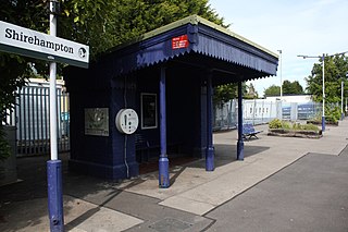
Shirehampton railway station is on the Severn Beach Line and serves the district of Shirehampton in Bristol, England. It is 7.6 miles (12.2 km) from Bristol Temple Meads. Its three letter station code is SHH. The station has a single platform which serves trains in both directions. As of 2015 it is managed by Great Western Railway, which is the third franchise to be responsible for the station since privatisation in 1997. They provide all train services at the station, mainly a train every 30 minutes in each direction.
Philip Napier Miles JP DLitt h.c. (Bristol) was a prominent and wealthy citizen of Bristol, UK, who left his mark on the city, especially on what are now its western suburbs, through his musical and organisational abilities and through good works of various kinds. He was the only son of Philip William Skynner Miles (1816–1881), a major promoter and developer of the docks at Avonmouth, who was the eldest son of Philip John Miles (1773–1845) by his second marriage to Clarissa Peach (1790–1868), and Pamela Adelaide Napier, daughter of the soldier and military historian General Sir William Francis Patrick Napier. He was therefore half-nephew of Sir William Miles, 1st Baronet, half-cousin of Sir Philip John William Miles, 2nd Baronet, both Conservative politicians, and cousin of the fashionable portrait painter Frank Miles, gentleman cricketer Robert Miles and Mount Everest explorer, General The Hon Charles Granville Bruce. He was educated at Harrow School and Oriel College, Oxford, and was selected as High Sheriff of Gloucestershire for 1916–17.

Kings Weston House is a historic building in Kings Weston Lane, Kingsweston, Bristol, England. Built during the early 18th century, it was remodelled several times, the most recent in the mid-19th century. The building was owned by several generations of the Southwell family. By World War I, the house was used as a hospital and then later used as a school by the Bath University School of Architecture. The building is today used as a conference and wedding venue, as well as a communal residence.
Kingsweston was a ward of the city of Bristol. The three districts in the ward wer Coombe Dingle, Lawrence Weston and Sea Mills. The ward takes its name from the old district of Kings Weston, now generally considered part of Lawrence Weston. Following a Local Government Boundary Commission review in 2015 ward boundaries were redrawn and Kingsweston ward is now split between the Stoke Bishop ward and the Avonmouth and Lawrence Weston ward.

The Portway is a major road in the City of Bristol. It is part of the A4 and connects Bristol City Centre to the Avonmouth Docks and the M5 motorway via the Avon Gorge.

The Avonmouth Light Railway(ALR) was a nominally independent railway company operating a short standard-gauge branch line from a point on what is now the Severn Beach Line near Avonmouth Docks station in Bristol to a Bristol Corporation electricity installation east of the main entrance to Avonmouth Docks. Its promoters had aspirations which were never fulfilled.


