The Karakoram is a mountain range in the Kashmir region spanning the border of Pakistan, China, and India, with the northwestern extremity of the range extending to Afghanistan and Tajikistan. Most of the Karakoram mountain range falls under the jurisdiction of Gilgit-Baltistan, which is controlled by Pakistan. Its highest peak, K2, is located in Gilgit-Baltistan, Pakistan. It begins in the Wakhan Corridor (Afghanistan) in the west, encompasses the majority of Gilgit-Baltistan, Pakistan and extends into Ladakh and Aksai Chin. It is part of the larger Trans-Himalayan mountain ranges.

Mount Elbrus is the highest mountain in Russia and Europe. It is a dormant volcano rising 5,642 m (18,510 ft) above sea level, and is the highest stratovolcano in the supercontinent of Eurasia, as well as the tenth-most prominent peak in the world. It is situated in the southern Russian republic of Kabardino-Balkaria in the western extension of Ciscaucasia, and is the highest peak of the Caucasus Mountains.

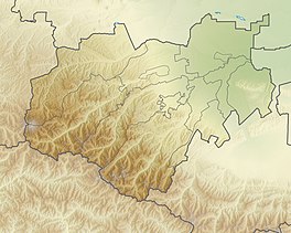
The Caucasus Mountains is a mountain range at the intersection of Asia and Europe. Stretching between the Black Sea and the Caspian Sea, they are surrounded by the Caucasus region and are home to Mount Elbrus, the highest peak in Europe at 5,642 metres (18,510 ft) above sea level.

Mount Kazbek or Mount Kazbegi is a dormant stratovolcano and one of the major mountains of the Caucasus, located in Georgia, just south of the border with Russia.

The Caucasian languages comprise a large and extremely varied array of languages spoken by more than ten million people in and around the Caucasus Mountains, which lie between the Black Sea and the Caspian Sea.

Shkhara is the highest point in the country of Georgia. It is located near the Russian-Georgian border, in Russia's Kabardino-Balkaria region on the northern side, and the Svaneti region of Georgia in the south. Shkhara lies 88 kilometres (55 mi) north of the city of Kutaisi, Georgia's second-largest city, and closer to the townlet of Mestia in Svaneti. The summit lies in the central part of the Greater Caucasus Mountain Range, to the south-east of Mount Elbrus, Europe's highest mountain. Shkhara is the third-highest peak in the Caucasus, just behind Dykh-Tau.

Shota Rustaveli is a mountain in the central part of the Greater Caucasus Mountain Range, straddling the border of Svaneti (Georgia) and Kabardino-Balkaria (Russia). The elevation of the mountain is 4,960 meters. Shota Rustaveli is generally considered to be the 9th highest peak of the Caucasus. The slopes of the mountain are glaciated and some of the glaciers descend well into the adjacent valleys. Its name comes from famous Georgian poet Shota Rustaveli.
Kolka Glacier is a glacier in North Ossetia, Russia, near Mount Kazbek, known for its surging properties. The most recent and the most powerful surge took place on 20 September 2002, resulting in the death of ca. 140 people.

Dykh-Tau or Dykhtau, is the second-highest mountain in Russia and Europe, standing at 5,205 m above sea level. It is located in Kabardino-Balkaria, Russia; its peak standing about 5 km (3 mi) north of the border with Georgia.

Glaciers in Georgia are mainly located along the Greater Caucasus Mountain Range.

The Cherek is a river in Kabardino-Balkaria in Russia, a right tributary of the Baksan. The Cherek is 79 kilometres (49 mi) long and drains a basin of 3,070 square kilometres (1,190 sq mi). The Cherek is formed by the confluence of the Cherek-Balkarsky and Cherek-Khulamsky, both of which originate in the glaciers of the northern slopes of the Greater Caucasus, one of them being the Bezengi Glacier. The river Nalchik flows into the Urvan, which is a branch of the Cherek.

Adishi Glacier is a valley glacier located in the central part of the Greater Caucasus Mountain Range in the Svaneti Region of Georgia. The glacier lies on the southern slopes of the Caucasus. The length of the Adishi Glacier is 9 km (5.6 mi) and its surface area is 12.9 km2 (5.0 sq mi). The tongue of the glacier descends down to 2,298 m (7,539 ft) above sea level. The glacier feeds off of the runoff and ice flows from the adjacent glaciers that are located on the southern slopes of Tetnuldi, Gistola and Lakutsia. The Adishi Glacier is the source of the river Adishchala. The glacier takes its name from the nearby village Adishi.
Tviberi is a glacier located in the Svaneti Region of Georgia on the southern slopes of the Greater Caucasus Mountain Range. The length of the Tviberi Glacier is 9.5 km (5.9 mi) and its surface area is 27.9 km2 (10.8 sq mi). The tongue of the glacier descends to 2,150 metres (7,050 ft) above sea level. Tviberi represents a polisynthetic type of a valley glacier. It has many tributaries among which are Laskhedari, Iriti, Asmashi, Toti, Seri and others. The surface of Tviberi is mainly covered with morainal sediments and debris. The glacier feeds off of the runoff and ice flows from the adjacent peaks. The nearest larger community is Mestia, 13.5 km southwest of Tviberi Glacier. The area around Tviberi Glacier consists mainly of grassland.

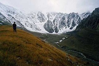
Alaniya National Park, is a heavily glaciated, mountainous section of the northern slope of the Central Caucasus Mountains. It covers the southern third of the Irafsky District of the Republic of North Ossetia-Alania. The park was created to have a dual purpose of serving as an ecological refuge - it has very high levels of biodiversity and vulnerable species, such as the near-endangered west Caucasian tur – and also an area of high cultural heritage and potential for recreational tourism. The park contains widespread archaeological ruins from several notable past civilizations, including the Bronze Age Koban people, and the Alan people. It is from the Alans that the name "Alaniya", and indirectly the term "Aryan", is ultimately derived. Because altitudes in the park can span almost 4,000 meters vertical in very short distances, the slopes and valleys display strong 'altitude zoning'. These climatic zones range from alpine glaciers and peaks in the high, southern sections, to steppe grasslands in the northern reaches.

Prielbrusye National Park is in the area around Mount Elbrus, the highest mountain in Europe at 5,642 meters above sea level. The relative isolation of steep gorges has led to high levels of endemism and biodiversity. The park is in the central Caucasus Mountains, one of 22 national parks in the Caucasus of different nationalities, covering 1.8% of the region. The park is situated in Elbrussky District and Zolsky District, in the southwestern corner of the Kabardino-Balkar Republic of Russia.

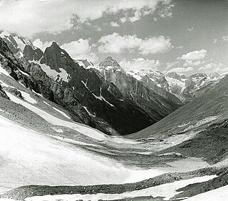
Kabardino-Balkarski Nature Reserve is a Russian 'zapovednik' on main ridge of the north Caucasus Mountains. It contains all of the mountains in Europe over 5,000 meters besides Mt. Elbrus and Mt. Kazbek, and contains the most glaciers. The ridge at the reserve forms the famous "Bezengi wall" consisting of the peaks Gestola, Katyn-Tau, Janga, Eastern Jangi-Tau and Shkhara. There are 256 glaciers in the reserve's boundaries. The reserve is situated in the Chereksky District of Kabardino-Balkar Republic; it was created in 1976, and covers an area of 82,507 ha (318.56 sq mi).
Mountains of Azerbaijan cover approximately 60 percent of the country's land area. There are three mountain ranges in the territory of Azerbaijan, which are the Greater Caucasus, the Lesser Caucasus, and the Talysh Mountains.
The Main Caucasian Range is a mountain range in the Russian Federation, Georgia and Azerbaijan. It is the dividing range of the Greater Caucasus.

Bezengi Wall, Pitsrula is a 11-to-12 km (6.8-to-7.5 mi) long mountain range of the Greater Caucasus, in the Svaneti region of Georgia and Kabardino-Balkaria region of Russia.