Bezujno

Last updated
Bezujno
Village
Bosnia and Herzegovina location map.svg
Red pog.svg
Bezujno
Coordinates: 43°34′30″N19°00′09″E / 43.57500°N 19.00250°E / 43.57500; 19.00250
CountryFlag of Bosnia and Herzegovina.svg  Bosnia and Herzegovina
Entity Flag of Republika Srpska.svg  Republika Srpska
Municipality Čajniče
Population (1991)
  Total 138
Time zone CET (UTC+1)
  Summer (DST) CEST (UTC+2)

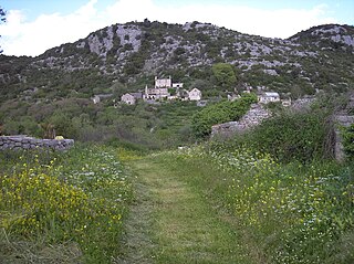
Bezujno (Serbian Cyrillic : Безујно) is a village in the municipality of Čajniče, in the Republika Srpska entity of Bosnia and Herzegovina. It is located near the border with Montenegro.

The Serbian Cyrillic alphabet is an adaptation of the Cyrillic script for the Serbian language, developed in 1818 by Serbian linguist Vuk Karadžić. It is one of the two alphabets used to write standard modern Serbian, Bosnian and Montenegrin, the other being Latin.

Village Small clustered human settlement smaller than a town

A village is a clustered human settlement or community, larger than a hamlet but smaller than a town, with a population ranging from a few hundred to a few thousand. Though villages are often located in rural areas, the term urban village is also applied to certain urban neighborhoods. Villages are normally permanent, with fixed dwellings; however, transient villages can occur. Further, the dwellings of a village are fairly close to one another, not scattered broadly over the landscape, as a dispersed settlement.

In Bosnia and Herzegovina the smallest administrative unit is the municipality. Prior to the 1992–95 Bosnian War there were 109 municipalities in what was then Socialist Republic of Bosnia and Herzegovina. Ten of these formed the area of the capital Sarajevo.

History

Bezujno was once a municipality ( opština ) during Yugoslavia. [1] [2]

Opština, Obshtina, Občina or Općina, Cyrillic општина or община is a local government unit, most commonly translated as municipality in English. It is used by the following countries:

Yugoslavia 1918–1992 country in Southeastern and Central Europe

Yugoslavia was a country in Southeastern and Central Europe for most of the 20th century. It came into existence after World War I in 1918 under the name of the Kingdom of Serbs, Croats and Slovenes by the merger of the provisional State of Slovenes, Croats and Serbs with the Kingdom of Serbia, and constituted the first union of the South Slavic people as a sovereign state, following centuries in which the region had been part of the Ottoman Empire and Austria-Hungary. Peter I of Serbia was its first sovereign. The kingdom gained international recognition on 13 July 1922 at the Conference of Ambassadors in Paris. The official name of the state was changed to Kingdom of Yugoslavia on 3 October 1929.

According to the 1991 census, the village had a total of 138 inhabitants, out of whom 107 were Serbs, 30 Muslims, and 1 Croat. [3]

The former settlement of Medoševići was annexed into Bezujno by 1995. [4]

Related Research Articles

Začula Village in Federation of Bosnia and Herzegovina, Bosnia and Herzegovina

Začula is a village in the municipality of Ravno, Bosnia and Herzegovina. In the 1991 census it had 23 inhabitants, all of them being Serbs. Prior the war in Bosnia and Herzegovina it belonged to Trebinje municipality.

Batkovica Village in Republika Srpska, Bosnia and Herzegovina

Batkovica is a village in the municipality of Višegrad, Bosnia and Herzegovina.

Dobrunska Rijeka Village in Republika Srpska, Bosnia and Herzegovina

Dobrunska Rijeka is a village in the municipality of Višegrad, Bosnia and Herzegovina.

Drina (Višegrad) Village in Republika Srpska, Bosnia and Herzegovina

Drina is a village in the municipality of Višegrad, Bosnia and Herzegovina.

Gornja Brštanica Village in Republika Srpska, Bosnia and Herzegovina

Gornja Brštanica is a village in the municipality of Višegrad, Bosnia and Herzegovina.

Kamenica, Višegrad Village in Republika Srpska, Bosnia and Herzegovina

Kamenica is a village in the municipality of Višegrad, Bosnia and Herzegovina.

Klisura (Višegrad) Village in Republika Srpska, Bosnia and Herzegovina

Klisura is a village in the municipality of Višegrad, Bosnia and Herzegovina.

Kočarim Village in Republika Srpska, Bosnia and Herzegovina

Kočarim is a village in the municipality of Višegrad, Bosnia and Herzegovina.

Međuselje Village in Republika Srpska, Bosnia and Herzegovina

Međuselje is a village in the municipality of Višegrad, Bosnia and Herzegovina.

Meremišlje Village in Republika Srpska, Bosnia and Herzegovina

Meremišlje is a village in the municipality of Višegrad, Bosnia and Herzegovina.

Mirlovići Village in Republika Srpska, Bosnia and Herzegovina

Mirlovići is a village in the municipality of Višegrad, Bosnia and Herzegovina.

Pijavice (Višegrad) Village in Republika Srpska, Bosnia and Herzegovina

Pijavice is a village in the municipality of Višegrad, Bosnia and Herzegovina.

Pretiša Village in Republika Srpska, Bosnia and Herzegovina

Pretiša is a village in the municipality of Višegrad, Bosnia and Herzegovina.

Stražbenice Village in Republika Srpska, Bosnia and Herzegovina

Stražbenice is a village in the municipality of Višegrad, Bosnia and Herzegovina.

Tusta Međ Village in Republika Srpska, Bosnia and Herzegovina

Tusta Međ is a village in the municipality of Višegrad, Bosnia and Herzegovina.

Velje Polje (Višegrad) Village in Republika Srpska, Bosnia and Herzegovina

Velje Polje is a village in the municipality of Višegrad, Bosnia and Herzegovina.

Podromanija Village in Republika Srpska, Bosnia and Herzegovina

Podromanija is a village in the municipality of Sokolac, Republika Srpska, Bosnia and Herzegovina.

Dobrak Village in Srebrenica, Bosnia and Herzegovina

Dobrak is a village in the municipality of Srebrenica, Bosnia and Herzegovina.

Kalimanići (Srebrenica) Village in Srebrenica, Bosnia and Herzegovina

Kalimanići is a village in the municipality of Srebrenica, Bosnia and Herzegovina.

Žabokvica Village in Srebrenica, Bosnia and Herzegovina

Žabokvica is a village in the municipality of Srebrenica, Bosnia and Herzegovina.

References

  1. Hamdija Kreševljaković (1957). Hanovi i karavansaraji u Bosni i Hercegovini. p. 56.
  2. Nikola Čupić (1940). Godišnjica Nikole Čupića. Štampa Državne štamparije Kraljevine Jugoslavije. p. 99.
  3. Official results from the book: Ethnic composition of Bosnia-Herzegovina population, by municipalities and settlements, 1991. census, Zavod za statistiku Bosne i Hercegovine - Bilten no.234, Sarajevo 1991.
  4. Marinko Grizelj; Anđelko Akrap (1995). Stanovništvo Bosne i Hercegovine: narodnosni sastav po naseljima. Državni Zavod za Statistiku. p. 405. ISBN   978-953-96284-5-9. Medoševići (SI. 1. SRBiH, 24/85)

Coordinates: 43°34′30″N19°00′09″E / 43.57500°N 19.00250°E / 43.57500; 19.00250

Geographic coordinate system Coordinate system

A geographic coordinate system is a coordinate system that enables every location on Earth to be specified by a set of numbers, letters or symbols. The coordinates are often chosen such that one of the numbers represents a vertical position and two or three of the numbers represent a horizontal position; alternatively, a geographic position may be expressed in a combined three-dimensional Cartesian vector. A common choice of coordinates is latitude, longitude and elevation. To specify a location on a plane requires a map projection.