Bhedetar

Last updated
Bhedetar
भेडेटार
Vedetar 2019 web small.jpg
Evening view of Bhedetar, the hill station of Nepal.
Nepal adm location map.svg
Red pog.svg
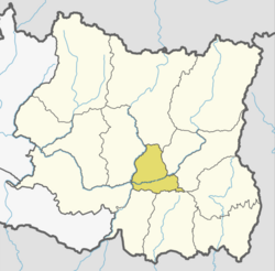
Bhedetar
Location in Nepal
Coordinates: 26°53′0″N87°20′0″E / 26.88333°N 87.33333°E / 26.88333; 87.33333
CountryFlag of Nepal.svg    Nepal
Province Koshi Province
District Dhankuta
Area Sangurigadhi
Elevation
1,420 m (4,660 ft)
Population
 (2011)
  Total2,977
Time zone UTC+5:45 (NST)
Postal code
56804
Area code 026
Nearest city Dharan

Bhedetar (translation: Sheep's Butte) is a village development committee in Dhankuta District in the Koshi Province of eastern Nepal. The main settlement began when the Dharan - Dhankuta Highway was completed in 1982. At the time of the 1991 Nepal census it had a population of 2643 people living in 513 individual households. [1] It is 1,420 meters high from the sea level. It is actually on the border line of Sunsari and Dhankuta districts.

Attractions

Bhedetar is a developing tourist spot. It is a small hill station just 16 kilometers away from Dharan Sub-metropolis. It has unpredictable weather - one moment it hides itself in the blanket of thick fog and another moment it reveals itself as the crown of urban Dharan. it is also known as a transit point to the namaste jharna, which is a waterfall.

Nepal Television has a High Power Transmitter Station at Bhedetar which broadcasts different Channels of Nepal Television. Transmissions are not only received by the Bhedetar but also neighbouring places.

Statue of Iman Xin Chemjong (   ) at Bhedetaar. Iman singh chemjong.jpg
Statue of Iman Xin Chemjong (ᤀᤡᤔᤠᤏ ᤛᤡᤲᤜ ᤆᤣᤶᤈᤥᤅ ᤗᤡᤶᤒᤢ) at Bhedetaar.

Related Research Articles

<span class="mw-page-title-main">Dhankuta</span> City in Koshi Province, Nepal

Dhankuta is a hill town and the headquarters of Dhankuta District in Koshi Province in Eastern Nepal. According to 2011 Nepal census, it has population of 26,440 inhabitants.

<span class="mw-page-title-main">Biratnagar</span> Capital of Koshi province

Biratnagar is a metropolitan city in Nepal, which serves as the capital of Koshi Province. With a Metropolitan Urban Agglomeration population of 244,750 as per the 2021 census, it is the largest city and fastest growing city in the province and also the headquarters of Morang district. As per the preliminary report of 2022 Nepal census, Biratnagar Metropolitan has an estimated city population of 244,750 excluding the suburban areas which are now very well connected to the old town. It is the administrative center of the Greater Birat Development Area which incorporates the cities of Biratnagar and its suburbs and towns of-Itahari-Gothgau-Biratchowk-Dharan primarily located on the Koshi Highway in Eastern Nepal, with an estimated total urban agglomerated population of 804,300 people in 159,332 households including the town of Ithari. Biratnagar is located 399 km (248 mi) east of the capital, Kathmandu, and 6 km (3.7 mi) north of the bordering town of Jogbani in the Indian state of Bihar. It is one of the major entry point in Nepal for Businessmen as well as Tourists who come to visit Nepal for various purposes.

<span class="mw-page-title-main">Bhojpur Municipality</span> Municipality in Province No. 1, Nepal

Bhojpur is one of the two urban municipalities of Bhojpur District of Province No. 1 of Nepal.

<span class="mw-page-title-main">Dharan</span> Sub-Metropolitan City in Koshi Province

Dharan is a sub-metropolitan city in Sunsari District of Koshi Province, in eastern Nepal, which was established as a fourth municipality in the Kingdom in 1958. It is the third most populous city in eastern Nepal after Biratnagar and Itahari. The Nepali word "dharan" means a saw pit. The rainforest from which the tree trunks came is still just on the edge of the city. Much later the British Gurkha camp opened in October 1960. The use of the camp by British Gurkhas finished in the mid-1990s. Dharan has an estimated city population of 173,096 living in 34,834 households as per the 2021 Nepal census. It is one of the cities of the Greater Birat Development Area which incorporates the cities of Biratnagar-Itahari-Gothgau-Biratchowk-Dharan primarily located on the Koshi Highway in Eastern Nepal, with an estimated total urban agglomerated population of 804,300 people living in 159,332 households. It is the largest city in the province number one by Area. It covers 192.32 square kilometers while Biratnagar and Itahari is 2nd and 3rd biggest cities by Area

<span class="mw-page-title-main">Dhankuta District</span> District in Koshi Province, Nepal

Dhankuta District is one of 14 districts of Koshi Province of eastern Nepal. The district covers an area of 891 km2 (344 sq mi) and has a population (2011) of 163,412. The hill town of Dhankuta serves as the district headquarters of Dhankuta District.

<span class="mw-page-title-main">Kosi Zone</span> Zone in Nepal

Kosi or Koshi was one of the fourteen zones of Nepal until the restructure of zones to provinces. The headquarters of Kosi Zone was Biratnagar which was also its largest city. Other cities of Kosi Zone were Inaruwa, Dharan, Dhankuta, Jhumka, Duhabi, Tarahara and Itahari. Its main rivers were Arun, Tamor and Sapta Koshi.

<span class="mw-page-title-main">Ilam Municipality</span> Municipality in Koshi Province, Nepal

Ilam is one of four urban municipalities of Ilam District, which lies in the Mahabharata hilly range of Koshi Province, eastern Nepal. Ilam also acts as the headquarters of Ilam District. Being the largest producer region for Nepali tea, its tea farms are a major tourist attraction in Koshi Province. Ilam is also famous for its natural scenery and landscapes as well as its diverse agricultural economy which specializes in horticultural crop production.

The Bantawa Language, is a Kiranti language spoken in the eastern Himalayan hills of eastern Nepal by Kirati Bantawa ethnic groups. They use a syllabic alphabet system known as Kirat Rai. Among the Khambu or Rai people of Eastern Nepal, Sikkim, Darjeeling and Kalimpong in India, Bantawa is the largest language spoken. According to the 2001 National Census, at least 1.63% of the Nepal's total population speaks Bantawa. About 370,000 speak Bantawa Language mostly in eastern hilly regions of Nepal (2001). Although Bantawa is among the more widely used variety of the Bantawa language, it falls in the below-100,000 category of endangered languages. It is experiencing language shift to Nepali, especially in the northern region.

Phakchamara is a village development committee in the Himalayas of Terhathum District in the Kosi Zone of eastern Nepal. At the time of the 1991 Nepal census it had a population of 3041. Brahmin, Chhetri, and Limbu are the main cast of this VDC. Naween Shikshya Sadan Higher Secondary School is the oldest School of this region as well as of this VDC. Several philanthropists contribute to the educational development of this VDC through this school. Mr. Krishna Prasad Dahal was a long time "Head sir" of this school and significantly contributed to the local society for uplifting the educational levels of numerous people of this region. "Dahal" and "Niroula" families contributions are tremendous for the development of this region and of this VDC. Currently, under new reformation of the political system in Nepal, it is included within "Chhathar VDC Ward No. 4". The Chhathar VDC chair after the election on 2017 is Santosh Tigela from Communist Party of Nepal. The only road that connects this region to Teria and accessible municipalities like Dhankuta and Dharan is by "Sindhuwa Sukrabare Road". The construction of this 8 km road has been started in 1986 but not pitched and completed yet due to corruption and idiot leaders. "Sukrabare bazaar" is the major business hub of this region. Buses and private vehicles are now run in this road 12 months after the graveling of the road in 2019. This is beautiful VDC with a pristine panorama of "KumbhaKarna Mountain" and a silver lining shine of Tamor River. Rhododendroen is everywhere mostly in the higher region. Water crises, foreign employment are the major problems. The Upper regions which are mostly wetland should be protected and initiate aforestation for the future of this VDC.

Bhirgaun is a village development committee in Dhankuta District in the Kosi Zone of eastern Nepal. At the time of the 1991 Nepal census it had a population of 4413 people living in 792 individual households.

Budhabare is a village development committee in Dhankuta District in the Koshi Zone of eastern Nepal. At the time of the 1991 Nepal census it had a population of 1954.

Dandagaun is a small village located northern part of Mahalaxmi Municipality at Dhankuta district in the Province no. 1 of eastern Nepal. At the time of the 1991 Nepal census it had a population of 1838 people living in 924 individual households. But latest survey which hold by village it has more than 2500 population.

Basantapur is a village development committee in Sunsari District in the Kosi Zone of south-eastern Nepal. At the time of the 1991 Nepal census it had a population of 5566 people living in 879 individual households.

Barah Nagarpalika previously Mahendranagar is a municipality in Sunsari District in the Kosi Zone of south-eastern Nepal. It is situated near the Koshi River. Most of the residents, as is common in Nepal, depend on agriculture but in the last few years the trend of going to the Persian Gulf region as workers is increasing. The town is yet to have any prominent business houses but is a growing market with a number of small industries, hotels and shops. Being linked with some major cities, Dharan & Itahari of the Sunsari District, this town holds a very good chance of development. There is one community radio station also, named Sunsari FM.

<span class="mw-page-title-main">Phidim Municipality</span> Municipality in Koshi Province, Nepal

Phidim Municipality is the headquarters of the Panchthar District in the Koshi Province of eastern Nepal. Phidim was upgraded to a 'municipality' from a 'village', when a development committee merged with other VDCs - including the Phidim, Chokmagu and Siwa villages - on May 18, 2014. It offers a route for trekkers and locals, who travel to and from the Taplejung district bordering with the Tibetan Autonomous Region of China. It is also a commercial hub for the rural surroundings.

<span class="mw-page-title-main">Hile</span> Hill station in Koshi Province, Nepal

Hile is a hill town located in the Province of Nepal, 13 km north of the regional center of Dhankuta Bazar. At an elevation of 1948 meters, it is the main route to other hilly districts like Bhojpur and Sankhuwasabha.

<span class="mw-page-title-main">Namaste Falls</span> Waterfall in Dhankuta, Nepal

Namaste Falls is located in Bhedetar village development committee of Dhankuta district. It is popular among domestic tourists. The falls are about 80 meters high. Domestic tourists from Jhapa, Dhankuta, Morang and Sunsari visit this falls in large. One can see a rainbow-like, seven-colour formation while standing close to the waterfall. It is in the shape of Namasthe. The falls are also frequently visited by researchers.

<span class="mw-page-title-main">Koshi Province</span> Province of Nepal

Koshi Province is the autonomous easternmost province adopted on 20 September 2015 by Constitution of Nepal. The province is rich in natural resources, tourist attractions, recreational activities, and natural beauty. The province covers an area of 25,905 km2 (10,002 sq mi), about 17.5% of the country's total area. With the industrial city of Biratnagar as its capital, the province includes major eastern towns of Birtamod, Sundar Haraincha, Damak, Dharan, Itahari, Triyuga Municipality and Mechinagar, and the Mount Everest, Kangchenjunga and Ama Dablam. Koshi River, the largest river of the nation, forms the province's western boundary. Under the First-past-the-post voting system issued by the Constituency Delimitation Commission, Nepal, the province hosts 28 parliamentary seats and 56 provincial assembly seats.

Sangurigadhi is a rural municipality (gaunpalika) out of four rural municipality located in Dhankuta District of Koshi Province of Nepal. There are a total of 7 municipalities in Dhankuta in which 3 are urban and 4 are rural.

References

  1. "Nepal Census 2001". Nepal's Village Development Committees. Digital Himalaya. Archived from the original on 12 October 2008. Retrieved 24 November 2008.