The 1991 Nepal census was a widespread national census conducted by the Nepal Central Bureau of Statistics.

Bhimpokhara is a village development committee in Baglung District in the Dhaulagiri Zone of central Nepal. At the time of the 1991 Nepal census it had a population of 2,907 and had 545 houses in the village.
Binamare is a village development committee in Baglung District in the Dhaulagiri Zone of central Nepal. At the time of the 1991 Nepal census it had a population of 2,288 and had 467 houses in the village.
Basuling is a village development committee in Baitadi District in the Sudurpashchim Pradesh of western Nepal. At the time of the 1991 Nepal census it had a population of 2,642 and had 482 houses in the village.
Bhumeshwar is a village development committee in Baitadi District in Sudurpashchim Pradesh of western Nepal. At the time of the 1991 Nepal census it had a population of 2,697 and had 489 houses in the village.
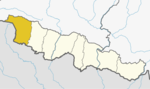
Chaukham is a village development committee in Baitadi District in the Mahakali Zone of western Nepal. At the time of the 1991 Nepal census it had a population of 2,026 and 341 houses in the village.
Durga Bhabani is a village development committee in Baitadi District in the Mahakali Zone of western Nepal. At the time of the 1991 Nepal census it had a population of 2,052 and had 410 houses in the village.
Giregada is a village development committee in Baitadi District in the Mahakali Zone of western Nepal. At the time of the 1991 Nepal census it had a population of 2,918 and had 538 houses in the village.
Mahakali is a village development committee in Baitadi District in the Mahakali Zone of western Nepal. It is located on the Mahakali River which is also the border with Uttarakhand state, India across from Jhulaghat. Amraad and Basku are main places in this village. Indian and Nepalese nationals cross without restrictions, however there is a customs checkpoint for goods.
Bhimdhunga is a village and former Village Development Committee that is now part of Nagarjun Municipality in Province No. 3 of central Nepal. At the time of the 2011 Nepal census it had a population of 2,915 and had 619 houses in it.
Satungal is a village and former Village Development Committee that is now part of Chandragiri Municipality in Kathmandu District in Province No. 3 of central Nepal. Satungal is also known as Satyapur. At the time of the 1991 Nepal census it had a population of 2730 and had 464 households in it. At the time of the 2001 Nepal census Satungal had a population of 5834 and had 1375 households in it. Satungal had 5173 literate people i.e. 88.66%..
Aaru Chanuate is a village development committee in Gorkha District in the Gandaki Zone of northern-central Nepal. At the time of the 1991 Nepal census it had a population of 2,478 and had 494 houses in the village.
Baguwa is a village development committee in Gorkha District in the Gandaki Zone of northern-central Nepal. At the time of the 1991 Nepal census it had a population of 2,246.
Gakhu is a village development committee in Gorkha District in the Gandaki Zone of northern-central Nepal. At the time of the 1991 Nepal census it had a population of 2,870 and had 572 houses in the town.
Kerauja is a village development committee in Gorkha District in the Gandaki Zone of northern-central Nepal. At the time of the 1991 Nepal census it had a population of 2,621 and had 574 houses in the village.
Kharibot is a village development committee in Gorkha District in the Gandaki Zone of northern-central Nepal. At the time of the 1991 Nepal census it had a population of 2,848 and had 540 houses in the village.
Makaising is a village development committee in Gorkha District in the Gandaki Zone of northern-central Nepal. At the time of the 1991 Nepal census it had a population of 2,231 and had 416 houses in the village.
Ghyachok is a village development committee in Gorkha District in the Gandaki Zone of northern-central Nepal. At the time of the 1991 Nepal census it had a population of 2,236.
Dhanauji is a village development committee in Dhanusa District in Province No. 2 of south-eastern Nepal. At the time of the 1991 Nepal census it had a population of 5,581 persons living in 974 individual households.
Madan Kundari is a village development committee in Kabhrepalanchok District in the Bagmati Zone of central Nepal. At the time of the 1991 Nepal census it had a population of 2,321 in 413 individual households.