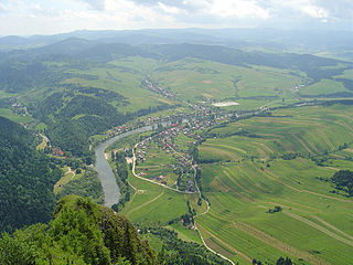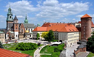
Poland is a part of the global tourism market with constantly increasing number of visitors. Tourism in Poland contributes to the country's overall economy. The most popular cities are Kraków, Warsaw, Wrocław, Gdańsk, Poznań, Szczecin, Lublin, Toruń, Zakopane, the Salt Mine in Wieliczka and the historic site of Auschwitz – A German nazi concentration camp in Oświęcim. The best recreational destinations include Poland's Masurian Lake District, Baltic Sea coast, Tatra Mountains, Sudetes and Białowieża Forest. Poland's main tourist offers consist of sightseeing within cities and out-of-town historical monuments, business trips, qualified tourism, agrotourism, mountain hiking (trekking) and climbing among others.
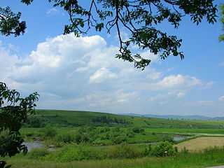
The Poprad is a river in northern Slovakia and southern Poland, and a tributary of the Dunajec River near Stary Sącz, Poland. It has a length of 170 kilometres and a basin area of 2,077 km²,. Much of the Polish part of its basin is included in the protected area called Poprad Landscape Park featuring the Poprad River Gorge, a popular tourist destination between the towns of Piwniczna and Rytro.
Biała is a Polish word for white. It may refer to:

Podhale is Poland's southernmost region, sometimes referred to as the "Polish highlands". The Podhale is located in the foothills of the Tatra range of the Carpathian mountains.

Pieniny National Park is a protected area located in the heart of Pieniny Mountains in the southernmost part of Poland. Administratively, the Park lies in the Lesser Poland Voivodeship on the border with Slovakia. Its head office is in Krościenko nad Dunajcem.
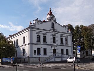
Żabno is a town and municipality on the river Dunajec in southern Poland, 15 kilometres north of Tarnów. Since Poland's administrative reorganization in 1999, Żabno has been a part of Tarnów powiat which belongs to Lesser Poland Voivodeship. Before administrative reorganization in 1999 it belonged to the Tarnów Voivodeship.

Czarny Dunajec, is a village located in southern Poland near the Polish-Slovak border. Czarny Dunajec is in the Nowy Targ County (Polish: Powiat Nowotarski) and in the Lesser Poland. Czarny Dunajec is about 60 miles south of Kraków.
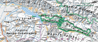
Zamagurie is an area in the north of the Spiš region, between the Spišská Magura in the south, the Dunajec river in the north and the Białka river in the west. It is divided between the Prešov Region of Slovakia and the Lesser Poland Voivodeship of Poland and is further divided between the Slovak districts of Stará Ľubovňa and Kežmarok and Polish gminas of Bukowina Tatrzańska, Nowy Targ and Łapsze Niżne. The centre of the region is the Slovak town Spišská Stará Ves, which is just near the border. The region also used to be one of the official tourist regions of Slovakia until 2004.

Zakliczyn is a town in Tarnów County, Lesser Poland Voivodeship, Poland, with 1,558 inhabitants (2006). Zakliczyn lies on the right bank of the Dunajec river, surrounded by wooded hills 300 to 500 metres above sea level. Zakliczyn has a town hall, located in a spacious market square, one of the largest in the province, at 100 by 170 metres. The town was originally called Opatkowice; its name was changed in 1558, in honor of the village of Zakliczyn, Myślenice County, which was ancient seat of the Jordan family.
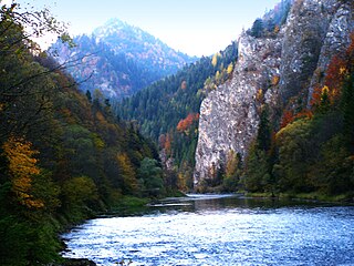
The Dunajec River Gorge runs through the Pieniny Mountains in the south of Poland and the north of Slovakia. The gorge is characterized by some of the most interesting geological and geomorphological structures and area-specific natural ecosystems with little anthropogenic influence. It is featured on UNESCO's Tentative List of World Heritage Sites in Poland.

Czchów is a town in Brzesko County, Lesser Poland Voivodeship, Poland, with 2,205 inhabitants (2004). It lies on the Dunajec river, and along National Road Nr. 75. In the period 1928 - 2000, Czchów was a village.

Niedzica, is a resort town in Nowy Targ County of Lesser Poland province, Poland, located on the banks of Lake Czorsztyn. It is famous for Niedzica Castle, also known as Dunajec Castle, an important centre of Polish-Hungarian relations built between the years 1320 and 1326 on foundations of a prehistoric roost. Originally, the village almost exclusively inhabited by the Slovak ethnic group was in 1920 and again in 1945 affiliated to Poland. The town lies approximately 6 kilometres (4 mi) north-east of Łapsze Niżne, 21 km (13 mi) east of Nowy Targ, and 75 km (47 mi) south of the regional capital Kraków.

Niedzica Castle also known as Dunajec Castle, is located in the southernmost part of Poland in Niedzica. It was erected between the years 1320 and 1326 by Kokos of Brezovica on the site of an ancient stronghold surrounded by earthen walls in the Pieniny mountains. The Niedzica Castle stands at an altitude of 566 m, on a hill 300 metres (980 ft) upstream from the Dunajec River mouth, measured from the center of the dam on Lake Czorsztyn. The outline of Niedzica Castle can best be viewed from the ruins of Czorsztyn Castle on the other side of the lake. It is known as one of the most picturesque castles in the country and adorns the covers of many books.

Krościenko nad Dunajcem is a village in southern Poland situated in the Nowy Targ County in Lesser Poland Voivodeship since 1999. it is approximately 31 kilometres (19 mi) east of Nowy Targ and 78 km (48 mi) south-east of the regional capital Kraków. Town rights were given to Krościenko by Kazimierz Wielki in 1348.

1934 flood in Poland was the biggest flood in the Second Polish Republic. It began with heavy rains in the Dunajec river basin, which took place between 13 and 17 July 1934. In the following days, the flood spread to the basins of the Raba, Wisłoka, and Skawa, all of which are tributaries to the Vistula. The disaster took the lives of 55 people and caused damages estimated at 60 million interbellum Polish zlotys.

The Lesser Poland Gorge of the Vistula is a geographical region located in central-eastern Poland, which administratively belongs to three Polish voivodeships – Lublin, Masovian, and Świętokrzyskie. The Gorge is for the most part made by the valley of the Vistula, with two Polish uplands on both sides of the river – Lesser Poland Upland to the west, and Lublin Upland to the east. The gorge is about 70 kilometers long, extending from the town of Zawichost in the south, to Puławy in the north. It is considerably narrow, only up to 3 kilometers wide. In some places, the banks of the Vistula valley are very steep, up to 70 meters above the water level.
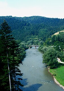
The Poprad River Gorge runs through the Western Carpathian Mountain Range in the southernmost part of Poland. It is formed by the river Poprad, the only large river flowing north from Slovakia into Poland, the tributary of Dunajec near Stary Sącz, in Lesser Poland Voivodeship. The Gorge is located within the Poprad Landscape Park which is the biggest protected area in the country. It marks the frontier between Poland and Slovakia in the area.

Beskid Sądecki is a mountain range in the Western Carpathians, which belongs to the Western Beskids. Around the Polish side they stretch in the area of 670 km², between the Dunajec river in the West and the valleys of the Kamienica Nawojowska river, Mochnaczka, Muszynka, Przełęcz Tylicka in the East. The highest peak of the mountain range is Radziejowa at 1262 metres. The mountains are built from flysch rocks.

The Polish-Slovak border is the state border between the Republic of Poland and the Republic of Slovakia and is existing formally in the modern form from January 1, 1993, from the moment of the dissolution of Czechoslovakia into two independent states. Before the collapse of Czechoslovakia, the current border with Slovakia was part of it and had an almost identical course with minor corrections made in later years. It is 541km long.


