
Cyców-Kolonia Pierwsza is a village in the administrative district of Gmina Cyców, within Łęczna County, Lublin Voivodeship, in eastern Poland. It lies approximately 2 kilometres (1 mi) south-west of Cyców, 18 km (11 mi) east of Łęczna, and 40 km (25 mi) east of the regional capital Lublin.
Łysów is a village in the administrative district of Gmina Przesmyki, within Siedlce County, Masovian Voivodeship, in east-central Poland. It lies approximately 8 kilometres (5 mi) east of Przesmyki, 32 km (20 mi) north-east of Siedlce, and 116 km (72 mi) east of Warsaw.
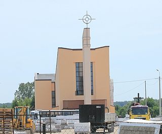
Błogoszcz is a village in the administrative district of Gmina Siedlce, within Siedlce County, Masovian Voivodeship, in east-central Poland. It lies approximately 8 kilometres (5 mi) north-east of Siedlce and 94 km (58 mi) east of Warsaw.
Chodów is a village in the administrative district of Gmina Siedlce, within Siedlce County, Masovian Voivodeship, in east-central Poland. It lies approximately 7 kilometres (4 mi) north-west of Siedlce and 85 km (53 mi) east of Warsaw.

Golice is a village in the administrative district of Gmina Siedlce, within Siedlce County, Masovian Voivodeship, in east-central Poland. It lies approximately 7 kilometres (4 mi) north-east of Siedlce and 93 km (58 mi) east of Warsaw.
Grabianów is a village in the administrative district of Gmina Siedlce, within Siedlce County, Masovian Voivodeship, in east-central Poland. It lies approximately 4 kilometres (2 mi) south of Siedlce and 89 km (55 mi) east of Warsaw.
Grubale is a village in the administrative district of Gmina Siedlce, within Siedlce County, Masovian Voivodeship, in east-central Poland. It lies approximately 8 kilometres (5 mi) east of Siedlce and 95 km (59 mi) east of Warsaw.
Joachimów is a village in the administrative district of Gmina Siedlce, within Siedlce County, Masovian Voivodeship, in east-central Poland. It lies approximately 8 kilometres (5 mi) south-east of Siedlce and 94 km (58 mi) east of Warsaw.
Osiny is a village in the administrative district of Gmina Siedlce, within Siedlce County, Masovian Voivodeship, in east-central Poland. It lies approximately 11 kilometres (7 mi) east of Siedlce and 97 km (60 mi) east of Warsaw.

Pruszyn is a village in the administrative district of Gmina Siedlce, within Siedlce County, Masovian Voivodeship, in east-central Poland. It lies approximately 11 kilometres (7 mi) east of Siedlce and 97 km (60 mi) east of Warsaw.
Stare Opole is a village in the administrative district of Gmina Siedlce, within Siedlce County, Masovian Voivodeship, in east-central Poland. It lies approximately 5 kilometres (3 mi) west of Siedlce and 83 km (52 mi) east of Warsaw.
Stok Lacki is a village in the administrative district of Gmina Siedlce, within Siedlce County, Masovian Voivodeship, in east-central Poland. It lies approximately 6 kilometres (4 mi) east of Siedlce and 93 km (58 mi) east of Warsaw.

Strzała is a village in the administrative district of Gmina Siedlce, within Siedlce County, Masovian Voivodeship, in east-central Poland.

Ujrzanów is a village in the administrative district of Gmina Siedlce, within Siedlce County, Masovian Voivodeship, in east-central Poland. It lies approximately 5 kilometres (3 mi) south-east of Siedlce and 91 km (57 mi) east of Warsaw.
Wólka Leśna is a village in the administrative district of Gmina Siedlce, within Siedlce County, Masovian Voivodeship, in east-central Poland. It lies approximately 11 kilometres (7 mi) east of Siedlce and 97 km (60 mi) east of Warsaw.
Wołyńce is a village in the administrative district of Gmina Siedlce, within Siedlce County, Masovian Voivodeship, in east-central Poland. It lies approximately 7 kilometres (4 mi) south-west of Siedlce and 84 km (52 mi) east of Warsaw.
Żabokliki is a village in the administrative district of Gmina Siedlce, within Siedlce County, Masovian Voivodeship, in east-central Poland. It lies approximately 4 kilometres (2 mi) north-east of Siedlce and 90 km (56 mi) east of Warsaw.
Żytnia is a village in the administrative district of Gmina Siedlce, within Siedlce County, Masovian Voivodeship, in east-central Poland. It lies approximately 6 kilometres (4 mi) north-west of Siedlce and 84 km (52 mi) east of Warsaw.

Cielemęc is a village in the administrative district of Gmina Zbuczyn, within Siedlce County, Masovian Voivodeship, in east-central Poland. It lies approximately 6 kilometres (4 mi) north of Zbuczyn, 11 km (7 mi) east of Siedlce, and 98 km (61 mi) east of Warsaw.
Lipiny is a village in the administrative district of Gmina Zbuczyn, within Siedlce County, Masovian Voivodeship, in east-central Poland.


