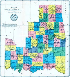
Sequoyah County is a county located in the U.S. state of Oklahoma. As of the 2010 census, the population was 42,391. The county seat is Sallisaw. Sequoyah County was created in 1907 when Oklahoma became a state. It was named after Sequoyah, who created the Cherokee syllabary and its written language.

Pushmataha County is a county in the southeastern part of the U.S. state of Oklahoma. As of the 2010 census, the population was 11,572. Its county seat is Antlers.
Muskogee County is a county located in the U.S. state of Oklahoma. As of the 2010 census, the population was 70,990. The county seat is Muskogee. The county and city were named for the Muscogee (Creek) Nation. The official spelling of the name was changed to Muskogee by the post office in 1900.
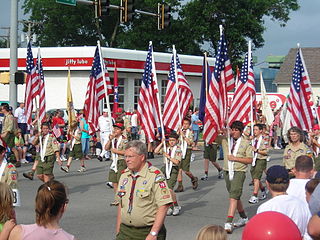
Scouting in Oklahoma has a long history, from the 1910s to the present day, serving thousands of youth in programs that suit the environment in which they live.
Dwight Mission is a census-designated place (CDP) in Sequoyah County, Oklahoma, United States. It is part of the Fort Smith, Arkansas-Oklahoma Metropolitan Statistical Area. The population was 55 at the 2010 census, a 71.9 percent gain over the figure of 32 recorded in 2000. It is currently the home of Dwight Mission Presbyterian Camp & Retreat Center.

Sallisaw is a city and county seat in Sequoyah County, Oklahoma, United States. As of the 2010 Census, it had a population was 8,880, an 11.2 percent increase over the figure of 7,891 recorded in 2000. Sallisaw is part of the Fort Smith, Arkansas–Oklahoma Metropolitan Statistical Area.

The Ozarks is a physiographic region in northern Arkansas and southern Missouri, United States.

Dwight Presbyterian Mission was one of the first American missions to the Native Americans. It was established near present-day Russellville, Arkansas in 1820 to serve the Arkansas Cherokees. After the Cherokee were required to move to Indian Territory in 1828, the mission was reestablished in 1829 near present-day Marble City, Oklahoma. The mission is listed on the National Register of Historic Places.

The Boston Mountains is a Level III ecoregion designated by the Environmental Protection Agency (EPA) in the U.S. states of Arkansas and Oklahoma. Part of the Ozarks, the Boston Mountains are a deeply dissected plateau. The ecoregion is steeper than the adjacent Springfield Plateau to the north, and bordered on the south by the Arkansas Valley. The Oklahoma portion of the range is locally referred to as the Cookson Hills.
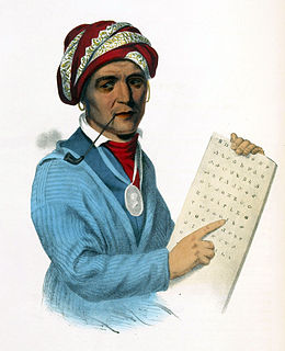
Sequoyah (c.1770–1843), was a Native American polymath of the Cherokee Nation. In 1821, he completed his independent creation of the Cherokee syllabary, making reading and writing in Cherokee possible. His achievement was one of the few times in recorded history that a member of a pre-literate people created an original, effective writing system. His creation of the syllabary allowed the Cherokee nation to be one of the first North American Indigenous groups to have a written language. Sequoyah was also an important representative for the Cherokee nation, by going to Washington, D.C. to sign two relocations and trading of land treaties.
The State of Sequoyah was a proposed state to be established from the Indian Territory in the eastern part of present-day Oklahoma. In 1905, with the end of tribal governments looming, Native Americans of the Five Civilized Tribes—the Cherokee, Choctaw, Chickasaw, Creek (Muscogee), and Seminole—in Indian Territory proposed to create a state as a means to retain control of their lands. Their intention was to have a state under Native American constitution and governance. The proposed state was to be named in honor of Sequoyah, the Cherokee who created a writing system in 1825 for the Cherokee language.
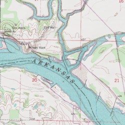
Sallisaw Creek is a 46.7-mile-long (75.2 km) tributary of the Arkansas River in far eastern Oklahoma. Its source is between Taylor and Doublehead mountains just south of Stilwell in Adair County. It flows in a southwestern direction through southern Adair County and central Sequoyah County before it empties into Robert S. Kerr Lake on the Arkansas River. The creek has four large tributaries. Greasy Creek meets Sallisaw Creek in southern Adair County, while Dry Creek and Brushy Creek join Sallisaw Creek near Marble City in northern Sequoyah County, and Little Sallisaw Creek flows into Robert S. Kerr Lake as it meets Sallisaw Creek.

The Kiamichi River is a river in southeastern Oklahoma, United States of America. A tributary of the Red River of the South, its headwaters rise on Pine Mountain in the Ouachita Mountains near the Arkansas border. From its source in Polk County, Arkansas, it flows approximately 177 miles (285 km) to its confluence with the Red River at Hugo, Oklahoma.

The Spring River is a 129-mile-long (208 km) waterway located in southwestern Missouri, southeastern Kansas, and northeastern Oklahoma.
State Highway 101 is a 23.4 mile state highway in Sequoyah Co., Oklahoma, in the United States. It runs from US-59 north of Sallisaw to the Arkansas state line. After crossing the line, it becomes Highway 220.
Big Sugar Creek is a 47-mile-long (76 km) waterway in the Ozark Mountains of southwest Missouri. The creek starts near the Arkansas state line. Big Sugar starts from three tributaries. One flows north from Garfield, Arkansas, and one, west near Seligman, Missouri, and another, south from Washburn, Missouri. Big Sugar flows west down Sugar Creek Valley, where in the Jacket community it is joined by Otter Creek, from Pea Ridge, Arkansas.

The geography of Arkansas varies widely. The state is covered by mountains, river valleys, forests, lakes, and bayous in addition to the cities of Arkansas. Hot Springs National Park features bubbling springs of hot water, formerly sought across the country for their healing properties. Crowley's Ridge is a geological anomaly rising above the surrounding lowlands of the Mississippi embayment.

Piney is a census-designated place (CDP) in Adair County, Oklahoma, United States. The population was 115 at the 2010 census. Piney was the "head town" of the first wave of relocated Cherokee people who relocated there from their ancestral homelands in the southeastern United States.

Redbird Smith (1850–1918) was a traditionalist and political activist in the Cherokee Nation in Indian Territory. He helped found the Nighthawk Keetoowah Society, whose members revitalized traditional spirituality among the Cherokee from the mid-19th century to the early 20th century.
Lovely County was a county that existed from October 31, 1827, to 1828 in the Arkansas Territory.