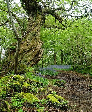
In the United Kingdom, ancient woodland is that which has existed continuously since 1600 in England, Wales and Northern Ireland. Planting of woodland was uncommon before those dates, so a wood present in 1600 is likely to have developed naturally.

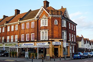
Coombe is a place in the London Borough of Croydon, situated south-east of central Croydon, between Addiscombe, Selsdon and Upper Shirley. Formerly a hamlet, since the growth of suburban development the area has become swallowed into the London conurbation and often does not appear on modern map.
Norbury is an area of south London. It shares the postcode London SW16 with neighbouring Streatham. Norbury is 6.7 miles (10.8 km) south of Charing Cross.
The London Borough of Bexley owns and maintains over 100 parks and open spaces within its boundaries, with a total of 638 hectares. They include small gardens, river and woodland areas, and large parks with many sporting and other facilities.

The London Borough of Croydon has over 120 parks and open spaces within its boundaries, ranging from the 200 acre (80ha) Selsdon Wood Nature Reserve to many recreation grounds and sports fields scattered throughout the Borough. Croydon covers an area of 86.52 km², the 256th largest district in England. Croydon's physical features consist of many hills and rivers that are spread out across the borough and into the North Downs, Surrey and the rest of South London. Some of the open spaces in Croydon form part of the well-known London LOOP walks where the first section was opened on 3 May 1996 with a ceremony on Farthing Downs in Coulsdon. As a borough in Outer London it also contains some open countryside in the form of country parks. Croydon Council is associated with several other boroughs who are taking part in the Downlands Countryside Management Project. These boroughs are Sutton; and by Surrey County Council; the City of London Corporation; the Surrey districts of Reigate and Banstead and Tandridge; and the Countryside Agency. An additional partner is Natural Britain.

The London Borough of Ealing, one of the outer London boroughs although not on the periphery, has over 100 parks and open spaces within its boundaries. These include allotments, cemeteries, playgrounds, and golf courses in addition to the larger open spaces such as nature conservation areas.

Hainault Forest was a large, mostly wooded area of Essex, which was mostly destroyed after 1851. The popular outrage at the destruction of most of the forest was the catalyst for the creation of the modern environmental movement.

Daws Heath contains a large area of woodland in eastern Thundersley, part of Castle Point near Southend-on-Sea in Essex, England. It is traversed by the Daws Heath Road and St Michael's Road. Daws Heath provides a semi-rural escape for local towns and villages and their residents as they walk, cycle or drive out of Castle Point, as Daws Heath Road has fields and woodland on both sides of the road with a small scattering of houses. Going down Daws Heath Road it is not uncommon to see rare-breed cattle, sheep and horses. Daws Heath is surrounded by Greenbelt and Woodland which are a buffer to stop the local villages merging by development. West Woods, nearly 80 acres (320,000 m2) of mixed woodland, was purchased from the Church of England in 2009, securing continued public access to these woods; public support in the Daws Heath area is very strong especially on green belt and woodland preservation. The area has established neighbourhood watch schemes, Church Groups and Greenbelt Protection Groups. Daws Heath contains The Deanes,, and is linked to a local Sixth Form College in Thundersley (SEEVIC), now part of USP College.
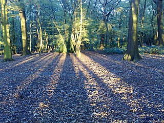
Coldfall Wood is an ancient woodland in Muswell Hill, North London. It covers an area of approximately 14 hectares and is surrounded by St Pancras and Islington Cemetery, the East Finchley public allotments, and the residential streets Creighton Avenue and Barrenger Road. It is the site of the discoveries which first led to the recognition that glaciation had once reached southern England. It was declared a local nature reserve in 2013, and is also a Site of Borough Importance for Nature Conservation, Grade 1.

The Norwood Ridge is a 10-square-mile (26 km2) rectangular upland which occupies the geographical centre of south London, centred 5 miles (8 km) south of London Bridge. Beneath its topsoil it is a ridge of London Clay that is capped on all sides with remaining natural gravel deposits mixed with some sandy soil, which in the South Thames basin is a material known as the Claygate Beds.
Beaulieu Heights 16 acres (6.5 ha) is an area of ancient woodland between South Norwood and Upper Norwood in the London Borough of Croydon, London. It is located between South Norwood Hill and Auckland Road with Auckland Rise to the north and Tummonds Gardens to the south. There are pedestrian entrances from South Norwood Hill and Auckland Rise, and a pond. The name is pronounced as if spelled "Beulah" like the nearby Beulah Hill, and not like the French word or the town of Beaulieu, Hampshire.

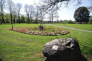
Grangewood Park is an extensive woodland area situated in South Norwood, London. It is managed by the London Borough of Croydon. It is bounded by Grange Road, Wharncliffe Road, and Ross Road. It covers an area of 27.7 acres. The park is located on the main A212 road between Thornton Heath and Upper Norwood/Crystal Palace. The nearest stations are Thornton Heath, Selhurst and Norwood Junction.

Sydenham Hill Wood is a ten-hectare wood on the northern slopes of the Norwood Ridge in the London Borough of Southwark. It is designated as a Local Nature Reserve and Site of Metropolitan Importance for Nature Conservation. With the adjacent Dulwich Wood, Sydenham Hill Wood is the largest extant tract of the ancient Great North Wood. The two woods are formed from coppices known as Lapsewood, Old Ambrook Hill Wood and Peckarmans Wood after the relocation of The Crystal Palace in 1854 and the creation of the high level line in 1865.

Gunnersbury Triangle is a 2.57-hectare (6.4-acre) local nature reserve in Chiswick, in the London boroughs of Ealing and Hounslow, immediately to the east of Gunnersbury. It was created in 1983 when, for the first time in Britain, a public inquiry ruled that a planned development of the land could not go ahead because of its value for nature. It opened as a nature reserve in 1985.
Betts Park is a public park in Anerley, London Borough of Bromley, in southeast London, England. It is approximately 13 acres and has a number of attractions, including part of the old Croydon Canal. The current park was opened in December 1928 and extended throughout the 1930s, with the final addition of "new fields" by the King George V Memorial Trust in 1937. The boundaries of the park mirror the outline of an ancient copse dating back over 1000 years.

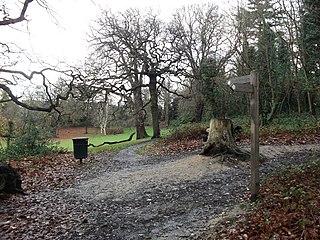
Littleheath Woods is the collective name for Littleheath Wood, Foxearth Woods, part of Queenhill Shaw and part of Gee Wood in Selsdon in the London Borough of Croydon. It is a Site of Borough Importance for Nature Conservation, Grade I, with an area of 64 acres (26 ha). It is owned by Croydon Council and the Friends of Littleheath Woods assist with the management.

Spa Wood is an area of ancient woodland in the London Borough of Croydon that was once a part of The Great North Wood. In 2017, the London Wildlife Trust began a four-year project based around the Great North Wood, working with Croydon Council and the Friends of Spa Wood to improve the site for wildlife, as a part of The Great North Wood Project. The 15.5 acres (6.3 ha) site, also known as The Lawns, is owned by the Borough of Croydon and includes the woods, a multi-games court and playground.

Norwood Grove is an ornamental urban park in the northern extent of the London Borough of Croydon, by whom it is managed, although the most westerly part lies within the London Borough of Lambeth. It is bordered to the south-west by Covington Way, to the south-east by Gibson's Hill and to the north-east by Copgate Path, itself also referred to as 'Norwood Grove', and also by Ryecroft Road. To the north-west the grounds adjoin those of The Rookery which itself adjoins Streatham Common of which Norwood Grove was once a part. The main entrances are on Covington Way and Gibson's Hill but access is also available from Copgate Path as it effectively forms part of the park for much of its length.


