Greenwich Village often referred to by locals as simply "the Village", is a neighborhood on the west side of Lower Manhattan, New York City. In the 20th century, Greenwich Village was known as an artists' haven, the Bohemian capital, the cradle of the modern LGBT movement, and the East Coast birthplace of both the Beat and '60s counterculture movements. Groenwijck, one of the Dutch names for the village, was Anglicized to Greenwich. Greenwich Village contains Washington Square Park, as well as two of New York's private colleges, New York University (NYU) and the New School.

A village is a clustered human settlement or community, larger than a hamlet but smaller than a town, with a population ranging from a few hundred to a few thousand. Though villages are often located in rural areas, the term urban village is also applied to certain urban neighborhoods. Villages are normally permanent, with fixed dwellings; however, transient villages can occur. Further, the dwellings of a village are fairly close to one another, not scattered broadly over the landscape, as a dispersed settlement.

North Carolina State University is a public research university in Raleigh, North Carolina. It is part of the University of North Carolina system and is a land-, sea-, and space-grant institution. The university forms one of the corners of the Research Triangle together with Duke University in Durham and The University of North Carolina at Chapel Hill.

Buffalo Grove is a village in Lake and Cook counties in the U.S. state of Illinois, within the northwest suburbs of Chicago.

Northbrook is a suburb of Chicago, located at the northern edge of Cook County, Illinois, United States.
Oak Park is a village adjacent to the West Side of Chicago, Illinois. It is the 29th largest municipality in Illinois as measured by population in the 2010 U.S. census. As of the 2010 United States Census the village had a population of 51,878.

North Smithfield is a town in Providence County, Rhode Island, United States, settled as a farming community in 1666 and incorporated into its present form in 1871. North Smithfield includes the historic villages of Forestdale, Primrose, Waterford, Branch Village, Union Village, Park Square, and Slatersville. The population was 12,314 at the 2015 census.

York—Simcoe is a federal electoral district in Ontario, Canada, that has been represented in the House of Commons of Canada from 1968 to 1979, from 1988 to 1997 and since 2004.
The administrative divisions of India are subnational administrative units of India; they compose a nested hierarchy of country subdivisions. Indian states and territories frequently use different local titles for the same level of subdivision.
The following is a list of lists of the cities, towns and villages of the United States separated by state, territory or district name.
In the United States, the meaning of "village" varies by geographic area and legal jurisdiction. In many areas, "village" is a term, sometimes informal, for a type of administrative division at the local government level. Since the Tenth Amendment to the United States Constitution prohibits the federal government from legislating on local government, the states are free to have political subdivisions called "villages" or not to and to define the word in many ways. Typically, a village is a type of municipality, although it can also be a special district or an unincorporated area. It may or may not be recognized for governmental purposes.
Badli is one of the oldest villages in Delhi. In old times it was one of the richest village in Delhi. History says that whenever Delhi was attacked Badli used to face the attack and used to be the camp of the invaders. AJESH YADAV is the MLA of Badli. Once famous for lush green crops this village today has good environment for living.Most of the villagers have their source of income from rent.Godowns and rooms made by landlords have made the village environment for peace living.

Attilly is a commune in the department of Aisne in the Hauts-de-France region of northern France.

Aulnois-sous-Laon is a commune in the department of Aisne in the Hauts-de-France region of northern France.

Barenton-Bugny is a commune in the department of Aisne in the Hauts-de-France region of northern France.
Barenton-sur-Serre is a commune in the department of Aisne in the Hauts-de-France region of northern France.
Betageri is a village in Belgaum district in the north west part of Karnataka state, India. The Kannada poet Betageri Krishnasharma was born here. Before the integration of Karnataka the whole of Belgaum district and other some districts of the north west were part of Bombay Karnataka

Diggewadi is a village in Raybag taluk in Belgaum Panchayat in the southern state of Karnataka, India. The official language of Diggewadi is Kannada.
Ulee Geudong is a village in subdistrict Sawang, North Aceh Regency, Aceh province, Indonesia. The main occupations in Gampong Ulee Geudong are farming, gardening and breeding livestock. The village is located on the Jalan Elak (Bypass) Krueng Mane - Buket Rata 7-8 km Lhokseumawe and is very close to the Malikussaleh Airport as well as the Malikussaleh University.

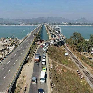
Bhomolahati is a village in Kamrup rural district, in the state of Assam, India, situated in north bank of river Brahmaputra.