The Mishmi or Deng people of Tibet and Arunachal Pradesh are an ethnic group comprising mainly three tribes: Idu Mishmi ; Digaro tribe, and Miju Mishmi. The Mishmis occupy the northeastern tip of the central Arunachal Pradesh in Upper and Lower Dibang Valley, Lohit and Anjaw Districts/Medog County. The three sub-divisions of the tribe emerged due to the geographical distribution, but racially all the three groups are of the same stock. The Idu are also known as Yidu Lhoba in Tibet and often referred as Chulikatas in Assam. The Idus are primarily concentrated in the Upper Dibang Valley and Lower Dibang Valley district and parts of the northern part of Lohit district of Arunachal Pradesh in India. Taraon, also called Digaru Mishmis, are distributed in the hill and the foothills between the Dibang, Digaru and the Lohit rivers. Kamans are also known as the Miju Mishmis; they live between the Lohit and the Kambang rivers in the foothills and in the Mishmi Hills on both sides of the Lohit river right up to the frontiers to Rima. There are around 30,000 of them in Arunachal Pradesh.

Changlang district (Pron:/tʃæŋˈlæŋ/) is located in the Indian state of Arunachal Pradesh, located south of Lohit district and north of Tirap district. As of 2011 it is the second most populous district of Arunachal Pradesh, after Papum Pare.

East Kameng district is one of the 23 districts of Arunachal Pradesh state in northeastern, India. It shares an international border with Tibet in the north and a state border with Assam and district borders with West Kameng, Papumpare and Kurung Kumey, which was bifurcated from Lower Subansiri district on 1 April 2000.

The Tirap district (Pron:/tɪˈɹæp/) is located in the southeastern part of the state of Arunachal Pradesh in India. It shares a state border with Nagaland and Assam, an international border with Myanmar and a district border with Changlang and Longding.
Upper Subansiri (Pron:/su:bənˈsɪɹi/) is an administrative district in the state of Arunachal Pradesh in India.

Yingkiong is the administrative headquarter of the Upper Siang district in the state of Arunachal Pradesh in India. A small town that lies 1 km east of Siang river in Arunachal Pradesh. It is situated at an elevation of 200 meters (700 ft)above sea level, to its west flows the Siang river or ,The Town has a population of 8573 persons as of. The town falls under Class/Tier-5 category of RBI(Reserve Bank of India) classification based on population density i.e

Kurung Kumey district is one of the 22 districts of the northeastern Indian state of Arunachal Pradesh, with its district headquarters in Koloriang.
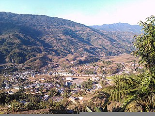
Changlang is a census town and headquarters of the Changlang district in the Indian state of Arunachal Pradesh. It has become one of the major districts in the area owing to the presence of crude oil, coal and mineral resources other than tourism and hydro power.

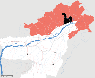
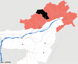
Anjaw District (Pron:/ˈændʒɔ:/) is an administrative district in the state of Arunachal Pradesh in north-east India. It is a newly created district, having been split from Lohit district on 16 February 2004 under the Arunachal Pradesh Re-organization of Districts Amendment Bill. The district borders China on the north. Hawai, at an altitude of 1296 m above sea level, is the district headquarters, located on the banks of the Lohit River, a tributary of the Brahmaputra River. It is the easternmost district in India. The easternmost community in Anjaw is the village of Dong.
The Idu Mishmi language is a small language spoken by the Mishmi people in Dibang Valley district, Lower Dibang Valley district, Lohit district, East Siang district, Upper Siang district of the Indian state of Arunachal Pradesh and in Zayü County of the Tibet Autonomous Region, China. There were 8569 speakers in India in 1981 and 7000 speakers in China in 1994. It is considered an endangered language.
The Takpa or Dakpa language, Dakpakha, known in India as Tawang Monpa, is an East Bodish language spoken in the Tawang district of Arunachal Pradesh, claimed by Tibet as a part of Lho-kha Sa-khul, and in northern Trashigang District in eastern Bhutan, mainly in Chaleng, Phongmed Gewog, Yobinang, Dangpholeng and Lengkhar near Radi Gewog. Van Driem (2001) describes Takpa as the most divergent of Bhutan's East Bodish languages, though it shares many similarities with Bumthang. SIL reports that Takpa may be a dialect of the Brokpa language and that it been influenced by the Dzala language whereas Brokpa has not.
The Puroik language, also called Sulung, is a language spoken by the Puroik people of Arunachal Pradesh in India and of Lhünzê County, Tibet, in China. Puroik is a Kho-Bwa language.
Tangsa, also Tase and Tase Naga, is a Sino-Tibetan languages or language cluster spoken by the Tangsa people of Burma and north-eastern India. Some varieties, such as Shangge, are likely distinct languages. There are about 60,000 speakers in Burma and 40,000 speakers in India.
Palin is a small hill station town and the headquarter of Kra Daadi district in Arunachal Pradesh. It is inhabited by Nyishi tribe of Arunachal Pradesh and has a population of 5816 according to the 2001 census. The incumbent MLA from Palin constituency is Takam Tagar (Pario).
Arunachal Frontier Highway, also Mago-Thingbu–Vijaynagar Border Highway, in Arunachal Pradesh India is a 2,000-kilometre-long (1,200 mi) under-construction road along the McMahon Line, the international border between India and China, by the Government of India at the cost of ₹40,000 crore.

Gomsi is an ancient archaeological site located between Rani Village and Sika Tode in East Siang District, Arunachal Pradesh, India. It is associated with the 13th-century Chutiya Kingdom, which was located at the field of Rani Village, about 15 km from the town of Pasighat.
Dirang is a village in the Indian state of Arunachal Pradesh. West Kameng is the name of the district that contains village Dirang.
Doimukh is a village in the Indian state of Arunachal Pradesh. Papum Pare is the name of the district that contains village Doimukh.
Sagalee is a village in the Indian state of Arunachal Pradesh. Papum Pare is the name of the district that contains village Sagalee.