
Mountaineering, mountain climbing, or alpinism is a set of outdoor activities that involves ascending mountains. Mountaineering-related activities include traditional outdoor climbing, skiing, and traversing via ferratas that have become sports in their own right. Indoor climbing, sport climbing, and bouldering are also considered variants of mountaineering by some, but are part of a wide group of mountain sports.

Ski touring is skiing in the backcountry on unmarked or unpatrolled areas. Touring is typically done off-piste and outside of ski resorts, and may extend over a period of more than one day. It is similar to backcountry skiing but excludes the use of a ski lift or transport.
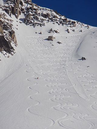
Backcountry skiing (US), also called off-piste (Europe), alpine touring, freeriding or out-of-area, is skiing in the backcountry on unmarked or unpatrolled areas either inside or outside a ski resort's boundaries. This contrasts with alpine skiing, which is typically done on groomed trails benefiting from a ski patrol. Unlike ski touring, backcountry skiing can – and often does – include the use of ski lifts including snowcats and helicopters. Recent improvements in equipment have increased the popularity of the sport. As the sport does confront the individual practicing it with the dangers of natural, unprepared alpine terrain like avalanches, it is generally recommended to carry standard safety equipment and to learn beforehand how to behave safely under such conditions.

Glacier National Park is part of a system of 43 parks and park reserves across Canada, and one of seven national parks in British Columbia. Established in 1886, the park encompasses 1,349 km2 (521 sq mi), and includes a portion of the Selkirk Mountains, which are part of the larger grouping of mountains, the Columbia Mountains. It also contains the Rogers Pass National Historic Site.

Garibaldi Provincial Park, also called Garibaldi Park, is a wilderness park located on the coastal mainland of British Columbia, Canada, 70 kilometres (43.5 mi) north of Vancouver. It was established in 1920 and named a Class A Provincial Park of British Columbia in 1927. The park is a popular destination for outdoor recreation, with over 30,000 overnight campers and over 106,000 day users in the 2017/2018 season.

The Bogong High Plains, part of the Victorian Alps of the Great Dividing Range, are a section of plains located in the Alpine National Park in the Australian state of Victoria and are situated south of Mount Bogong.

The Tonquin Valley is located in Jasper National Park, Alberta, Canada, next to the border of the provinces of Alberta and British Columbia, an area which is also the continental divide, running along the peaks of the South Jasper Range which rise above Amethyst Lake. Tonquin Creek drains Moat Lake and flows west into Mount Robson Provincial Park in British Columbia, and empties into the Fraser River. The Astoria River drains south and east into the Athabasca River.

The Alpine Club of Canada (ACC) is an amateur athletic association with its national office in Canmore, Alberta that has been a focal point for Canadian mountaineering since its founding in 1906. The club was co-founded by Arthur Oliver Wheeler, who served as its first president, and Elizabeth Parker, a journalist for the Manitoba Free Press. Byron Harmon, whose 6500+ photographs of the Canadian Rockies in the early 20th century provide the best glimpse of the area at that time, was official photographer to the club at its founding. The club is the leading organization in Canada devoted to climbing, mountain culture, and issues related to alpine pursuits and ecology.
The Stanley Mitchell hut is an alpine hut located at an altitude of 2,060 metres (6,759 ft) in the Little Yoho Valley in Yoho National Park, British Columbia, Canada. It sits in a small meadow not far from the base of a mountain called The President. It serves as a base for hiking, scrambling, ski-touring and climbing the nearby mountains. The hut is maintained by the Alpine Club of Canada.
The Elk Lakes cabin is an alpine hut located between the French and Italian Military Groups in the Canadian Rockies. It resides near the Continental Divide in Elk Lakes Provincial Park, British Columbia. It is 62 km south of the Trans-Canada Highway in Kananaskis Country, Alberta and 104 km north of Sparwood, British Columbia. The area has hiking trails, and provides access to mountaineering objectives. In winter, ice climbs and skiing terrain with much powder abound. Elk Lakes terrain is similar to that near the Elizabeth Parker hut. The hut is maintained by the Alpine Club of Canada.

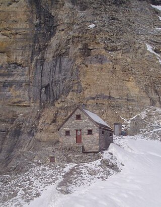
The Arthur O. Wheeler hut is an alpine hut located four km southwest of Rogers Pass in Glacier National Park, British Columbia. Although not truly a backcountry hut, this log cabin is situated conveniently close to the Trans-Canada Highway in the Selkirk Mountains, west of the Rocky Mountains. It is often used as a base for mountaineering, hiking, and ski touring into the Asulkan Range and Illecillewaet Glacier areas south of the highway, and the Hermit Range north of the highway. The hut is maintained by the Alpine Club of Canada (ACC). It is the only ACC hut which can be reached by vehicle.
The Abbot Pass hut was an alpine hut located at an altitude of 2,925 metres (9,596 ft) in Abbot Pass in the Rocky Mountains in Alberta, Canada. It was nestled between Mount Victoria and Mount Lefroy, straddling the Great Divide, which, in this region, defines the boundary between Banff National Park in Alberta and Yoho National Park in British Columbia. While close to the border, the hut lay entirely in Banff National Park, and was the second-highest permanently habitable structure in Canada. The hut was maintained by the Alpine Club of Canada.
The Fay hut was an alpine hut located above Prospectors Valley in Kootenay National Park, British Columbia. Although the higher Neil Colgan hut superseded it as a base for climbs in the Valley of the Ten Peaks area, it still served as a convenient base for hikers and skiers doing day trips in the area, and as an overnight stop for mountaineers continuing on to the Neil Colgan hut. A new hut was built in 2005 to replace the original Fay hut, which was destroyed by a forest fire in 2003. The Fay hut was maintained by the Alpine Club of Canada (ACC).
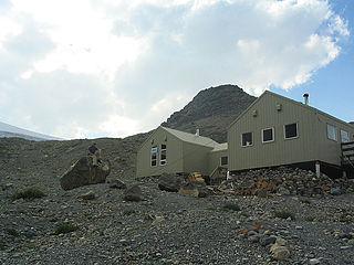
The Bow Hut is an alpine hut located at an elevation of 2,350 metres (7,710 ft) on the eastern edge of the Wapta Icefield in Banff National Park. It is the largest, best equipped, and most accessible of the four alpine huts on the Wapta Icefield, and serves as the base for a wide variety of ski tours and mountaineering ascents to half a dozen peaks on the Wapta. It is the easiest and safest starting point for the Wapta traverse; and Balfour Hut, the next hut on the traverse, can easily be reached from it in a day. It can also serve as an intermediate stop in a longer traverse which starts at the less easily accessible Peyto Hut. The hut is maintained by the Alpine Club of Canada.
William Lowell Putnam III was an alpinist, author and retired broadcasting executive. He was Trustee Emeritus of the Lowell Observatory, a private astronomical research facility. He was the son of politician and businessman Roger Putnam and a member of the prominent Lowell family of Massachusetts.

The Nlháxten/Cerise Creek Conservancy is a 2,272-hectare conservancy north of Pemberton, British Columbia, established in 2008. Located within the mountainous Joffre Group between the Pacific Cayoosh ranges, it encompasses diverse tarrain, including mountain tarns in the Anniversary Glacier area, subalpine meadows, Engelmann spruce forest ecosystems, and portions of the Cerise Creek watershed. Mount Chief Pascal stands at the center of the conservancy, with other striking peaks like Joffre Peak and Mount Matier forming its boundary. It abuts the popular Joffre Lakes Provincial Park. The area is popular for backcountry skiing and other outdoor recreation, and is the site of a mountain hut that predates the conservancy's establishment.
Sentinel Peak is a 2,992-metre (9,816-foot) mountain in British Columbia, Canada.
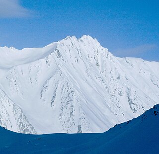
Doubletop Mountain is a 2,667-metre (8,750-foot) mountain in British Columbia, Canada.

Unicorn Mountain is a 3,010-metre (9,880-foot) mountain in British Columbia, Canada.
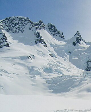
Pioneer Peak is a 3,245-metre (10,646-foot) mountain in British Columbia, Canada.

