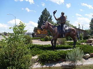
Converse County is a county located in the U.S. state of Wyoming. As of the 2010 United States Census, the population was 13,833. Its county seat is Douglas.
Anabel is an unincorporated community in eastern Macon County, Missouri, United States.< It is located on U.S. Route 36, approximately seven miles east of Macon.
The High Rockies, or high country, is a term for a region of the U.S. state of Colorado. It commonly includes Larimer County, Jackson County, Routt County, Grand County, Summit County, Eagle County, Lake County, and Pitkin County. Some notable towns there include Estes Park, Walden, Steamboat Springs, Grand Lake, Winter Park, Breckenridge, Dillon, Vail, Leadville, and Aspen. The geography of the High Rockies has some of the most rugged parts of the Rocky Mountains and consists of the Front Range and mountainous topography to the west, much of which is on or near the Continental Divide. Known for pine forests and winding roads, the former mining towns there have been reinvented by wilderness tourism such as hiking, cycling, fishing, and most especially both cross-country and alpine skiing. Notable ski resorts include Copper Mountain, Keystone Resort, Steamboat Ski Resort, Beaver Creek Resort, Buttermilk, Aspen Highlands, Snowmass, and Aspen Mountain. The High Rockies are also the location of Rocky Mountain National Park and Arapaho National Forest.
Peoga is an unincorporated community in Brown and Johnson counties, Indiana.

Garrett is an unincorporated community in northern Albany County, Wyoming, United States, along the North Laramie River. It lies along local roads north of the city of Laramie, the county seat of Albany County. Its elevation is 6,785 ft (2,068 m), and it is located at 42°6′48″N105°36′36″W. Although Garrett is unincorporated, it once had a post office, with the ZIP code of 82058. The building remains, though is no longer in use. Garrett is also home to River Bridge School, a one-room schoolhouse that is part of Albany County School District #1. Aside from the schoolhouse, the land is privately owned.
Dawsonville is an unincorporated community in Montgomery County, Maryland.

Sunnybrook is an unincorporated community in Amador County, California. It is located on Mountain Spring Creek 3 miles (4.8 km) east of Ione. It lies at an elevation of 784 feet.
Parkerton, Wyoming is an unincorporated community in Converse County, Wyoming, United States. It is in the Mountain Standard Time Zone. Elevation is 5,030 feet.
Naysash Inlet is an inlet on the Central Coast of British Columbia, Canada, branching off the north side of Smith Inlet in the Smith Sound area. Naysash Bay is located just inside the entrance to Naysash Inlet at 51°18′59″N127°20′35″W. Naysash Creek, formerly Boulder Creek, flows southwest into Naysash Inlet at 51°20′21″N127°19′15″W.
Irvine is an unincorporated community in Converse County, in the U.S. state of Wyoming.
Dirty Mountain is a summit in Albany County, Wyoming, in the United States. With an elevation of 8,340 feet (2,540 m), Dirty Mountain is the 764th highest summit in the state of Wyoming.
Pansy is an unincorporated community in Clinton County, in the U.S. state of Ohio.
Yankeeburg is an unincorporated community in Washington County, in the U.S. state of Ohio.
Several sections of the Bozeman Trail in Wyoming are listed on the National Register of Historic Places. Typically there are sections of trail that are concentrated at geographic features such as fords or crossings of divides, where the trail consolidates from a broad swath of parallel, poorly defined paths to a small area where remnants of the trail are visible.
February is an unincorporated community in Washington County, Tennessee.
Halfway is one of two unincorporated areas located in Sublette County, Wyoming.


